
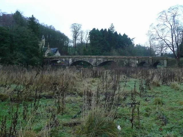
Mauldslie Bridge in South Lanarkshire
Mauldslie Bridge in South Lanarkshire is an unlit service road (private). It runs in a northeast-southwest direction and ends in a cul-de-sac. Mauldslie Bridge is also known as Dalserf, River Clyde, Mauldslie Bridge. Ⓦ.
- Bicycle
- yes
- Road Type
- service road
- Route
- northeast-southwest
Image
Farm shops
Viewpoint
Bus stops
Roads nearby
Mauldslie Castle Orchard500 m
Kirk RoadDalserf
550 m
Lanark RoadLeshmahagow Road, Crossford, Holm Road, Smugglers Brig Road, Braidwood Road, Crossford Post Office, Tillietudlem Hotel, Crossford Garage, Jenny's Cakes Ltd, Ravenstruther, Westbank Terrace, Silvermuir Road, Ayr Road, Milton Road, Goremire Road, Smugglers Bridge, Upper Cairnie, Craig Cottage, Silverbirch Garden Centre, The Buttery, 212 Lanark Road, Hazelbank, Orchardville, Auchenheath, Lancaster Avenue, Shieldhill Road, Tesco, Rosebank, Flower Of Scotland Garden Centre, Popinjay Hotel, Shelley Road, Shelley road, Carstairs, At Rosemount Crescent On Lanark Road, Carstairs, Opposite Rosemount Crescent On Lanark Road
1,0 km
Horsley BraeKlyde Mobility
1,2 km
Manse Brae1,2 km
Quarry RoadHigh Whitehills Road, High whitehills Road, Sycamore Crescent, Law Hill, Quarry Road, Lovers' Loup
1,3 km
Netherburn RoadOver Dalserf Cottage, Overton Road
1,3 km
Garrion BridgeGarrion Bridge
1,3 km
Cornsilloch BraeThe Beeches, Cornsilloch Cottage
1,3 km
Nursery Drive1,3 km
Clyde View1,3 km
Brownlee RoadThe Salon at Law
1,4 km
Dunlop Place1,4 km
Mauldslie RoadMauldslie Mains, Mauldslie Kennels, Binniesbrig, Pillans Avenue, Little Mallen
1,4 km
Rorison Place1,4 km
WhinknoweRosslyn Road, Rorison Place, Bogside Road, Nursery Drive
1,4 km
Millburn Gate1,5 km
Ashkirk Drive1,5 km
Ailsa Avenue1,5 km
Mauldslie Place1,5 km
Milton-Lockhart Bridge1,6 km
Birks Road1,6 km
Abandoned railways nearby
Lesmahawgo Branch1,2 km
Body of waters nearby
River Clyde750 m
Buildings nearby
Erskinebank1,6 km
Georgevale1,6 km
Farmlands nearby
Overton Farm1,7 km
Farmyards nearby
Over Dalserf1,3 km
Cornsilloch1,6 km
Garden centres nearby
Garrion Bridges Garden Centre & Antique Centre1,2 km
Nature reserves nearby
Mauldslie Woods - Clyde Valley Woodlands NNR1,3 km
Outdoor shops nearby
Gouldings Garden Centre750 m
Places of worship nearby
Dalserf Parish Church650 m
Plant nurseries nearby
Reynard Nursery1,4 km
Razed railways nearby
Woodside Colliery1,4 km
Residential buildings nearby
Clydeview1000 m
Hazelwood Cottage1,0 km
Woodside House1,2 km
The Coach House1,2 km
Lodge1,3 km
Over Dalserf Cottage1,3 km
West High Overton1,6 km
Rivers nearby
Dalserf Burn900 m
Streams nearby
Tod Burn100 m
Rams Gill800 m
Regill Burn1,0 km
Stewarts Gill1,3 km
Carcain Gill1,3 km
Woodlands nearby
Overton Wood1,4 km
| Heritage designation | category A listed building |
|---|---|
| Located in | South Lanarkshire, Dalserf |
| Country | United Kingdom |
| Crosses | River Clyde |
| Carries thoroughfare | unclassified road |
| Location | Dalserf |
 Public transport map South Lanarkshire Legend
| Railway | |
| Bus | |
| Tram |
 Cycling map South Lanarkshire Legend
| Cycle path | |
| Cycle lane on road | |
| Cycling on bus lane | |
| Bicycle street | |
| Cyclists allowed | |
| Cyclists allowed, good surface | |
| No cycling | |
| Cobblestones |
| Long-distance cycle route | (depending on scale) | |
| Long-distance cycle route |
 Walking map South Lanarkshire Legend
| Path |
| Long-distance hiking trail | (depending on scale) | |
| Long-distance hiking trail | ||
| No pedestrians |