
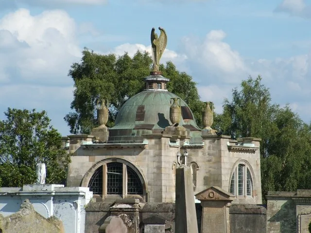
Murray Chapel in South Lanarkshire
Murray Chapel in South Lanarkshire is a church. It is near Alder Lane and is also known as Lanark, Hyndford Road, Cemetery Chapel. The church is a listed building. Ⓦ.
- Amenity
- place of worship
- Building Type
- building
Image
Clothing shops
Petrol stations
Hairdressers
Cafés
Stations
Doctor's office
Bus stops
Pet shops
Kindergarten
Supermarkets
Variety stores
Community centre
Fast food restaurants
Clinic
Platforms
Roads nearby
Willow Place150 m
Maple Gate150 m
Woodburn Gait150 m
Gavel Lane200 m
Woodlands AvenueKingson's Knowe
200 m
Alder Lane200 m
Beechwood Gate200 m
Frost Hill200 m
Old Market RoadPets at Home
200 m
Auctioneers Way200 m
Bidders GaitAuctioneers Way, St Kentigerns Church
250 m
Beechwood Court250 m
Rowan View250 m
Silver Bell WayHome Street
250 m
Hazel Gardens300 m
Hyndford RoadHyndford Road, Holmview, Hyndford Grange, Hyndfordbridge End, Hyndford Bridge, Ayr Road
300 m
Albany DriveHigh Crosshill
300 m
Woodburn Court300 m
Woodlands Drive300 m
Gavel Grove300 m
Muir GlenGrand y Care Academy
350 m
Woodside Lane350 m
Whitelees RoadB&M Home Store
400 m
Portland PlacePortland Park, Burnside Lane
400 m
Kirklands Road400 m
Ladyacre RoadEsso
400 m
Bonnington Avenue450 m
Well Road450 m
St Vincent PlaceLanark Interchange, Stance E, Valerio`s Fish and Chips, Universal Connections, Mosko hairdressing, Lanark Interchange, Stance A
450 m
Bankhead Terrace500 m
Braxfield Road500 m
Brierybank Avenue550 m
St Mungo's550 m
Guschet Place600 m
Wallace Court600 m
Wellgatehead600 m
Markgreen Park600 m
Weavers Walk650 m
Lady Mary's Walk700 m
New Lanark RoadVillage Store, New Lanark Visitor Centre, New Lanark World Heritage Site
800 m
Buildings nearby
Old Lanark Grammar Science Building500 m
Cemeteries nearby
Lanark Cemetery100 m
Places of worship nearby
St Mary's RC Church450 m
Railway lines nearby
Lanark Branch450 m
Retail areas nearby
Unit 9250 m
Braidfute Retail Park350 m
Retail buildings nearby
Units 9a to 9d200 m
Supermarkets nearby
Morrisons450 m
Other nearby
Ruins of Church of St Kentigern's100 m
| Heritage designation | category A listed building |
|---|---|
| Located in | South Lanarkshire, Lanark |
| Country | United Kingdom |
| Location | Lanark |
 Public transport map South Lanarkshire Legend
| Railway | |
| Bus | |
| Tram |
 Cycling map South Lanarkshire Legend
| Cycle path | |
| Cycle lane on road | |
| Cycling on bus lane | |
| Bicycle street | |
| Cyclists allowed | |
| Cyclists allowed, good surface | |
| No cycling | |
| Cobblestones |
| Long-distance cycle route | (depending on scale) | |
| Long-distance cycle route |
 Walking map South Lanarkshire Legend
| Path |
| Long-distance hiking trail | (depending on scale) | |
| Long-distance hiking trail | ||
| No pedestrians |