
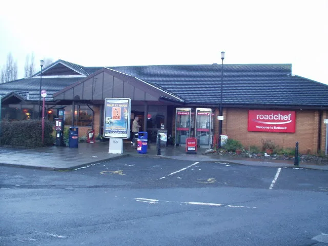
RoadChef Bothwell Services in South Lanarkshire
RoadChef Bothwell Services in South Lanarkshire is a service station. In the vicinity, you can find 2 convenience stores, a petrol station and a café. Ⓦ.
- Road Type
- service station
- Operator
- RoadChef
- Website
- https://www.roadchef.com/locations/bothwell
Image
Roads nearby
Fallside Road300 m
Rowans Gardens350 m
Merlewood Avenue350 m
Coalburn RoadGlaikhead, New Trows Road, Coalburn, Shoulderigg Road, Lockhart Place, Dunn crescent, Dunn Crescent, Garden Street, Caledonian Gardens, Coalburn Road
350 m
Ashley Drive400 m
Reen Place400 m
Farm Court500 m
McPherson Drive500 m
Whiteloans500 m
Goldie Road550 m
Campbell Crescent550 m
McGuire Gate550 m
Wordsworth Way600 m
Thorntree Way600 m
Olifard Avenue700 m
Bracken Terrace700 m
Tantallon Road750 m
Bothwellpark Road750 m
Keats Park750 m
Rosebank Lane750 m
Alderside Place800 m
Thornhill Lane800 m
Burleigh Road800 m
Coleridge Avenue800 m
Churchill Crescent850 m
Newfield Lane850 m
Barnswood Place850 m
Shelley Drive850 m
Hozier Place850 m
Hillcrest Terrace850 m
Lomond Drive900 m
The Glebe900 m
Hirsel PlaceKirkfield
900 m
Byron Court950 m
Albany Place950 m
Glebe Hollow1000 m
Glebe Wynd1000 m
Bothwell Park Road1000 m
Body of waters nearby
SUDS pond550 m
Buildings nearby
DGG Transport500 m
Churches nearby
St Bride's500 m
Commercial buildings nearby
Training Advantage Group Ltd300 m
Industrial buildings nearby
Pallet 2 Packagin & Thistle Scientific450 m
Virgin Media550 m
Parks nearby
Old Mine Nature Park400 m
Railway lines nearby
West Coast Main Line400 m
Edinburgh to Glasgow via Shotts800 m
Residential areas nearby
Bothwell Park Farm700 m
Schools nearby
St Bride's Primary School (Bothwell)650 m
| Located in | South Lanarkshire |
|---|---|
| Country | United Kingdom |
 Public transport map South Lanarkshire Legend
| Railway | |
| Bus | |
| Tram |
 Cycling map South Lanarkshire Legend
| Cycle path | |
| Cycle lane on road | |
| Cycling on bus lane | |
| Bicycle street | |
| Cyclists allowed | |
| Cyclists allowed, good surface | |
| No cycling | |
| Cobblestones |
| Long-distance cycle route | (depending on scale) | |
| Long-distance cycle route |
 Walking map South Lanarkshire Legend
| Path |
| Long-distance hiking trail | (depending on scale) | |
| Long-distance hiking trail | ||
| No pedestrians |