
Robert Owen's School in South Lanarkshire
Robert Owen's School in South Lanarkshire is a building. Robert Owen's School is also known as New Lanark, The School. Robert Owen's School is near Braxfield Terrace. Ⓦ.
- Building Type
- building
Image
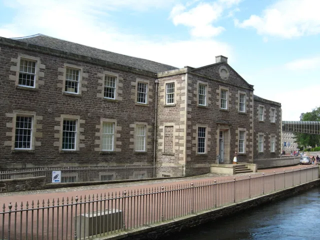
Viewpoint
Cafés
Hostel
Petrol stations
Variety stores
Hairdressers
Bus stops
Gift shops
Sports shops
Supermarkets
Charity shops
Tourist information offices
Convenience stores
Hotels
Guest house
Community centre
Artwork
Roads nearby
Rosedale StreetWee Row Youth Hostel, New Lanark Mill Hotel, New Lanark
300 m
Braxfield Terrace450 m
New Lanark RoadVillage Store, New Lanark Visitor Centre, New Lanark World Heritage Site
500 m
Lady Mary's Walk550 m
Bankhead Terrace650 m
The Beeches650 m
Well Road750 m
Braxfield Road750 m
Bonnington Avenue850 m
Brierybank Avenue850 m
Kirklands Road900 m
Alder Lane900 m
St Mungo's950 m
Maple Gate1000 m
Weavers Walk1,0 km
Delves RoadDelves Park House, Glenmuir
1,0 km
Friars Lane1,0 km
Guschet Place1,1 km
Castlegate1,1 km
Friarsdene1,1 km
Hyndford RoadHyndford Road, Holmview, Hyndford Grange, Hyndfordbridge End, Hyndford Bridge, Ayr Road
1,1 km
Albany DriveHigh Crosshill
1,1 km
Wellgatehead1,1 km
Wellgate1,1 km
Markgreen Park1,1 km
Broomgate1,1 km
South Vennel1,2 km
Bernard's Wynd1,2 km
Thomson's CloseMarie Curie
1,2 km
Attraction nearby
Mill 450 m
Buildings nearby
Visitor Centrr former Institute for the Formation of Character100 m
The Mechanics Workshop100 m
Museum Stair400 m
Glenmuir1000 m
Old Lanark Grammar Science Building1,0 km
Canals nearby
Mill Race50 m
Churches nearby
St. Nicholas Parish Church Hall1,1 km
Community centres nearby
New Lanark Community Hall250 m
Gardens nearby
MId-Lodge Tree Nursery700 m
Industrial buildings nearby
Bonnington Power Station850 m
Museum nearby
Robert Owen's House200 m
Parks nearby
Delves Park1,1 km
Places of worship nearby
St Mary's RC Church1,2 km
Retail areas nearby
Unit 91,1 km
Streams nearby
Mill Lade200 m
Ponclair Burn350 m
Weirs nearby
Mill Weir400 m
Other nearby
Corra Linn Substation800 m
Ruins of Church of St Kentigern's1,1 km
| Heritage designation | category A listed building |
|---|---|
| Located in | South Lanarkshire, Lanark |
| Country | United Kingdom |
| Location | Lanark |
 Public transport map South Lanarkshire Legend
| Railway | |
| Bus | |
| Tram |
 Cycling map South Lanarkshire Legend
| Cycle path | |
| Cycle lane on road | |
| Cycling on bus lane | |
| Bicycle street | |
| Cyclists allowed | |
| Cyclists allowed, good surface | |
| No cycling | |
| Cobblestones |
| Long-distance cycle route | (depending on scale) | |
| Long-distance cycle route |
 Walking map South Lanarkshire Legend
| Path |
| Long-distance hiking trail | (depending on scale) | |
| Long-distance hiking trail | ||
| No pedestrians |