
West Kirk in South Lanarkshire
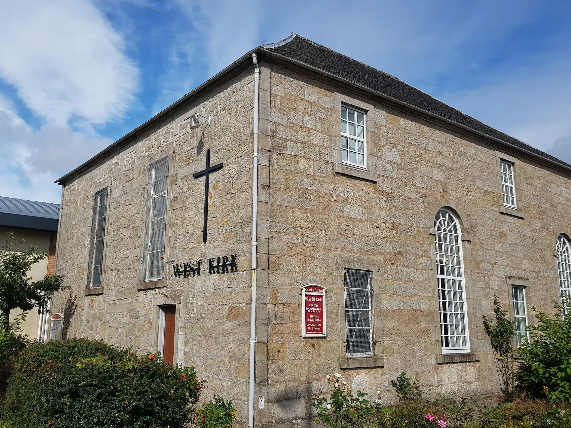
West Kirk in South Lanarkshire is a Presbyteriana church (G74 4JW). It is near Kirkton Gate and is also known as East Kilbride, West Mains Road, West Kirk. The church is a listed building. West Kirk also exists in Orkney Islands and East Lothian.
- Postal Code
- G74 4JW
- Amenity
- place of worship
- Building Type
- building
Image
Restaurants
Benches
Stations
Fountains
Bus stops
Artwork
Off-licences
Platforms
Pubs
Funeral directors
Roads nearby
Kittoch Street50 m
Ladybank Place50 m
Ladybank Court100 m
Barr Terrace100 m
Montgomery Place100 m
Parkhall Street100 m
Ladybank Gardens150 m
West Mains RoadLadybank Court, Torrance Road, Reay Gardens, Kirktonholme, Kirktonholme Road, Mitchell Grove, Fairfield Place, Rosenheath Gate, Strathfillan Road, Dalmellington Drive, Burncrooks Avenue, Glebe Crescent, Glebe Street, Churchill Avenue, Arrotshole Road, Lithgow Place, Graham Avenue, In Search Of Inspiration, Stewartfield Road
150 m
Strait Dykes150 m
Dundas Court150 m
School LaneBothwell Library
150 m
Dundas Place150 m
Brouster Place200 m
Torrance RoadEast Kilbride
250 m
Kirkton GateEast Kilbride
250 m
Graham Avenue250 m
Brouster Hill250 m
Harrington Road300 m
Cunninghame Road300 m
Stuarton Park300 m
Old Coach RoadCo-op Fountain (disused), Wardrop Place, Bosfield place, Shiel Avenue
350 m
Ashton Green350 m
Kirktonholme Gardens350 m
Abbotsford Brae400 m
Park TerraceConcrete sculpture
400 m
Vernon Bank400 m
Holm Lane450 m
Dalrymple Drive450 m
Wardrop PlaceWardrop Place
450 m
Kirtonholme Crescent450 m
Seyton Lane500 m
Markethill Road500 m
Dalmellington Drive550 m
East Mains RoadWilson Place, Iona Avenue, Markethill Road
650 m
Aillort Place650 m
Buildings nearby
Pavilion300 m
The Wee Toll300 m
Former village Police Station350 m
Laigh Markethill Cottage350 m
Constructions nearby
Former Lindsay House100 m
Gardens nearby
Torrance Square Public Garden350 m
Hotels nearby
The Torrance Hotel300 m
Houses nearby
Wellcroft50 m
Parks nearby
Barr Terrace Park100 m
Kirktonholme Park300 m
Town Centre Park350 m
Playgrounds nearby
Dalrymple Drive Children's Play Area500 m
Razed railways nearby
East Kilbride Branch100 m
Social centres nearby
St Andrews Lodge50 m
| Heritage designation | category B listed building |
|---|---|
| Located in | South Lanarkshire, East Kilbride |
| Country | United Kingdom |
| Location | East Kilbride |
 Public transport map South Lanarkshire Legend
| Railway | |
| Bus | |
| Tram |
 Cycling map South Lanarkshire Legend
| Cycle path | |
| Cycle lane on road | |
| Cycling on bus lane | |
| Bicycle street | |
| Cyclists allowed | |
| Cyclists allowed, good surface | |
| No cycling | |
| Cobblestones |
| Long-distance cycle route | (depending on scale) | |
| Long-distance cycle route |
 Walking map South Lanarkshire Legend
| Path |
| Long-distance hiking trail | (depending on scale) | |
| Long-distance hiking trail | ||
| No pedestrians |