
Cononish Gold Mine in Stirling
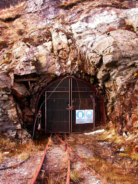
Cononish Gold Mine in Stirling is a quarry.
- Land Use
- quarry
Image
Platforms
Restaurants
Bus stops
ATMs
Tourist information offices
Guest house
Fast food restaurants
Cafés
Clothing shops
Convenience stores
Stations
Petrol stations
Gift shops
Attraction
Roads nearby
Ben Lui north route3,6 km
Lower Station RoadTyndrum Lower, Dalkell Cottage, Kilbride Lodge
3,7 km
West Highland Way - Slighe Taobh an Iar na GàidhealtachdBalmaha, St. Mocha, Village Shop, Rowardennan, St Fillian's Priory, Peatland Restoration Project, Kirkton, Dumgoyach, Inversnaid Hotel, Ardchoil, Ben Lomond Cottage, Top Up Tap, Honesty Box (self-service), Rowchoish, Beinglas, Beinglas Campsite Shop, Showers, Mill of Ross, Scottish Centre for Ecology and the Natural Environment, Cashell Glen, The Battle of Dalrigh, Derrydarroch, Balmaha Car Park, Balmaha Lodges, Rob Roy's Cave, Sroin Uaidh, Dumgoyne, Turnip The Beet, Local Information Box, Turnip the Beet, Wild Camp (3 Tents), Carmyle Cottage, Holy Pool of St Fillan, Welcome to SRUC Kirkton and Auchtertyre Farms, Holy Pool, Cailness, The Lochan of the Lost Sword, Tyndrum Community Woodland, Bealach Ard, Reception & Shop, The Happy Haggis, The Beech Tree
3,8 km
MansefieldTyndrum
4,1 km
Buildings nearby
24,0 km
34,0 km
Arran4,0 km
Lewis4,0 km
Luing4,0 km
Lismore4,0 km
Canna4,0 km
Coll4,0 km
Rum4,0 km
Tiree4,0 km
Raasay4,0 km
Staffa4,0 km
Eriskay4,0 km
Eigg4,0 km
Mull4,0 km
Muck4,1 km
Islay4,1 km
Gigha4,1 km
Body of waters nearby
Lochan Bhe3,2 km
Buildings nearby
Tyndrum Telephone Exchange4,0 km
Caravan site nearby
Tyndrum Holiday Park4,0 km
Fire stations nearby
Tyndrum Fire Station3,8 km
Forests nearby
Coille Coire Chuilc3,8 km
Guest house nearby
Clifton Cottage B&B3,9 km
Hostel nearby
Camping cabin 23,7 km
By the Way3,7 km
Hotels nearby
Muthu Ben Doran Hotel3,9 km
Muthu Royal Hotel3,9 km
Tyndrum Lodges4,0 km
Platforms nearby
13,8 km
Pubs nearby
The Tyndrum Inn Restaurant4,0 km
Railway lines nearby
West Highland Line3,8 km
Restaurants nearby
The Real Food Cafe4,0 km
Ridges nearby
Sob Garbh2,9 km
Stob an Tighe Aird3,1 km
Streams nearby
Allt Eas Anie150 m
Alt nan Sae2,0 km
Allt Coire Ghaothaich2,2 km
Allt an Rund2,4 km
Allt Coire Dubhcraig2,8 km
Allt Coire Laoigh3,1 km
Eas Daimb3,3 km
Alt Garbh Choirean3,4 km
Crom Allt4,2 km
Valleies nearby
Strath Fillan3,9 km
| Located in | Killin |
|---|---|
| Country | United Kingdom |
 Public transport map Stirling Legend
| Railway | |
| Bus | |
| Tram |
 Cycling map Stirling Legend
| Cycle path | |
| Cycle lane on road | |
| Cycling on bus lane | |
| Bicycle street | |
| Cyclists allowed | |
| Cyclists allowed, good surface | |
| No cycling | |
| Cobblestones |
| Long-distance cycle route | (depending on scale) | |
| Long-distance cycle route |
 Walking map Stirling Legend
| Path |
| Long-distance hiking trail | (depending on scale) | |
| Long-distance hiking trail | ||
| No pedestrians |