
Crosswood Reservoir in West Lothian
Crosswood Reservoir in West Lothian is a body of water. Ⓦ.
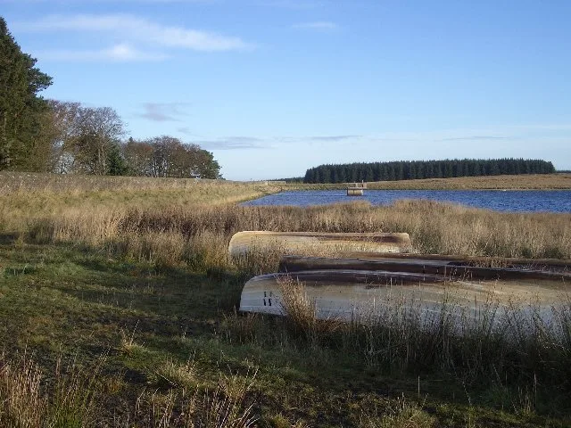
- Nature
- body of water
Bus stops
Clinic
Public clocks
Beauty salons
Drinking water fountains
Viewpoint
Community centre
Restaurants
Fast food restaurants
Cafés
Hairdressers
Kindergarten
Car dealerships
Butcher's
Pubs
Convenience stores
Craft shops
Roads nearby
Crosswood Bridge1,1 km
Shear Bridge1,2 km
Viewfield Road3,7 km
Crosswood TerraceTarbrax
3,9 km
Midgy Lane3,9 km
Torphin Bridge4,6 km
Murieston South District RoadMurieston Valley
4,9 km
Buildings nearby
Crosswood Hill1,7 km
Maidenwell2,5 km
Colzium House2,8 km
Parkview Cottages3,8 km
Lawhead Farm4,2 km
Dykehead4,3 km
South Tarbrax4,6 km
Bents Cottages4,8 km
Commercial buildings nearby
Harburn Golf Club clubhouse4,5 km
Community centres nearby
Tarbrax Village Hall3,7 km
Harburn Village Hall4,7 km
Dams nearby
Cobbinshaw Reservoir Dam3,5 km
Farmlands nearby
Colzium2,7 km
Farmyards nearby
Crosswoodburn350 m
Harburnhead3,0 km
Over Williamston4,2 km
West Torphin4,3 km
Coalheugh Head4,5 km
Blackhall4,9 km
Golf courses nearby
Harburn Golf Club4,0 km
Grasslands nearby
Tor Whitie Wetland4,5 km
Houses nearby
Station House4,4 km
Landfills nearby
Tarbrax Bing3,7 km
Parks nearby
Tarbrax common3,7 km
Quarries nearby
Harburn Lime Works3,1 km
Torphin Quarry3,8 km
Railway lines nearby
West Coast Main Line4,6 km
Residential areas nearby
Broadmeadow4,5 km
Residential buildings nearby
Over Williamston Cottage4,0 km
Rivers nearby
Water of Leith4,2 km
Streams nearby
Green Burn650 m
Crosswood Burn1,8 km
Coldwell Strand2,3 km
West Burn2,6 km
Mid Burn3,1 km
Whitelea Burn3,2 km
East Burn3,5 km
Black Burn3,8 km
Bog Burn4,1 km
Camilty Water4,2 km
South Medwyn4,2 km
Woodlands nearby
Tor Whitie4,7 km
| Located in | West Lothian |
|---|---|
| Country | United Kingdom |
 Public transport map West Lothian Legend
| Railway | |
| Bus | |
| Tram |
 Cycling map West Lothian Legend
| Cycle path | |
| Cycle lane on road | |
| Cycling on bus lane | |
| Bicycle street | |
| Cyclists allowed | |
| Cyclists allowed, good surface | |
| No cycling | |
| Cobblestones |
| Long-distance cycle route | (depending on scale) | |
| Long-distance cycle route |
 Walking map West Lothian Legend
| Path |
| Long-distance hiking trail | (depending on scale) | |
| Long-distance hiking trail | ||
| No pedestrians |