
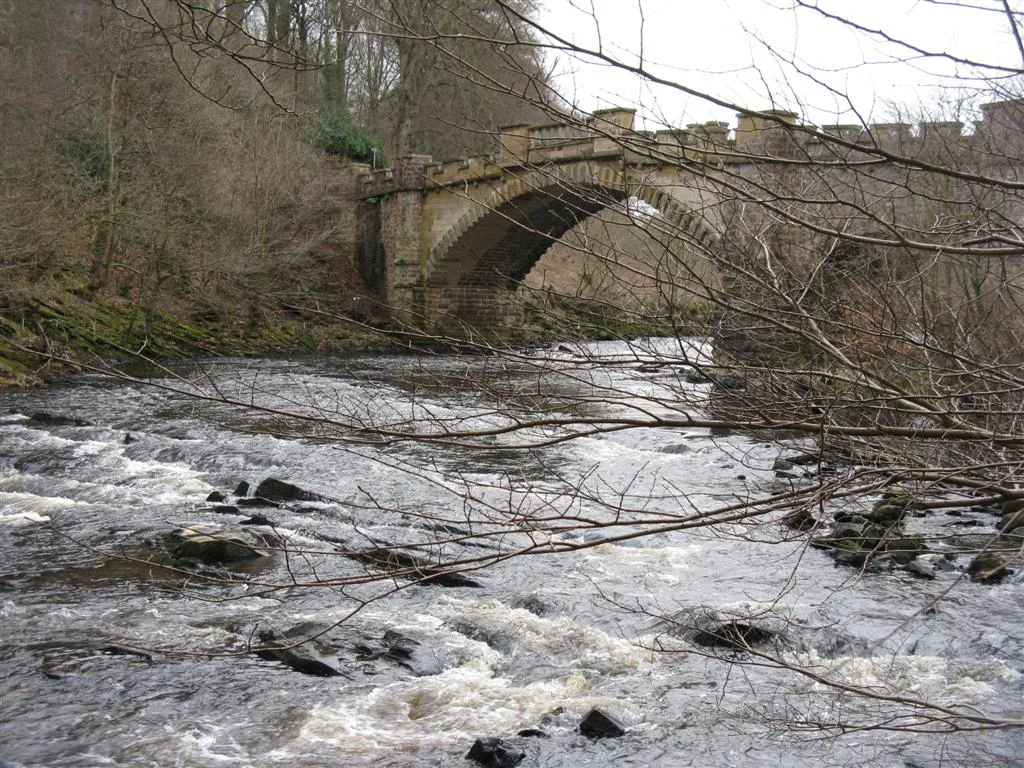
Nasmyth Bridge in West Lothian
Nasmyth Bridge in West Lothian is an asphalted, unlit service road. The road has no sidewalks as well as a width of 3 m. It runs in a north-south direction and ends in a cul-de-sac. This road is part of the bicycle routes Feeder Canal Path (incomplete) and NCN National Route Link 75, 754. Ⓦ.
- Road Type
- service road
- Route
- north-south
Image
Tourist information offices
Car repair shops
Convenience stores
Tattoo studios
Cafés
Bus stops
Hairdressers
Clinic
Artwork
Fast food restaurants
Pet shops
Post offices
Pharmacy
Roads nearby
Larchwood Path100 m
Daffodil Way200 m
Snowdrop Path200 m
Fern Way250 m
Hawthorn Road250 m
Whitebeam Road300 m
Calderwood RoadCalderwood Mobility Hub
300 m
Renwick Court350 m
Almondell Aqueduct350 m
Bluebell Road350 m
Forest Glade400 m
Badger Walk400 m
Thistle Road400 m
Aspen Crescent450 m
Camps Viaduct450 m
Alder Walk450 m
Lavender Crescent450 m
Grouse Drive500 m
Capercaillie Road550 m
Woodpecker Road550 m
Laburnum Crescent550 m
Rowan Walk550 m
Raven Road600 m
Sheil Place600 m
Kestrel Drive600 m
Beech Path600 m
Osprey Crescent600 m
Golden Eagle Road650 m
Rowan Place650 m
Sheil Lane650 m
Sheil Path650 m
Beech Lane700 m
Almondell Terrace700 m
Almond Grove700 m
Drovers RoadJustGo
750 m
Main StreetPark Terrace, Fabulous Face & Nail Studio, Road End, Fauldhouse, Barbara's, Day-Today Express, Bridge Street, St Kentigerns Academy, Redmill Cottages, Redmill Court, Country Fayre, Lawson's, Oriental Dynasty, Scotmid, Winchburgh Cafe, Best-one, Station Road, Marley & Co Pet Supplies, King Turkish Barbers, Streaks Ahead, East Whitburn, Hair port, Pentland View, Jet, Newton Stores, Duddingstone Terrace, East Calder, Inkwell, Mabitt Cafe, Cooking House, East Calder Pharmacy, TJ's Barbers, Aldo's, East Calder Post Office, East Calder Convenience Store, Tillychance Dog Grooming, St Theresa's Church, Grove Public House, The Bay Tree Cafe, Past and Present, Chiropractic Care West Lothian, Simply Play, Library, Longridge, Jorga's, Aldo's Fish and Chicken Bar, Northfield Terrace, Mid Calder, The Midcalder Inn, The Pie & Sausage Shop, Beverley Pawz, Alainn, M M stylists, Glow Up, Cemetery, Omnicare Pharmacy, McDonald Footcare, Union Square, Stewart Street, Chillies, New Cafe (Cafe Nuovo), Hazel's Fabric Craft, Travelyard, Bliss, Lindsay & Gilmour, Annie's Calder, Day-Today, DiBiasio Styling, Chippy Takeaway, Hairways, Button Nose and Tiny Toes, Ghosts & Ghouls, Hair by Katie, La Salute Ristorante, Just Sew, Katie's Pet Point, R & J McDonald Kiltmakers, Chinese Takeaway, Railway Inn, The Sweet Life, The Central Inn, Zayna Food Store, Pedal Power, Thistles Coffee Shop, Blackridge, Blackridge Post Office, Blackridge Pharmacy, Parish Church, Post Office, Linlithgow Bridge, Sainsburys, Argos, Mill Road, Garden City, Meadow Road, Millgate, Philpstoun, Church Court, Mosshall Caravan Park, Ali Brothers, Primary School, Our Ladys RC School, War Memorial, Stoneyburn Workshops, Connells, Eastern Spice, HD, Nice 'n' Spicy, Smartways, Health Centre, Eldrick Avenue, Cemetery Road, Caledonian Road, Brig Inn, Kirknewton, Festival Stores, The Inn, Kirknewton Community Centre, Forth View, Kirknewton Pharmacy, Kirknewton Post Office, Kirknewton Inn, Raw Cottages, Livingston Station Post Office, Peking Inn, Opa Opa, Black Rooster, China Palace, Livingston Village, Aaron Michael's, AM Coffee, Dechmont, Badger Wood, Knightsridge Road, Calderwood, Colin Nixon Autosafe, Meadowbank Road, Winchburgh, Fauldhouse Road, Dog's Galore, School, Aaron Michaels
750 m
Little Sheil RoadShiel Lane
800 m
Templar Road800 m
Calder De Clere Crescent800 m
Buildings nearby
Old Clapperton Hall200 m
Four Winds200 m
Robins Nest250 m
Calderwood Phase 2250 m
Calderwood450 m
Cafés nearby
The Larder Cafe450 m
Cemeteries nearby
Almondell Cemetery700 m
Gardens nearby
Calderwood Community Garden400 m
Streams nearby
Union Canal Feeder200 m
Tourist information offices nearby
Almondell & Calderwood Country Park Visitor Centre500 m
| Located in | West Lothian, Uphall, Kirknewton |
|---|---|
| Country | United Kingdom |
| Crosses | River Almond |
| Carries thoroughfare | farm road |
| Location | Uphall |
 Public transport map West Lothian Legend
| Railway | |
| Bus | |
| Tram |
 Cycling map West Lothian Legend
| Cycle path | |
| Cycle lane on road | |
| Cycling on bus lane | |
| Bicycle street | |
| Cyclists allowed | |
| Cyclists allowed, good surface | |
| No cycling | |
| Cobblestones |
| Long-distance cycle route | (depending on scale) | |
| Long-distance cycle route |
 Walking map West Lothian Legend
| Path |
| Long-distance hiking trail | (depending on scale) | |
| Long-distance hiking trail | ||
| No pedestrians |