
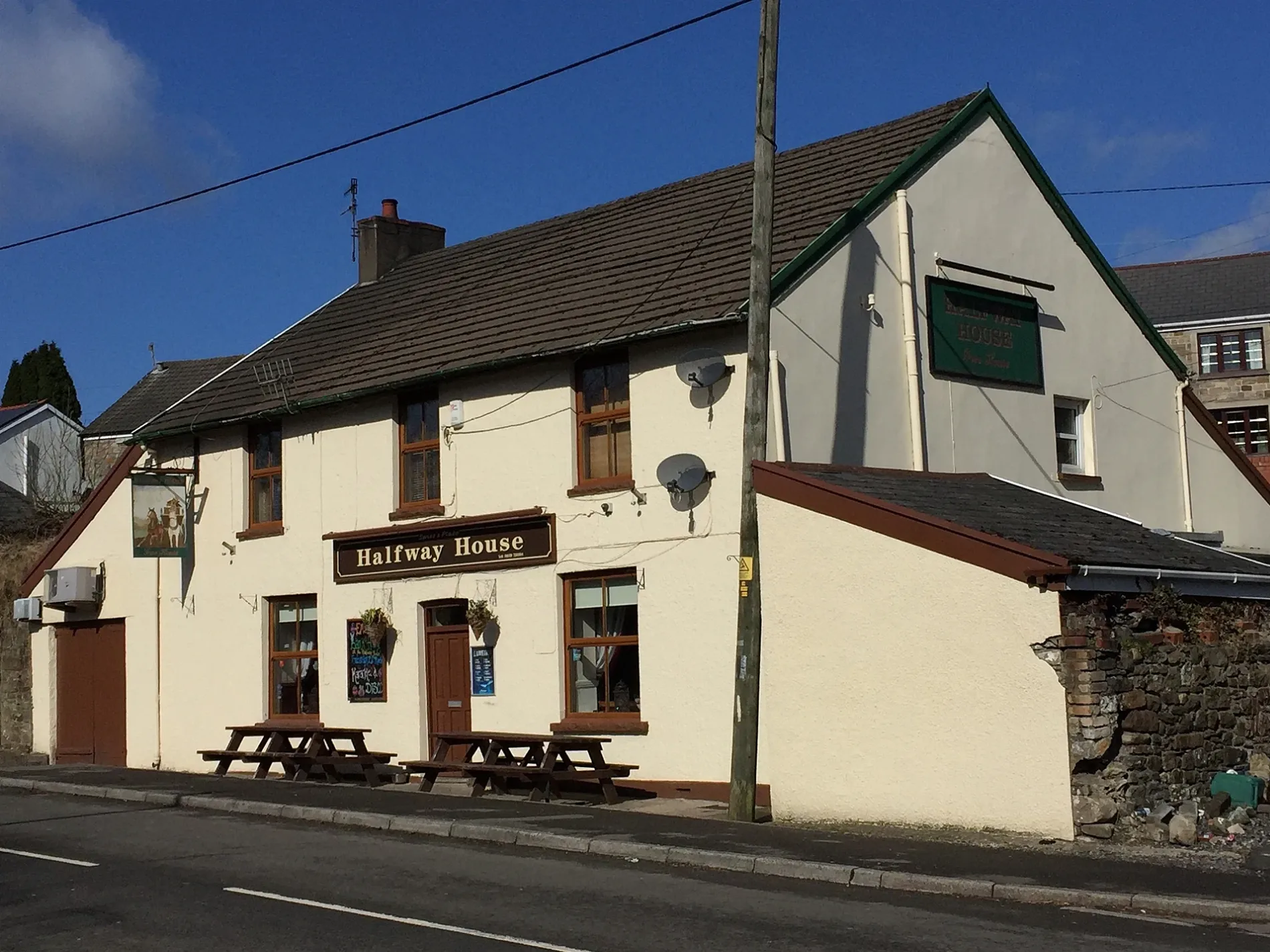
Halfway House in Glynneath
Halfway House in Neath Port Talbot, Glynneath is a pub (limited wheelchair access), Aberdare Road (SA11 5HY). Halfway House is also known as The Halfway House, Neath. Halfway House also exists in Sir Gaerfyrddin / Carmarthenshire, Bridgend, Flintshire and Gwynedd.
- Postal Code
- SA11 5HY
- Street
- Aberdare Road
- Amenity
- pub
- Building Type
- building
- Wheelchair Access
- limited
Image
Pet groomings
Pharmacy
Bar
Bus stops
Places of worship
Artwork
Supermarkets
Doctor's office
Dive centres
Roads nearby
Pontneathvaughan RoadPontneath Vaughan Road
100 m
Brynhyfryd150 m
Riverside Gardens200 m
Waungron200 m
Ynyslas Crescent250 m
Glan Gwrelych300 m
Heads of the Valleys RoadGlynneath
300 m
Woodland ParkGlynneath
350 m
Aberdare RoadPontwalby Bridge
350 m
Heol-Y-Glyn350 m
Freshfields350 m
Tramway Side350 m
Llewellyn StreetSt John Kemble RC Church
400 m
Bethel Road400 m
Lon-Y-Nant400 m
Merthyr RoadPontwalby
400 m
Glynmelyn Road450 m
High StreetFamily Shopper, Statue of Max Boyce, Rompers Nursery, Halfway Inn, Co-op
450 m
Vale of Neath Railway500 m
Hay's Crescent500 m
Heathfield AvenueBark Avenue Dog Grooming & Boutique
550 m
Oddfellows Street550 m
Lon-Y-Bryn550 m
Bethania Street550 m
New Street550 m
Heathfield Court600 m
Canal Place650 m
Whitting Street650 m
Edward Street750 m
Gellidawel Road800 m
Lancaster Close800 m
Robert Street800 m
Rock Street800 m
Gelliceibryn850 m
Farmyards nearby
Hendre-Wyddil700 m
Fast food restaurants nearby
Cosy Corner Fish & Chips500 m
Fitness centres nearby
Train Station350 m
Libraries nearby
Glynneath Library900 m
Police stations nearby
Glynneath Police650 m
Pubs nearby
Dinas Rock250 m
Glynneath Social Club450 m
Glynneath Town Football Club800 m
School buildings nearby
Cwmnedd School Barn750 m
Social facilities nearby
Trem y Glyn900 m
Sports pitches nearby
Glynneath RFC350 m
Streams nearby
Nant Gwrelych400 m
Nant y Gwyddyl650 m
Nant yr Eithin950 m
Supermarkets nearby
Co-op Food550 m
| Located in | Glynneath |
|---|---|
| Country | United Kingdom |
 Public transport map Glynneath Legend
| Railway | |
| Bus | |
| Tram |
 Cycling map Glynneath Legend
| Cycle path | |
| Cycle lane on road | |
| Cycling on bus lane | |
| Bicycle street | |
| Cyclists allowed | |
| Cyclists allowed, good surface | |
| No cycling | |
| Cobblestones |
| Long-distance cycle route | (depending on scale) | |
| Long-distance cycle route |
 Walking map Glynneath Legend
| Path |
| Long-distance hiking trail | (depending on scale) | |
| Long-distance hiking trail | ||
| No pedestrians |