
South Avenue in Gwynfi and Croeserw
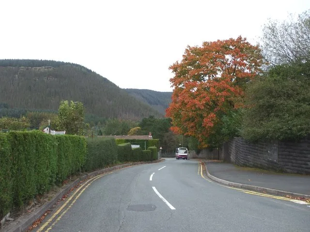
South Avenue in Neath Port Talbot, Gwynfi and Croeserw is a two-lane, asphalted residential street. There is no cycle path. It runs in a southeast-northwest direction starting from Eastern Avenue and crosses Sunny Crescent, Penhydd Road, Dwyfor Road, Prescelly Road, Gwynedd Avenue and Bryn Siriol and ends at Church Street. South Avenue also exists in Sir Gaerfyrddin / Carmarthenshire, Denbighshire, Torfaen and Rhondda Cynon Taf.
- Bicycle
- yes
- Cycle Path
- no
- Road Type
- residential street
- Lanes
- 2
- Speed Limit
- 20 mph
- Route
- southeast-northwest
Image
Roads nearby
Prescelly Road100 m
Sunny Crescent150 m
Dwyfor Road150 m
Hillcroft CrescentCroeserw
200 m
Penderyn Road200 m
Penhydd Road250 m
Gwynedd Avenue250 m
Heol Syr William250 m
Fairfield Road250 m
Llanofer Road250 m
Bryn Siriol300 m
Church Street300 m
Heol-y-Fedw300 m
Pen y Mynydd300 m
Eastern AvenueWilkins Ltd
300 m
Queens Road350 m
Pen-y-Wern350 m
Nant-y-Fedw Road350 m
Heol Tewdwr350 m
Coronation Avenue400 m
Heol Croeserw400 m
Maesteg Road400 m
Menai Avenue400 m
Bryn Coed400 m
Pen-y-Bryn500 m
Afan Valley Cycle TrackGelli Junction, Gelli Houses
500 m
Brynheulog Road600 m
Viaduct Road650 m
Blaencaerau Estate750 m
Cymer RoadCaerau
800 m
Lloyd's Terrace850 m
North's Navigation Railway900 m
Brynglas Terrace1,0 km
Alexandra Place1,0 km
Blaencaerau Road1,0 km
Albert Street1,1 km
North Street1,1 km
Alexandra Road1,1 km
Hamilton Terrace1,1 km
Buildings nearby
Croeserw Hotel100 m
Convenience stores nearby
Premier Croeserw Stores400 m
Industrial areas nearby
Croeserw Industrial Estate200 m
Recreation grounds nearby
Tudor Park500 m
Red Field Rugby & Football Gound650 m
Rivers nearby
River Afan650 m
Streams nearby
Nant y Wern500 m
Nant Graig-Iwyd700 m
Llynfi River1000 m
Other nearby
Caerau Primary Substation650 m
 Public transport map Gwynfi and Croeserw Legend
| Railway | |
| Bus | |
| Tram |
 Cycling map Gwynfi and Croeserw Legend
| Cycle path | |
| Cycle lane on road | |
| Cycling on bus lane | |
| Bicycle street | |
| Cyclists allowed | |
| Cyclists allowed, good surface | |
| No cycling | |
| Cobblestones |
| Long-distance cycle route | (depending on scale) | |
| Long-distance cycle route |
 Walking map Gwynfi and Croeserw Legend
| Path |
| Long-distance hiking trail | (depending on scale) | |
| Long-distance hiking trail | ||
| No pedestrians |