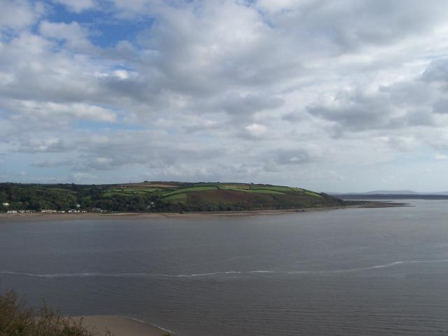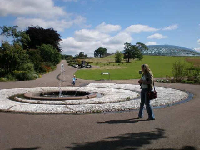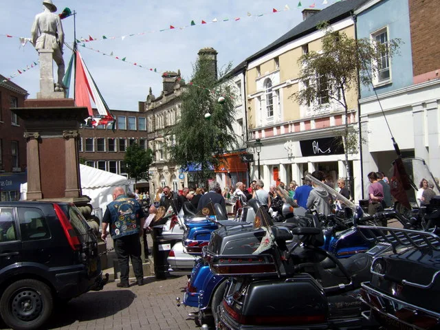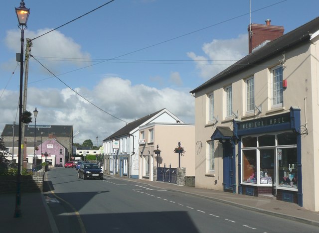
Sir Gaerfyrddin

This City map of Sir Gaerfyrddin / Carmarthenshire shows the region’s streets, paths and places in south-west Wales. The principal area covers approximately 2,370.3 square kilometres and extends to Carmarthen Bay. Around 187,900 people live in the region, whose population increased from 172,831 in 2001 to 187,568 in 2018. OpenStreetMap records 72 subregions within this Welsh administrative area.

City map Sir Gaerfyrddin
See those listed above-this is a composite of their work., CC BY-SA 4.0 – Wikimedia Commons
City map St Clears
Humphrey Bolton, CC BY-SA 2.0 – Wikimedia Commons

St Clears

St Clears is a Welsh parish in Carmarthenshire. It is recorded as an administrative level 10 subregion. The place lies within the Carmarthenshire area of south-west Wales. This map identifies St Clears together with its local streets and paths.
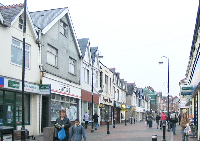
City map Ammanford
Nigel Davies, CC BY-SA 2.0 – Wikimedia Commons

Ammanford

Ammanford is an administrative level 10 subregion of Carmarthenshire. It is located in south-west Wales within the principal area of Sir Gaerfyrddin. The town is associated with the wider Amman Valley. The map records Ammanford and its surrounding roads and places.

City map Llanelli
Jaggery, CC BY-SA 2.0 – Wikimedia Commons

Llanelli

Llanelli is an administrative level 10 subregion in Carmarthenshire. The town is situated in the coastal south of the region, near the Burry Inlet and Carmarthen Bay. Llanelli forms one of the principal urban areas of south-west Wales. Its streets, paths and neighbouring places are shown on this map.

City map Llandovery
Nigel Davies, CC BY-SA 2.0 – Wikimedia Commons

Llandovery

Llandovery is an administrative level 10 subregion in Carmarthenshire. The town stands in the upper Tywi valley in inland south-west Wales. Llandovery is associated with the Cambrian Mountains and the River Tywi. The map shows its built-up area and connections with nearby places.

City map Llandeilo
Gerald England, CC BY-SA 2.0 – Wikimedia Commons

Llandeilo

Llandeilo is an administrative level 10 subregion of Carmarthenshire. It lies in the Tywi valley in south-west Wales. The town is close to Dinefwr Castle and the National Botanic Garden of Wales. Its local roads and surrounding settlements are included in the map.

City map Laugharne Township
Nilfanion, CC BY-SA 4.0 – Wikimedia Commons

Laugharne Township

Laugharne Township is a community in Carmarthenshire, Wales, recorded as an administrative level 10 subregion. Its population is 1,099. Laugharne lies on the estuary of the River Taf beside Carmarthen Bay. The town is closely associated with the poet Dylan Thomas and the medieval Laugharne Castle.

City map Carmarthen
Nigel Davies, CC BY-SA 2.0 – Wikimedia Commons

Carmarthen

Carmarthen is an administrative level 10 subregion and the county town of Carmarthenshire. It stands on the River Tywi in south-west Wales. The town occupies a central position within a region of approximately 2,370.3 square kilometres. This map shows Carmarthen’s streets, paths and surrounding places.

City map Llangennech
David Medcalf, CC BY-SA 2.0 – Wikimedia Commons

Llangennech

Llangennech is an administrative level 10 subregion in Carmarthenshire. It lies near the eastern side of the Loughor estuary, close to Llanelli. The settlement is part of the coastal and industrial corridor of south-west Wales. Its local transport connections and streets are represented on the map.

City map Llanelli Rural
Jaggery, CC BY-SA 2.0 – Wikimedia Commons

Llanelli Rural

Llanelli Rural is a community near Llanelli in Carmarthenshire and an administrative level 10 subregion. It has a population of 22,800 and an area of 62,115,600 square metres. The community surrounds the urban area of Llanelli in the coastal south of the region. The map covers its roads, paths and rural places.

City map Llanedi
Nigel Davies, CC BY-SA 2.0 – Wikimedia Commons

Llanedi

Llanedi is an administrative level 10 subregion of Carmarthenshire. It is located in the Amman and Loughor area of south-west Wales. The community belongs to the inland-coastal transition zone north of Llanelli. Its local places and road network are included in this map.

City map Betws
Eirian Evans, CC BY-SA 2.0 – Wikimedia Commons

Betws

Betws is an administrative level 10 subregion in Carmarthenshire. It lies in the northern part of the Llanelli and Ammanford area. The settlement is within the wider south-west Welsh principal area. Streets and paths around Betws are shown on the regional map.

City map Cwmamman
Nigel Davies, CC BY-SA 2.0 – Wikimedia Commons

Cwmamman

Cwmamman is a community in Carmarthenshire and an administrative level 10 subregion. It has a population of 4,486 and covers 27,461,300 square metres. The community is situated in the Amman Valley in south-west Wales. Its settlements, roads and paths are recorded in this map.

Cwarter Bach

Cwarter Bach is a community in Carmarthenshire, recorded at administrative level 10. Its population is 2,921 and its area is 32,047,800 square metres. The community lies in the south-west Welsh interior. This map identifies Cwarter Bach within the wider Carmarthenshire road network.

City map Llanddeusant
Nigel Davies, CC BY-SA 2.0 – Wikimedia Commons

Llanddeusant

Llanddeusant is a village and community in Carmarthenshire at administrative level 10. It has 220 residents and covers 61,527,700 square metres. The community lies in the upland landscape of south-west Wales. Its village, paths and surrounding roads appear on the map.

City map Myddfai
Nigel Davies, CC BY-SA 2.0 – Wikimedia Commons

Myddfai

Myddfai is a Welsh parish in Carmarthenshire and an administrative level 10 subregion. It lies near the western edge of the Brecon Beacons, now known as Bannau Brycheiniog National Park. The settlement is associated with the upper Tywi valley. This map shows Myddfai and its local access routes.

City map Llanfair-ar-y-Bryn
Flying Stag, CC BY-SA 2.0 – Wikimedia Commons

Llanfair-ar-y-Bryn

Llanfair-ar-y-Bryn is a community and parish in Carmarthenshire. It is recorded as an administrative level 10 subregion, with 624 residents and an area of 96,870,700 square metres. The parish is located near Llandovery in inland south-west Wales. Its roads, paths and settlements are included in this map.

City map Cilycwm
Stuart Wilding, CC BY-SA 2.0 – Wikimedia Commons

Cilycwm

Cilycwm is an administrative level 10 subregion of Carmarthenshire. It lies in the upper Tywi valley north of Llandovery. The community is situated within the rural interior of south-west Wales. The map records Cilycwm and its connections with nearby villages.

City map Cynwyl Gaeo
Jeremy Bolwell, CC BY-SA 2.0 – Wikimedia Commons

Cynwyl Gaeo

Cynwyl Gaeo is a community in Carmarthenshire at administrative level 10. It has a population of 940 and covers 108,398,500 square metres. The community lies in the upland interior between Carmarthen and Llandovery. Its roads and rural settlements are shown on the map.

City map Llanycrwys
irwel jones, CC BY-SA 2.0 – Wikimedia Commons

Llanycrwys

Llanycrwys is an administrative level 10 subregion in Carmarthenshire. It is located in the inland part of south-west Wales. The community belongs to the rural area between the Tywi valley and the Teifi valley. This map shows Llanycrwys and its local routes.

City map Pencarreg
Marion Phillips, CC BY-SA 2.0 – Wikimedia Commons

Pencarreg

Pencarreg is an administrative level 10 subregion of Carmarthenshire. It lies in the western interior near the Teifi valley. The community is situated within the principal area of south-west Wales. Its roads, paths and named places are included in this map.

City map Llanybydder
Nigel Brown, CC BY-SA 2.0 – Wikimedia Commons

Llanybydder

Llanybydder is an administrative level 10 subregion in Carmarthenshire. It stands on the River Teifi in the western part of south-west Wales. The town connects the rural areas of Carmarthenshire with neighbouring Ceredigion. This map records Llanybydder and its surrounding streets.

City map Llanllwni
Peter Conroy, CC BY-SA 2.0 – Wikimedia Commons

Llanllwni

Llanllwni is an administrative level 10 subregion of Carmarthenshire. It lies near the River Teifi in the western interior. The settlement is part of the rural landscape between Carmarthen and the Cambrian uplands. Its local roads and paths are shown on the map.

City map Llanfihangel-ar-Arth
Peter Conroy, CC BY-SA 2.0 – Wikimedia Commons

Llanfihangel-ar-Arth

Llanfihangel-ar-Arth is an administrative level 10 subregion in Carmarthenshire. It is located in the Teifi valley area of south-west Wales. The community lies between the towns of Llanybydder and Newcastle Emlyn. This map shows its streets, paths and nearby places.

City map Llangeler
John Gillibrand, CC BY-SA 2.0 – Wikimedia Commons

Llangeler

Llangeler is an administrative level 10 subregion of Carmarthenshire. It lies in the western part of the region near the River Teifi. The community is positioned close to Newcastle Emlyn and the Ceredigion border. Its local road network is represented on this map.

City map Newcastle Emlyn
Stephen McKay, CC BY-SA 2.0 – Wikimedia Commons

Newcastle Emlyn

Newcastle Emlyn is an administrative level 10 subregion in Carmarthenshire. The town stands on the River Teifi near the border with Ceredigion. Newcastle Emlyn Castle is a notable medieval ruin beside the river. The map includes the town’s streets and surrounding paths.

City map Cenarth
Cered, CC BY-SA 2.0 – Wikimedia Commons

Cenarth

Cenarth is an administrative level 10 subregion of Carmarthenshire. It lies on the River Teifi near the borders of Ceredigion and Pembrokeshire. Cenarth Falls is a recognised natural feature on the river. This map shows the village and its local routes.

City map Trelech
Humphrey Bolton, CC BY-SA 2.0 – Wikimedia Commons

Trelech

Trelech is an administrative level 10 subregion in Carmarthenshire. It lies in the western rural area between Newcastle Emlyn and Carmarthen. The community is situated within the south-west Welsh landscape. Its roads and local places are recorded on the map.

City map Llanwinio
Roger W Haworth, CC BY-SA 2.0 – Wikimedia Commons

Llanwinio

Llanwinio is an administrative level 10 subregion of Carmarthenshire. It lies in the western interior north of Carmarthen. The community is connected with the rural valleys leading towards the River Taf. This map identifies Llanwinio and its local streets and paths.

City map Llanboidy
Roger W Haworth, CC BY-SA 2.0 – Wikimedia Commons

Llanboidy

Llanboidy is an administrative level 10 subregion in Carmarthenshire. It lies near the River Taf in the west of the principal area. The community is situated between Whitland and the inland valleys of south-west Wales. Its routes and named places are shown on the map.

City map Cilymaenllwyd
Roger W. Haworth ( talk · contribs ), CC BY-SA 4.0 – Wikimedia Commons

Cilymaenllwyd

Cilymaenllwyd is a community in Carmarthenshire at administrative level 10. It has a population of 742 and covers 26,795,600 square metres. The community lies in the western part of the region. Its roads, paths and surrounding places are included in this map.

City map Henllanfallteg
welshbabe, CC BY-SA 2.0 – Wikimedia Commons

Henllanfallteg

Henllanfallteg is a community in Carmarthenshire and an administrative level 10 subregion. Its population is 480 and its area is 16,138,900 square metres. The community is located in the western rural part of south-west Wales. This map records Henllanfallteg and its local access routes.

City map Whitland
Whatlep, CC BY-SA 2.0 – Wikimedia Commons

Whitland

Whitland is a town and community in Carmarthenshire at administrative level 10. It has a population of 1,792 and covers 6,284,200 square metres. The town lies in the west of the region near the River Taf. Its streets and connections with neighbouring communities appear on the map.

City map Eglwyscummin
lizzie, CC BY-SA 2.0 – Wikimedia Commons

Eglwyscummin

Eglwyscummin is a community in Carmarthenshire and an administrative level 10 subregion. Its population is 432 and its area is 42,380,300 square metres. The community lies in the south-western part of the region near the Pembrokeshire border. The map shows its rural roads and places.

City map Pendine
Humphrey Bolton, CC BY-SA 2.0 – Wikimedia Commons

Pendine

Pendine is an administrative level 10 subregion on the Carmarthenshire coast. It faces Carmarthen Bay and is known for the long Pendine Sands beach. The settlement lies west of Laugharne and east of the Pembrokeshire boundary. Its coastal roads and paths are included in this map.

City map Llanddowror
Roger Cornfoot, CC BY-SA 2.0 – Wikimedia Commons

Llanddowror

Llanddowror is an administrative level 10 subregion in Carmarthenshire. It lies inland from Carmarthen Bay near the River Taf and the town of St Clears. The community is situated in the western coastal hinterland. This map records its streets, paths and surrounding settlements.

City map Pembrey and Burry Port Town
Jaggery, CC BY-SA 2.0 – Wikimedia Commons

Pembrey and Burry Port Town

Pembrey and Burry Port Town is a community in Carmarthenshire at administrative level 10. It has a population of 7,957 and an area of 41,458,000 square metres. The community lies on the coast beside the Burry Inlet and Carmarthen Bay. Burry Port harbour and Pembrey Country Park are notable local features.

City map Llangynin
Brian Robert Marshall, CC BY-SA 2.0 – Wikimedia Commons

Llangynin

Llangynin is an administrative level 10 subregion of Carmarthenshire. It lies in the western part of the region near St Clears and the River Taf. The community forms part of the rural area leading towards Carmarthen Bay. Its local roads and paths are shown on the map.

City map Meidrim
Nigel Davies, CC BY-SA 2.0 – Wikimedia Commons

Meidrim

Meidrim is an administrative level 10 subregion in Carmarthenshire. It lies in the western interior north of St Clears. The community is situated within the drainage area of the River Taf. This map includes Meidrim and its connections with nearby villages.

City map Llansteffan
Humphrey Bolton, CC BY-SA 2.0 – Wikimedia Commons

Llansteffan

Llansteffan is an administrative level 10 subregion on the Tywi estuary. The village faces Carmarthen Bay and is known for Llansteffan Castle on the headland. It lies south of Carmarthen across the lower River Tywi. The map shows its coastal streets and paths.

City map Llangynog
Peter Shaw, CC BY-SA 2.0 – Wikimedia Commons

Llangynog

Llangynog is an administrative level 10 subregion in Carmarthenshire. It lies in the rural interior north of Carmarthen. The community is part of the network of valleys between the Tywi and Taf catchments. Its local places and roads are recorded on the map.

City map Newchurch and Merthyr
Milestone Society, CC BY-SA 2.0 – Wikimedia Commons

Newchurch and Merthyr

Newchurch and Merthyr is a community in Carmarthenshire at administrative level 10. It has a population of 676 and covers 25,074,000 square metres. The community lies in the rural interior of south-west Wales. This map shows its roads, paths and named settlements.

City map Abernant
Ruth Sharville, CC BY-SA 2.0 – Wikimedia Commons

Abernant

Abernant is an administrative level 10 subregion in Carmarthenshire. It lies in the inland area north of Carmarthen. The community is situated among the valleys and uplands of south-west Wales. Its local streets and paths are included in the map.

City map Cynwyl Elfed
Dylan Moore, CC BY-SA 2.0 – Wikimedia Commons

Cynwyl Elfed

Cynwyl Elfed is an administrative level 10 subregion of Carmarthenshire. It lies north of Carmarthen in the valley of the River Gwili. The settlement is connected by road with Carmarthen and the western communities. This map records Cynwyl Elfed and its surrounding places.

City map Bronwydd
Robert Davies, CC BY-SA 2.0 – Wikimedia Commons

Bronwydd

Bronwydd is an administrative level 10 subregion in Carmarthenshire. It lies north of Carmarthen near the River Gwili. The community is associated with the Gwili Railway heritage line. Its roads, paths and nearby settlements are represented on the map.

City map Llanpumsaint
Nigel Davies, CC BY-SA 2.0 – Wikimedia Commons

Llanpumsaint

Llanpumsaint is an administrative level 10 subregion of Carmarthenshire. It lies in the inland area north of Carmarthen. The community is located near the upper River Gwili and the route towards Lampeter. This map shows its village streets and rural connections.

City map St. Ishmael
Cered, CC BY-SA 2.0 – Wikimedia Commons

St. Ishmael

St. Ishmael is a village and community in Carmarthenshire at administrative level 10. It has a population of 1,370 and covers 18,572,500 square metres. The community lies in the coastal south-west near the estuary of the River Taf. Its local roads and paths are included in this map.

City map Kidwelly
Jaggery, CC BY-SA 2.0 – Wikimedia Commons

Kidwelly

Kidwelly is an administrative level 10 subregion in coastal Carmarthenshire. The town lies near the estuary of the River Gwendraeth and Carmarthen Bay. Kidwelly Castle is a major medieval landmark beside the town. The map shows Kidwelly’s streets, paths and surrounding wetlands.

City map Trimsaran
Hywel Williams, CC BY-SA 2.0 – Wikimedia Commons

Trimsaran

Trimsaran is an administrative level 10 subregion in the coastal south of Carmarthenshire. It lies west of Llanelli and near the Gwendraeth estuary. The community is part of the former coalfield landscape of south-west Wales. Its local roads and places appear on the map.

City map Llangain
David Medcalf, CC BY-SA 2.0 – Wikimedia Commons

Llangain

Llangain is a village and community in Carmarthenshire at administrative level 10. It has a population of 573 and covers 11,047,800 square metres. The community lies west of Carmarthen near the Tywi estuary. This map records Llangain and its local routes.

City map Llandyfaelog
Nigel Davies, CC BY-SA 2.0 – Wikimedia Commons

Llandyfaelog

Llandyfaelog is an administrative level 10 subregion in Carmarthenshire. It lies near the lower River Tywi between Carmarthen and Llanelli. The community is situated in the coastal lowlands of south-west Wales. Its roads, paths and neighbouring places are shown on the map.

City map Llangyndeyrn
Nigel Davies, CC BY-SA 2.0 – Wikimedia Commons

Llangyndeyrn

Llangyndeyrn is an administrative level 10 subregion in Carmarthenshire. It lies in the Gwendraeth valley east of Kidwelly. The community is part of the southern coalfield and coastal area of the region. Its local settlements and roads are included in this map.

City map Llangunnor
Nigel Davies, CC BY-SA 2.0 – Wikimedia Commons

Llangunnor

Llangunnor is an administrative level 10 subregion near Carmarthen. It lies east of the River Tywi and close to the county town. The community forms part of the central transport area of Carmarthenshire. This map shows its streets, paths and nearby places.

City map Abergwili
Nigel Callaghan, CC BY-SA 2.0 – Wikimedia Commons

Abergwili

Abergwili is an administrative level 10 subregion north of Carmarthen. It stands at the meeting area of the Rivers Tywi and Gwili. The former Bishop’s Palace at Abergwili houses the Carmarthenshire County Museum. Its local streets and paths are shown on the map.

City map Llanllawddog
Marion Phillips, CC BY-SA 2.0 – Wikimedia Commons

Llanllawddog

Llanllawddog is an administrative level 10 subregion in the northern interior of Carmarthenshire. It lies near the River Cothi and the uplands north of Carmarthen. The community is part of the rural landscape leading towards the Cambrian Mountains. This map records its roads and local places.

City map Llannon
Nigel Davies, CC BY-SA 2.0 – Wikimedia Commons

Llannon

Llannon is an administrative level 10 subregion in southern Carmarthenshire. It lies north of Llanelli near the Loughor estuary and the Gwendraeth area. The community is connected with the former industrial corridor of south-west Wales. Its streets and paths are included in this map.

City map Pontyberem
Rose and Trev Clough, CC BY-SA 2.0 – Wikimedia Commons

Pontyberem

Pontyberem is an administrative level 10 subregion in the Gwendraeth valley. It lies in southern Carmarthenshire near the River Gwendraeth Fach. The settlement developed within the former coal-mining area of south-west Wales. The map shows Pontyberem and its local road network.

City map Gorslas
OLU, CC BY-SA 2.0 – Wikimedia Commons

Gorslas

Gorslas is an administrative level 10 subregion in Carmarthenshire. It lies north-east of Llanelli in the Gwendraeth and Loughor area. The community is part of the southern urban and former industrial belt. Its streets, paths and surrounding places appear on the map.

City map Llanddarog
Nigel Davies, CC BY-SA 2.0 – Wikimedia Commons

Llanddarog

Llanddarog is an administrative level 10 subregion in southern Carmarthenshire. It lies between Carmarthen and Llanelli near the Tywi valley. The community is situated in the lowland area north of the coastal belt. This map records Llanddarog and its local routes.

City map Llanarthney
Ben Brooksbank, CC BY-SA 2.0 – Wikimedia Commons

Llanarthney

Llanarthney is an administrative level 10 subregion in the Tywi valley. It lies east of Carmarthen near the National Botanic Garden of Wales. The community is close to the River Tywi and the historic estate landscape of south-west Wales. Its roads and paths are shown on the map.

City map Llanegwad
MumphingSquirrel, CC BY-SA 4.0 – Wikimedia Commons

Llanegwad

Llanegwad is an administrative level 10 subregion in Carmarthenshire. It lies in the Tywi valley north-east of Carmarthen. The community is situated within the central rural area of south-west Wales. This map includes Llanegwad, its local roads and nearby places.

Data sources: OpenStreetMap (ODbL), Wikidata (CC0) · Image: Wikimedia Commons

Sir Gaerfyrddin – Facts

Inhabitants 187568
Area 2370.3 km²
Subregions 72
Located in Wales
Country United Kingdom
Body of water Carmarthen Bay
Described by source Brockhaus and Efron Encyclopedic Dictionary, The Nuttall Encyclopædia, Encyclopædia Britannica 11th edition
Website http://www.carmarthenshire.gov.uk/

Data source: Wikidata (CC0)