
Holy Trinity in City of Nottingham
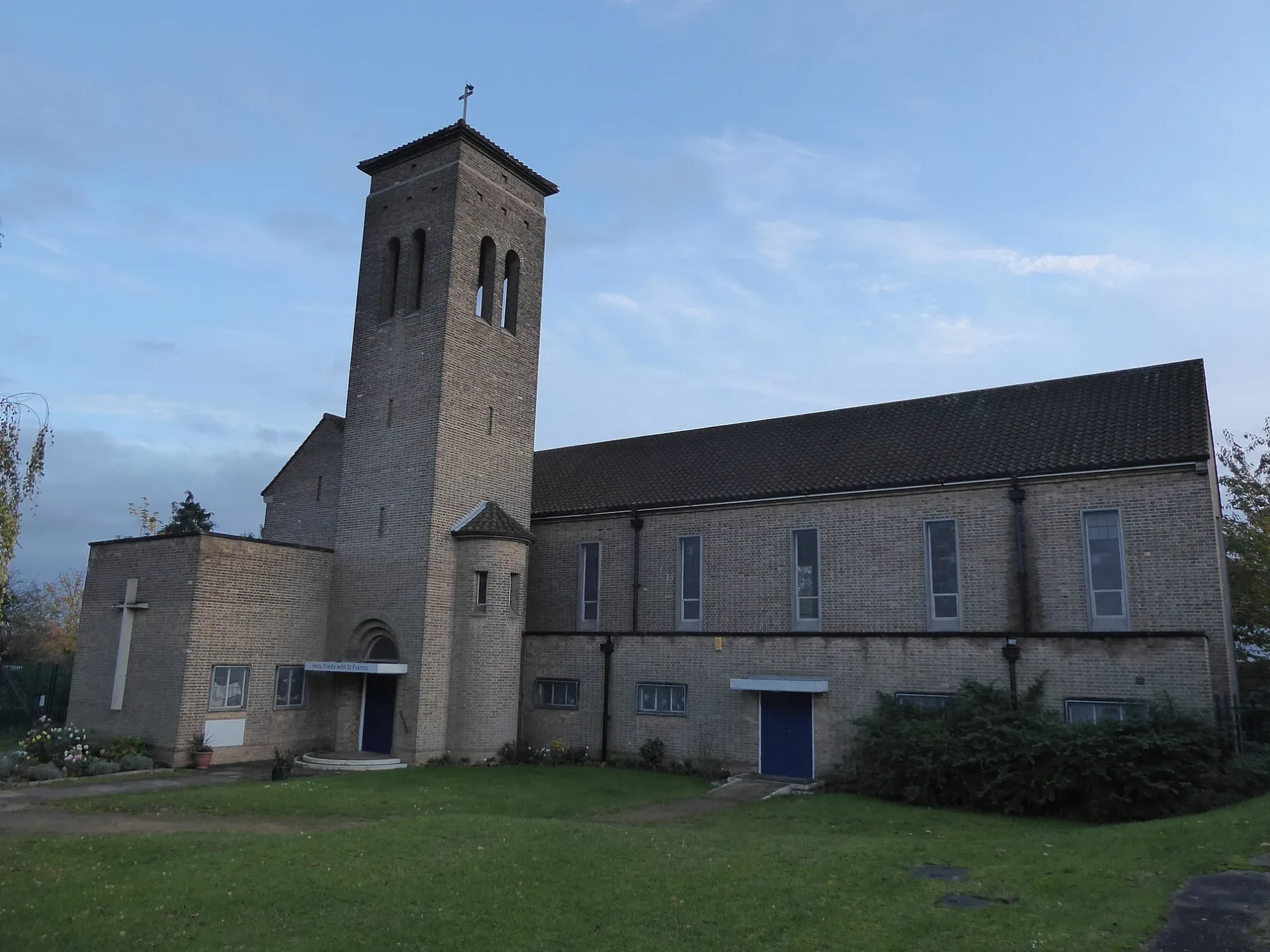
Holy Trinity in City of Nottingham is a Anglicana church (NG11 9DG). It is near Listowel Crescent and belongs to the Diocese of Southwell and Nottingham. The church is dedicated to Holy Trinity. Holy Trinity also exists in Derby.
- Postal Code
- NG11 9DG
- Amenity
- place of worship
- Building Type
- church
- Wheelchair Access
- yes
Image
Florist's
Bakeries
Bookmakers
Bed shops
Bus stops
Convenience stores
Tram stops
Pharmacy
Fast food restaurants
Beauty salons
Funeral directors
Roads nearby
Farnborough RoadHoly Trinity, Zara’s Pizza and Fish Bar, Coral, Fresh 2 You Bakery, Phoenix Nails, Southchurch Drive, Central College Nottingham, The Fairham, Fairham School, Glencoyne Road, Highbank Drive, Pastures Avenue, Summerwood Lane, Clifton Health Pharmacy, Occasionally Yours, Maid Marian Convenience Store, Southchurch News, The Bed Shop Clifton, The Co-operative Funeralcare, Orford Avenue, Farnborough Road Co-op, Bransdale Road, Farnborough School, Clifton Sports Centre, Dunkery Road
100 m
Moreton Road100 m
Thistledown Road100 m
Cheddar Road150 m
Spring Green150 m
Highbank Drive200 m
Listowel Crescent200 m
Bramber Grove200 m
Widecombe Lane200 m
Glencoyne Road200 m
Southchurch DriveCurtis Parkinson Solicitors, Clifton Cafe and Cob Shop, EATaliano, Rivergreen, Clifton Leisure Centre, Clifton Library, Clifton Post Office, Clifton Centre, TSB, Cancer Research UK, Kerry's Fish, Card Factory, Savers, Heron Foods, Betfred, Boots, Well Pharmacy, Birds the Confectioners, Vogue Hair and Beauty, Dawns Cards, Greggs, Clifton Flower Boutique, 63 Gents Hair Design, Sweet Things, Peacock, Dungannon Road, Holy Trinity, Dovenby Road, The In Plaice, City Carpet Care, Vienna Barbers, Jessica Nails & Spa, Clifton Convenience Store, Shaks, VapeHQ, Varney Road, Southchurch Drive North, Hope Church Nottingham
250 m
Clarewood Grove250 m
Clouds Hill300 m
Bexwell Close350 m
Sprydon Walk350 m
Killerton Green350 m
Bradley Walk400 m
Breckswood Drive400 m
Whitegate Vale400 m
Conifer Crescent400 m
Caister Road400 m
Dungannon RoadCostcutter Clifton, Cresta, Clifton Furniture Store, Billy Vapes
450 m
Creeton Green450 m
Glenloch Drive450 m
Old School Close450 m
Wrenthorpe ValePeacock
500 m
Summerwood LaneManesty Crescent, Pastures Avenue South, Thistledown Road, Clarewood Grove, Breckswood Drive, Fairham School
500 m
Tintagel Green500 m
Blaise Close550 m
Cerne Close550 m
Fergus Close600 m
Meadowvale Crescent600 m
Bournmoor Avenue600 m
Granton Avenue650 m
Corn Croft700 m
Lanthwaite Close750 m
Green LaneThe Fairham, Dungannon Road, Wheatacre Road, Peacock, Dalehead Road, Langstrath Road, Esquires, Sue Ryder, Whitegate Vale, Morrisons, Green Lane Junction
750 m
Charity shops nearby
Mencap150 m
Community centres nearby
Highbank Community Centre150 m
Frozen food shops nearby
Iceland700 m
Parks nearby
Breckswood Park400 m
Places of worship nearby
Corpus Christi Catholic Church350 m
Playgrounds nearby
Breckswood Park Play Area300 m
Police stations nearby
Clifton Police Station50 m
Service buildings nearby
Thistledown Road Clifton200 m
Social facilities nearby
Clifton View Care Home200 m
Supermarkets nearby
The Co-operative Food150 m
Tram lines nearby
NET Line 2500 m
Veterinary practices nearby
Vets4Pets150 m
| Dedicated to | Holy Trinity |
|---|---|
| Diocese | Diocese of Southwell and Nottingham |
| Located in | City of Nottingham |
| Country | United Kingdom |
 Public transport map City of Nottingham Legend
 | Railway | |
| Bus | |
| Tram |
 Cycling map City of Nottingham Legend
 | Cycle path | |
| Cycle lane on road | |
| Cycling on bus lane | |
| Bicycle street | |
| Cyclists allowed | |
| Cyclists allowed, good surface | |
| No cycling | |
| Cobblestones |
| Long-distance cycle route | (depending on scale) | |
| Long-distance cycle route |
 Walking map City of Nottingham Legend
 | Path |
| Long-distance hiking trail | (depending on scale) | |
| Long-distance hiking trail | ||
| No pedestrians |