This page is the City map of England, a country in north-west Europe and part of the United Kingdom. The map shows streets, roads, paths and places across approximately 130,278 square kilometres. England had about 53,012,456 inhabitants in 2011, and its population increased from 53,493,700 in 2012 to 57,106,398 in 2022. England was established as a unified kingdom in 927, and its name refers to the Angles and the Old English word for land. England contains counties, metropolitan areas, unitary authorities and major cities including London, Birmingham, Manchester and Liverpool; long-distance cycle routes include EuroVelo 1, EuroVelo 2 and EuroVelo 12.
Jacques Descloitres, MODIS Land Rapid Response Team, NASA/GSFC, Public domain – Wikimedia Commons
Herefordshire is a ceremonial county and unitary authority in western England. It covers approximately 2,179.7 square kilometres and had 193,615 inhabitants. Hereford stands on the River Wye, while the county includes the Black Mountains and the Malvern Hills. The cathedral in Hereford is known for the Mappa Mundi, a medieval world map.
Suffolk is a county in eastern England with an area of about 3,800.9 square kilometres. Its population was 758,556. Ipswich is the county town, and the River Orwell reaches the North Sea at Felixstowe. The county includes the historic towns of Bury St Edmunds and Newmarket.
Hertfordshire is a non-metropolitan and ceremonial county north of Greater London. It covers around 1,643.1 square kilometres and had 1,195,672 inhabitants. The county includes Hertford, St Albans, Watford and Stevenage. St Albans contains the remains of the Roman city of Verulamium and St Albans Cathedral.
Norfolk is a county in East Anglia covering approximately 5,380.0 square kilometres. It had 914,039 inhabitants. Norwich is the county city, and the county includes the Broads, a network of navigable rivers and lakes near the North Sea. The coastline includes Great Yarmouth, Cromer and the salt marshes of north Norfolk.
Rutland is a county and unitary authority in the East Midlands. Its area is about 381.8 square kilometres, and its population was 41,151. Oakham is the county town, while Uppingham lies in the south of the county. Rutland Water is one of England’s largest artificial lakes and lies west of Oakham.
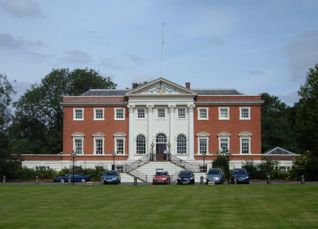
Warwickshire is a ceremonial and non-metropolitan county in central England. It covers approximately 1,975.1 square kilometres and had 607,604 inhabitants. Warwick Castle stands beside the River Avon, and Stratford-upon-Avon is associated with William Shakespeare. Other major places include Nuneaton, Rugby and Leamington Spa.
Wiltshire is a unitary authority area in south-west England that excludes Swindon. It covers about 3,255.3 square kilometres and had 498,064 inhabitants. Salisbury Cathedral has one of the tallest medieval church spires in the United Kingdom. Stonehenge, a prehistoric monument on Salisbury Plain, is a UNESCO World Heritage Site.
Cornwall is a unitary council area at the south-western tip of England. It covers approximately 3,546.0 square kilometres and had 565,968 inhabitants. Truro is the administrative centre, and the county includes the harbour towns of Falmouth, Penzance and St Ives. The coastline reaches Land’s End and includes the UNESCO-listed Cornwall and West Devon Mining Landscape.
Worcestershire is a non-metropolitan county in the West Midlands. It covers about 1,740.5 square kilometres and had 609,216 inhabitants. Worcester stands on the River Severn and contains Worcester Cathedral. The Malvern Hills form a prominent ridge along the western edge of the county.
Surrey is a county south-west of Greater London with an area of approximately 1,662.5 square kilometres. Its population was 1,214,540. Guildford is the county town, and the North Downs cross the county from west to east. Surrey includes parts of the Surrey Hills, an Area of Outstanding Natural Beauty, and towns such as Woking and Epsom.
Somerset is a unitary authority area in south-west England that excludes Bath and North-East Somerset and North Somerset. It covers around 3,450.6 square kilometres and had 576,852 inhabitants. Taunton is the administrative centre, while Glastonbury lies near the Somerset Levels. The Mendip Hills and the Quantock Hills are major upland areas.
Oxfordshire is a county in south-central England covering approximately 2,604.9 square kilometres. It had 687,524 inhabitants. Oxford lies at the confluence of the rivers Cherwell and Thames and is home to the University of Oxford. Other towns include Banbury, Bicester and Witney.
Southend-on-Sea is a city and unitary authority in Essex on the northern shore of the Thames Estuary. It covers about 41.8 square kilometres and had 160,257 inhabitants. Southend Pier extends into the estuary and is one of the town’s defining structures. The urban area includes Southend, Leigh-on-Sea and Westcliff-on-Sea.
Thurrock is a unitary authority with borough status in Essex. It covers approximately 163.5 square kilometres and had 172,525 inhabitants. The borough lies on the north bank of the River Thames opposite Dartford and Gravesend. Grays is the administrative centre, and Tilbury is the location of a major port.
North Somerset is a unitary authority area created in 1974 in south-west England. It covers around 373.8 square kilometres and had 213,919 inhabitants. Weston-super-Mare lies on the Bristol Channel, while Portishead is situated beside the Severn Estuary. The Mendip Hills extend into the southern part of the area.
Gloucestershire is a non-metropolitan county in south-west England and excludes South Gloucestershire. Its area is approximately 2,653.0 square kilometres, and its population was 652,409. Gloucester stands on the River Severn, while Cheltenham is known for its Regency architecture and racecourse. The Cotswolds cover much of the eastern and southern county.
Greater Manchester is a metropolitan county in north-west England established in 1974. It covers approximately 1,276.0 square kilometres and had 2,867,800 inhabitants. Manchester is the largest city, and the county also includes Salford, Bolton, Oldham and Stockport. The River Irwell passes through Manchester and Salford, while the Pennines rise east of the urban area.
East Sussex is a non-metropolitan county in south-east England and excludes Brighton and Hove. It covers about 1,708.6 square kilometres and had 545,800 inhabitants. Lewes is the county town, and the county includes Eastbourne, Hastings and the chalk cliffs of Beachy Head. The South Downs cross the western part of East Sussex.
Swindon is a unitary authority area in Wiltshire. It covers approximately 230.1 square kilometres and had 235,657 inhabitants. The town of Swindon lies between the Cotswolds and the North Wessex Downs. Its railway history is associated with the Great Western Railway and the former railway works.
Windsor and Maidenhead is a district of Berkshire established in 1974. It covers about 196.5 square kilometres and had 150,906 inhabitants. Windsor Castle stands beside the River Thames and is one of the official residences of the British monarch. Maidenhead lies farther west on the Thames and is connected with the historic bridge crossing.
Bracknell Forest is a unitary authority in Berkshire with an area of approximately 109.4 square kilometres. It had 124,607 inhabitants. Bracknell is the main town, and the authority includes parts of Windsor Forest. Crowthorne lies near the eastern edge, close to the county boundary with Surrey.
West Sussex is a ceremonial and non-metropolitan county in southern England. It covers about 1,990.9 square kilometres and had 882,676 inhabitants. Chichester is the county city, and its cathedral stands near the historic centre. The South Downs form a continuous chalk landscape north of coastal towns including Worthing and Bognor Regis.
Brighton and Hove is a city and unitary authority in East Sussex established in 1997. It covers approximately 82.7 square kilometres and had 277,103 inhabitants. Brighton developed as a seaside resort on the English Channel, while Hove lies immediately to the west. The Royal Pavilion is a distinctive historic building in central Brighton.
Wokingham is a unitary authority area in Berkshire covering about 179.0 square kilometres. Its population was 167,979. Wokingham town lies south-east of Reading, and the River Loddon passes through the area. The authority includes Earley, Woodley and rural settlements near the Berkshire Downs.
Reading is a historic market town and unitary urban area in Berkshire. It covers approximately 40.4 square kilometres and had 162,666 inhabitants. The town stands at the confluence of the rivers Thames and Kennet. Reading Abbey was founded in 1121 and remains a major medieval landmark in the town centre.
West Berkshire is a unitary authority area established in 1974. It covers about 704.2 square kilometres and had 158,527 inhabitants. Newbury is the administrative centre and lies on the River Kennet. The area includes the Berkshire Downs and the prehistoric hill figure known as the Uffington White Horse nearby in Oxfordshire.
Slough is a town and unitary authority in Berkshire. It covers approximately 32.5 square kilometres and had 119,070 inhabitants. The town lies west of London near the River Thames and the Grand Union Canal. Slough is connected to the national railway network and is close to Windsor and Heathrow Airport.
Portsmouth is a city and unitary authority on Portsea Island in Hampshire. It covers about 40.3 square kilometres and had 248,440 inhabitants. The city is a major naval base and contains Portsmouth Historic Dockyard. The Mary Rose Museum and HMS Victory are located within the dockyard complex.
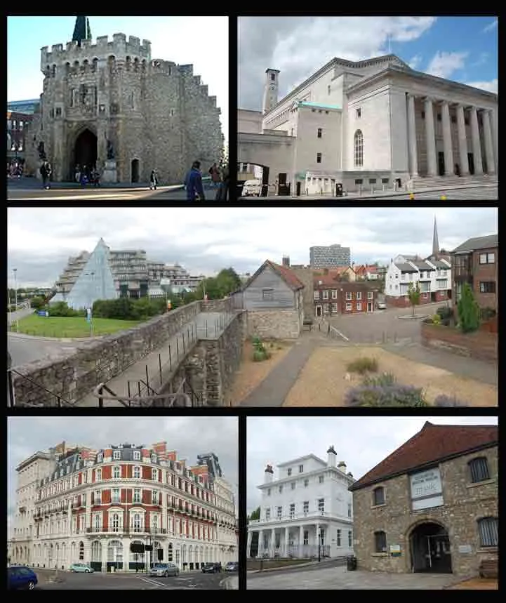
Southampton is a city and major port in Hampshire covering approximately 51.5 square kilometres. Its population was 271,173. The city stands at the head of Southampton Water, where the River Itchen and River Test reach the Solent. Medieval sections of the city wall remain near the historic centre.
Warrington is a district in Cheshire established in 1974. It covers about 180.6 square kilometres and had 209,547 inhabitants. The town lies on the River Mersey between Liverpool and Manchester. Warrington’s transport network includes the West Coast Main Line and the Manchester Ship Canal nearby.
Cheshire East is a unitary authority with borough status established in 2009. It covers approximately 1,166.4 square kilometres and had 380,790 inhabitants. Crewe is a major railway town, while Macclesfield lies near the western edge of the Peak District. The authority includes the historic market town of Nantwich and parts of the Cheshire Plain.
Cheshire West and Chester is a unitary authority with borough status established in 2009. It covers around 916.7 square kilometres and had 340,502 inhabitants. Chester stands on the River Dee and retains substantial Roman and medieval walls. Ellesmere Port lies on the Manchester Ship Canal near the Mersey Estuary.
The Isle of Wight is an island, county and unitary authority south of the mainland coast of Hampshire. It covers approximately 380.2 square kilometres and had 140,459 inhabitants. Newport is the county town, while Ryde, Cowes and Ventnor are major coastal settlements. The island includes chalk cliffs, the Needles and the estuary of the River Medina.
Medway is a unitary authority area in Kent established in 1998. It covers about 193.5 square kilometres and had 277,855 inhabitants. The River Medway flows through Rochester, Chatham and Gillingham before reaching the Thames Estuary. Rochester Cathedral and Rochester Castle stand within the historic city.
ISS Crew Earth Observations experiment and the Image Science & Analysis Laboratory, Johnson Space Center, Public domain – Wikimedia Commons
The Isles of Scilly are an archipelago and local government district off the south-western tip of mainland Britain. The islands cover approximately 16.3 square kilometres and had 2,281 inhabitants. St Mary’s is the largest island and contains Hugh Town, the principal settlement. The highest elevation is about 51 metres, and the islands lie west of Land’s End.
Luton is a district in Bedfordshire covering approximately 43.4 square kilometres. Its population was 214,109. The town lies on the River Lea north of London and is adjacent to London Luton Airport. Luton’s historic centre includes St Mary’s Church, whose origins date to the medieval period.
Bedford is a borough and unitary authority in the ceremonial county of Bedfordshire. It covers about 476.4 square kilometres and had 185,225 inhabitants. Bedford town stands on the River Great Ouse at an elevation of approximately 57 metres. The Embankment and the river corridor are prominent features of the town.
Central Bedfordshire is a unitary authority established in 2009. It covers approximately 715.7 square kilometres and had 274,000 inhabitants. Its settlements include Dunstable, Leighton Buzzard and Biggleswade. The Chiltern Hills reach the southern part of the authority, while the River Great Ouse lies to the north.
The City of Leicester is a unitary authority in Leicestershire established in 1835. It covers around 73.3 square kilometres and had 368,572 inhabitants. Leicester stands on the River Soar and has Roman origins as Ratae Corieltauvorum. The King Richard III Visitor Centre marks the discovery of the king’s remains beneath a city car park.
Stoke-on-Trent is a city in Staffordshire covering approximately 92.7 square kilometres. Its population was 249,008, and the city has an elevation of about 213 metres. It is formed from six historic towns, including Stoke-upon-Trent, Hanley and Burslem. The city is internationally associated with pottery manufacturing.
Telford and Wrekin is a unitary district with borough status in Shropshire established in 1974. It covers about 290.3 square kilometres and had 188,871 inhabitants. Telford is the principal town and grew around a planned new-town development. Ironbridge lies in the borough beside the River Severn and is part of a UNESCO World Heritage Site.
Shropshire is a unitary authority area that excludes Telford and Wrekin. It covers approximately 3,197.3 square kilometres and had 320,274 inhabitants. Shrewsbury stands on a loop of the River Severn and contains a medieval castle and abbey. The Shropshire Hills and Long Mynd form major upland landscapes in the south.
Kent is a non-metropolitan county in south-east England and excludes Medway. It covers around 3,544.9 square kilometres and had 1,568,623 inhabitants. Maidstone is the county town, while Canterbury contains a cathedral that forms part of a UNESCO World Heritage Site. The white cliffs near Dover face the Strait of Dover and mainland Europe.
The City of Milton Keynes is a unitary authority with city and borough status in Buckinghamshire. It covers approximately 308.6 square kilometres and had 268,607 inhabitants. Milton Keynes was designated as a new town in 1967 and is known for its planned grid-road system. The Grand Union Canal passes through the authority near Wolverton and Fenny Stratford.
Hampshire is a non-metropolitan county in south-east England that excludes Southampton and Portsmouth. It covers about 3,678.9 square kilometres and had 1,416,808 inhabitants. Winchester is the county city and was the capital of England before the Norman Conquest. The New Forest extends across the south-west, while the River Itchen flows through Winchester.
Greater London is the capital and largest city of England and the United Kingdom. It covers approximately 1,572 square kilometres, has an average recorded elevation of about 4 metres in the supplied data, and had 8,799,728 inhabitants. The River Thames crosses the city from west to east, passing landmarks such as the Houses of Parliament, Tower Bridge and the Tower of London. The City of London was founded by the Romans around AD 47, while modern Greater London was established in 1965.
Essex is a non-metropolitan county in eastern England and excludes Southend-on-Sea and Thurrock. It covers approximately 3,464.4 square kilometres and had 1,519,509 inhabitants. Chelmsford is the county city, and Colchester was the first Roman capital of Britain. The county has coastlines on the Thames Estuary and the North Sea, including the ports of Harwich and Tilbury nearby.
Leicestershire is a non-metropolitan county that excludes the City of Leicester. It covers about 2,082.9 square kilometres and had 722,155 inhabitants. County towns and market centres include Glenfield, Loughborough, Market Harborough and Melton Mowbray. The River Soar runs north through the county toward Leicester and the River Trent.
Plymouth is a city in Devon on the south coast of England. It covers approximately 79.3 square kilometres and had 267,918 inhabitants. The city lies between the mouths of the rivers Plym and Tamar, at sea level in the supplied geographic data. Plymouth Hoe overlooks Plymouth Sound, a major natural harbour.
Staffordshire is a non-metropolitan county that excludes Stoke-on-Trent. It covers around 2,620.3 square kilometres and had 875,219 inhabitants. Stafford is the county town, while Burton upon Trent is associated with brewing and the River Trent. Cannock Chase and the southern Peak District provide important upland landscapes.
Monmouthshire is a principal area in south-east Wales rather than an English county. It covers approximately 849.1 square kilometres and had 94,142 inhabitants. Monmouth stands at the meeting of the rivers Wye, Monnow and Trothy. The area includes the eastern Black Mountains and the Wye Valley near the border with England.
The West Midlands is a combined-authority area centred on England’s second-largest urban region. Birmingham is its largest city, and the wider conurbation includes Coventry, Wolverhampton, Solihull, Dudley, Sandwell and Walsall. The River Tame flows through the northern part of the metropolitan area. The West Midlands is distinct from the ceremonial county of West Midlands and from the wider government region.
Bournemouth, Christchurch and Poole is a unitary authority in Dorset established in 2019. It covers approximately 161.3 square kilometres and had 400,196 inhabitants. Bournemouth and Poole lie on the English Channel coast, while Christchurch stands at the confluence of the rivers Avon and Stour. Poole Harbour is one of the largest natural harbours in the world.
Dorset is a unitary authority area in south-west England. It covers around 2,491.4 square kilometres and had 376,484 inhabitants. Dorchester is the county town, and the Jurassic Coast extends along the English Channel. The Jurassic Coast is a UNESCO World Heritage Site and includes the natural limestone arch of Durdle Door.
West Northamptonshire is a unitary district in Northamptonshire. Its population was 429,013. The district includes Northampton, Daventry and the historic town of Towcester. The River Nene passes through Northampton, while the Grand Union Canal crosses the southern part of the district.
North Northamptonshire is a unitary district established in 2021. It had 363,408 inhabitants. The district includes Corby, Kettering, Wellingborough and Rushden. The River Nene runs through Wellingborough and continues east toward the Fens.
Buckinghamshire is a unitary authority area that excludes Milton Keynes. It covers approximately 1,564.9 square kilometres and had 540,059 inhabitants. Aylesbury is the county town, while High Wycombe lies in the wooded Chiltern Hills. The River Thames forms part of the northern and western boundary near Marlow and Henley-on-Thames.
The West of England is an area of English combined authority centred on Bristol and its surrounding local authorities. Bristol lies on the River Avon near the Severn Estuary, while Bath is known for its Roman baths and Georgian architecture. The area includes North Somerset, South Gloucestershire and parts of the former Avon region. The Clifton Suspension Bridge crosses the Avon Gorge in Bristol.
Cambridgeshire and Peterborough is an English combined-authority area. Cambridge stands on the River Cam and is home to the University of Cambridge, while Peterborough Cathedral is a major Norman building. Much of the area lies within the low-lying Fens, a drained wetland landscape. The River Great Ouse flows through the northern part of the area.
The North East is an English combined-authority area on the North Sea coast. Newcastle upon Tyne and Sunderland are major cities, and the River Tyne reaches the sea between North and South Tyneside. Durham Cathedral and Castle form a UNESCO World Heritage Site. The region also includes the Northumberland coast and the eastern Pennines.
Data sources: OpenStreetMap (ODbL), Wikidata (CC0) · Image: Wikimedia Commons
England – Facts
Inhabitants
53012456
Area
130278 km²
Subregions
2357
Named after
Angles, land
Inception
927
Located in
United Kingdom, United Kingdom of Great Britain and Ireland, Kingdom of Great Britain
Country
United Kingdom, United Kingdom of Great Britain and Ireland, Kingdom of Great Britain, Kingdom of England
Nickname
Blighty
Native label
England
Official name
England
Described by source
The Catholic Encyclopedia, Vlastenský slovník historický, Brockhaus and Efron Encyclopedic Dictionary, Jewish Encyclopedia of Brockhaus and Efron, Great Soviet Encyclopedia (1926–1947), Small Brockhaus and Efron Encyclopedic Dictionary, Encyclopædia Britannica 11th edition, The Nuttall Encyclopædia, Draft History of Qing, New World Encyclopedia, Armenian Soviet Encyclopedia, vol. 1, Meyer’s Universum, Zehnter Band, Otto's encyclopedia