Central Bedfordshire

This page is the City map of Central Bedfordshire, with streets, paths and places across the unitary authority in England. Central Bedfordshire covers approximately 715.7 square kilometres and forms part of the ceremonial county of Bedfordshire. The authority was established in 2009 and contains 79 mapped subregions, including towns, villages and civil parishes. Its population increased from about 260,000 in 2012 to 301,501 in 2022, while an earlier 2015 estimate recorded approximately 274,000 residents.

City map Central Bedfordshire
Marcus de Figueiredo, CC BY-SA 2.0 – Wikimedia Commons
City map Sandy
Orangeaurochs, Public domain – Wikimedia Commons

Sandy

Sandy is a town and civil parish in Bedfordshire with a recorded population of 12,172. It lies in the northern part of Central Bedfordshire, near the River Ivel and the Bedfordshire countryside.

The town is associated with the Greensand Ridge and the nearby RSPB nature reserve at Sandy Warren. Its administrative level in the regional mapping is 10.

City map Hyde
Martin Addison, CC BY-SA 2.0 – Wikimedia Commons

Hyde

Hyde is a civil parish in Bedfordshire with 411 residents. The parish is located in the rural Central Bedfordshire landscape between larger settlements such as Sandy and Biggleswade.

Its small population distinguishes Hyde from the authority’s larger towns. The locality is mapped as an admin_level 10 subregion.

City map Slip End
Nigel Cox, CC BY-SA 2.0 – Wikimedia Commons

Slip End

Slip End is a village and civil parish in Bedfordshire with a population of 1,842. It stands south of Luton and close to the M1 corridor in the southern part of Central Bedfordshire.

The settlement is near the Chiltern Hills and the road connections around Junction 11 of the M1. Slip End is recorded as an admin_level 10 locality.

City map Caddington
Nigel Cox, CC BY-SA 2.0 – Wikimedia Commons

Caddington

Caddington is a village and civil parish with 4,297 residents. It is situated south of Luton on the northern edge of the Chilterns.

The parish contains the village of Caddington and rural land extending towards Slip End and Kensworth. In the regional map, Caddington is an admin_level 10 subregion.

City map Kensworth
Rob Farrow, CC BY-SA 2.0 – Wikimedia Commons

Kensworth

Kensworth is a village and civil parish in Bedfordshire with a population of 1,517. It lies on the chalk uplands south of Dunstable and west of Caddington.

The locality is part of the Chiltern landscape, where the underlying chalk has influenced settlement and agriculture. Kensworth is mapped at admin_level 10.
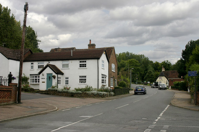
City map Studham
Robin Hall, CC BY-SA 2.0 – Wikimedia Commons

Studham

Studham is a village and civil parish in Bedfordshire with 1,182 inhabitants. It is located near the Hertfordshire boundary and the eastern Chiltern Hills.

The parish lies close to Whipsnade and the Dunstable Downs, a prominent chalk escarpment south-west of Dunstable. Studham is an admin_level 10 mapped locality.

City map Whipsnade
Dave Skinner, CC BY-SA 2.0 – Wikimedia Commons

Whipsnade

Whipsnade is a village and civil parish in Bedfordshire with a population of 455. It is situated in the Chiltern Hills near the Dunstable Downs.

The village is known for Whipsnade Zoo, established by the Zoological Society of London in 1931. Whipsnade is recorded as an admin_level 10 subregion of Central Bedfordshire.

City map Dunstable
Nigel Cox, CC BY-SA 2.0 – Wikimedia Commons

Dunstable

Dunstable is a market town and civil parish with 40,699 residents. It stands below the Dunstable Downs on the northern edge of the Chiltern Hills.

The town developed around the medieval priory founded by Henry I in 1131, and Dunstable Priory remains a major historic building. The A5 and M1 connect Dunstable with towns including Luton and Milton Keynes.

City map Houghton Regis
John Yaxley, CC BY-SA 2.0 – Wikimedia Commons

Houghton Regis

Houghton Regis is a town and civil parish in Bedfordshire with 19,692 residents. It adjoins Dunstable and lies close to the northern Chiltern escarpment.

The town is positioned beside the A5 and near the M1, making it part of the dense settlement corridor around Dunstable and Luton. Houghton Regis is mapped as an admin_level 10 subregion.

City map Eaton Bray
Rob Farrow, CC BY-SA 2.0 – Wikimedia Commons

Eaton Bray

Eaton Bray is a village and civil parish in Bedfordshire with a population of 2,644. It lies west of Dunstable near the Buckinghamshire boundary.

The parish is close to the River Ouzel and the Chiltern foothills. Eaton Bray is recorded as an admin_level 10 locality within Central Bedfordshire.

City map Totternhoe
Rob Farrow, CC BY-SA 2.0 – Wikimedia Commons

Totternhoe

Totternhoe is a village and civil parish with 1,197 residents. It is located west of Dunstable at the foot of the Dunstable Downs.

The parish includes chalk-downland scenery associated with the Chiltern Hills and Totternhoe Knolls. Totternhoe is mapped at admin_level 10.
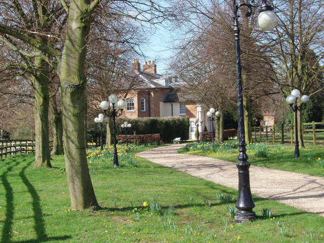
City map Streatley
Shaun Ferguson, CC BY-SA 2.0 – Wikimedia Commons

Streatley

Streatley is a village and civil parish in Bedfordshire with a population of 1,867. It lies north of Luton in the agricultural landscape of Central Bedfordshire.

The settlement is close to the A6 corridor linking Luton with Bedford. Streatley is an admin_level 10 subregion.

City map Sundon
David Ayrton, CC BY-SA 2.0 – Wikimedia Commons

Sundon

Sundon is a civil parish in Bedfordshire with 478 residents. It is situated north of Luton and near the chalk country around Sundon Hills.

The parish lies within the central Bedfordshire countryside between Houghton Regis and Harlington. Sundon is recorded as an admin_level 10 locality.

City map Chalton
John Yaxley, CC BY-SA 2.0 – Wikimedia Commons

Chalton

Chalton is a village and civil parish in Bedfordshire with a population of 554. It lies north of Luton and east of Dunstable.

The settlement is surrounded by the agricultural landscape of the Chiltern fringe. Chalton is mapped as an admin_level 10 subregion.

City map Chalgrave
Rob Farrow, CC BY-SA 2.0 – Wikimedia Commons

Chalgrave

Chalgrave is a village and civil parish in Bedfordshire with 495 residents. It is located north-east of Dunstable and close to the Luton urban area.

The parish occupies farmland near the Chiltern escarpment and the routes connecting Dunstable, Luton and Toddington. Chalgrave is an admin_level 10 locality.

City map Stanbridge
Nick MacNeill, CC BY-SA 2.0 – Wikimedia Commons

Stanbridge

Stanbridge is a village and civil parish in Bedfordshire with a population of 752. It lies west of Leighton Buzzard near the River Ouzel.

The parish is part of the rural west of Central Bedfordshire, close to the Buckinghamshire boundary. Stanbridge is recorded at admin_level 10.

City map Tilsworth
al partington, CC BY-SA 2.0 – Wikimedia Commons

Tilsworth

Tilsworth is a village and civil parish with 372 residents. It lies south-west of Leighton Buzzard in the Bedfordshire countryside.

The parish is near Stanbridge, Hockliffe and the River Ouzel catchment. Tilsworth is mapped as an admin_level 10 locality.

City map Leighton-Linslade
Basher Eyre, CC BY-SA 2.0 – Wikimedia Commons

Leighton-Linslade

Leighton-Linslade is a civil parish with a population of 42,401, making it one of the largest settlements in Central Bedfordshire. It is formed by the adjoining towns of Leighton Buzzard and Linslade on the River Ouzel.

The town lies beside the Grand Union Canal and has a railway station on the West Coast Main Line. Leighton-Linslade is an admin_level 10 subregion near the Buckinghamshire boundary.

City map Eggington
Rob Farrow, CC BY-SA 2.0 – Wikimedia Commons

Eggington

Eggington is a village and civil parish in Bedfordshire with 1,146 residents. It lies immediately south of Leighton Buzzard and close to the River Ouzel.

The parish is part of the lowland landscape between Leighton-Linslade and Stanbridge. Eggington is recorded as an admin_level 10 locality.

City map Hockliffe
Rob Farrow, CC BY-SA 2.0 – Wikimedia Commons

Hockliffe

Hockliffe is a village and civil parish with a population of 1,068. It is situated south-west of Leighton Buzzard at the junction of historic routes towards Dunstable and Milton Keynes.

The village lies near the A5 and the M1, which pass through the wider west of Central Bedfordshire. Hockliffe is mapped at admin_level 10.

City map Barton-le-Clay
Tom Presland, CC BY-SA 2.0 – Wikimedia Commons

Barton-le-Clay

Barton-le-Clay is a village and civil parish with 4,937 residents. It lies at the foot of the Barton Hills, part of the Chiltern Hills north of Luton.

The parish is close to the A6 and the River Flit, which runs through the central Bedfordshire landscape. Barton-le-Clay is an admin_level 10 subregion.

City map Heath and Reach
The original uploader was Hockeyshooter at English Wikipedia ., CC BY 2.0 – Wikimedia Commons

Heath and Reach

Heath and Reach is a village and civil parish with a population of 1,451. It lies north of Leighton Buzzard near the Greensand Ridge.

The parish is close to heathland and former sand-extraction landscapes around the southern part of Central Bedfordshire. Heath and Reach is mapped at admin_level 10.

City map Battlesden
Jayembee1969, CC BY-SA 3.0 – Wikimedia Commons

Battlesden

Battlesden is a village and civil parish with only 44 residents. It lies west of Hockliffe in the rural area between Leighton Buzzard and Woburn.

The parish has one of the smallest populations in Central Bedfordshire. Battlesden is recorded as an admin_level 10 locality.

City map Toddington
Poliphilo, CC0 – Wikimedia Commons

Toddington

Toddington is a village in Central Bedfordshire with a population of 4,506. It lies between Dunstable and Woburn, close to the M1 motorway.

The village is associated with Toddington Manor and the surrounding agricultural landscape. Toddington is mapped as an admin_level 10 subregion.

City map Harlington
Peter Roberts, CC BY-SA 2.0 – Wikimedia Commons

Harlington

Harlington is a village in Bedfordshire with 2,278 residents. It lies near the western edge of the Chiltern Hills and close to the railway between Bedford and Luton.

The parish is situated north of Sundon and west of Hitchin, amid farmland and chalk-country settlements. Harlington is an admin_level 10 locality.

City map Milton Bryan
Dennis simpson, CC BY-SA 2.0 – Wikimedia Commons

Milton Bryan

Milton Bryan is a village and civil parish in Bedfordshire with a population of 144. It lies in the western rural part of Central Bedfordshire near the Buckinghamshire boundary.

The parish is associated with the historic Milton Bryan estate and lies north-west of Woburn. Milton Bryan is mapped at admin_level 10.

City map Shillington
David Kemp, CC BY-SA 2.0 – Wikimedia Commons

Shillington

Shillington is a village and civil parish in Bedfordshire with 2,077 residents. Its recorded area is approximately 1,790,000 square metres.

The parish lies in the north-eastern part of Central Bedfordshire near the River Hiz and the Hertfordshire boundary. Shillington is an admin_level 10 subregion.

City map Potsgrove
Rob Farrow, CC BY-SA 2.0 – Wikimedia Commons

Potsgrove

Potsgrove is a village and civil parish in Bedfordshire with 31 residents. It lies in the rural west of Central Bedfordshire near Woburn.

Its very small population reflects the parish’s predominantly rural character. Potsgrove is recorded as an admin_level 10 locality.

City map Woburn
Chris Nyborg, CC BY-SA 3.0 – Wikimedia Commons

Woburn

Woburn is a village and civil parish in Bedfordshire with a population of 957. It is known for Woburn Abbey, the historic seat of the Dukes of Bedford, and Woburn Safari Park.

The town lies near the Greensand Ridge and Woburn Woods, south-west of Ampthill. Woburn is mapped as an admin_level 10 subregion.

City map Eversholt
Mr Biz, CC BY-SA 2.0 – Wikimedia Commons

Eversholt

Eversholt is a village and civil parish in Bedfordshire with 437 residents. It lies south of Woburn in the Greensand Ridge landscape.

The parish is close to Woburn Woods and the Bedfordshire-Buckinghamshire countryside. Eversholt is recorded at admin_level 10.

City map Ridgmont
Rob Farrow, CC BY-SA 2.0 – Wikimedia Commons

Ridgmont

Ridgmont is a village and civil parish in Bedfordshire with a population of 438. It lies on the Greensand Ridge between Woburn and Ampthill.

The village is near the M1 corridor and the Marston Vale railway route. Ridgmont is an admin_level 10 locality.

City map Husborne Crawley
Geoff Pick, CC BY-SA 2.0 – Wikimedia Commons

Husborne Crawley

Husborne Crawley is a small village and civil parish with 241 residents. It lies beside Woburn and the wooded Greensand Ridge.

The parish is close to Woburn Abbey and the former hunting landscape of Woburn. Husborne Crawley is mapped at admin_level 10.

City map Aspley Guise
Mr Biz, CC BY-SA 2.0 – Wikimedia Commons

Aspley Guise

Aspley Guise is a village in Bedfordshire with a population of 2,216. It lies near the western edge of the Greensand Ridge and close to Milton Keynes.

The village is situated near Aspley Woods and the transport corridor around Woburn Sands. Aspley Guise is an admin_level 10 subregion.

City map Aspley Heath
Dave Thompson, CC BY-SA 2.0 – Wikimedia Commons

Aspley Heath

Aspley Heath is a village and civil parish with 602 residents. It lies on heathland near Aspley Guise and Woburn Sands.

The settlement is part of the Greensand Ridge landscape in the west of Central Bedfordshire. Aspley Heath is mapped at admin_level 10.

City map Tingrith
Rob Farrow, CC BY-SA 2.0 – Wikimedia Commons

Tingrith

Tingrith is a village and civil parish in Bedfordshire with 161 residents. It lies south of Flitwick in the rural Greensand Ridge area.

The parish is near the River Flit and the villages of Westoning and Flitton. Tingrith is recorded as an admin_level 10 locality.

City map Westoning
Rob Farrow, CC BY-SA 2.0 – Wikimedia Commons

Westoning

Westoning is a village and civil parish with a population of 2,106. It lies south of Flitwick and near the River Flit.

The village is connected to the surrounding Central Bedfordshire settlements by roads through the Greensand Ridge countryside. Westoning is mapped at admin_level 10.

City map Lidlington
David Kemp, CC BY-SA 2.0 – Wikimedia Commons

Lidlington

Lidlington is a village and civil parish in Central Bedfordshire with 1,477 residents. It lies in the Marston Vale between Ampthill and Bedford.

The parish is close to the Marston Vale railway and the River Flit. Lidlington is recorded as an admin_level 10 subregion.

City map Hulcote and Salford
Richard Schmidt, CC BY-SA 2.0 – Wikimedia Commons

Hulcote and Salford

Hulcote and Salford is a civil parish in Central Bedfordshire with a population of 204. It lies north-east of Woburn and south of Bedford.

The parish includes the small settlements of Hulcote and Salford within the rural Marston Vale landscape. It is mapped at admin_level 10.

City map Brogborough
Richard Schmidt, CC BY-SA 2.0 – Wikimedia Commons

Brogborough

Brogborough is a village and civil parish in Bedfordshire with 350 residents. It lies in the Marston Vale near the M1 motorway and the A421.

The parish is close to the former clay-extraction landscapes characteristic of the Vale. Brogborough is recorded as an admin_level 10 locality.

City map Steppingley
James Yardley, CC BY-SA 2.0 – Wikimedia Commons

Steppingley

Steppingley is a village and civil parish in Bedfordshire with a population of 194. It lies near Flitwick and Ampthill in the Greensand Ridge area.

The settlement is surrounded by farmland and is close to the River Flit catchment. Steppingley is mapped at admin_level 10.

City map Cranfield
Richard Schmidt, CC BY-SA 2.0 – Wikimedia Commons

Cranfield

Cranfield is a village and civil parish in Bedfordshire with 7,284 residents. It is known for Cranfield University, whose main campus lies near the village.

The parish is located west of Bedford and north of the M1, in the agricultural landscape of the Marston Vale. Cranfield is an admin_level 10 subregion.

City map Flitwick
Rob Farrow, CC BY-SA 2.0 – Wikimedia Commons

Flitwick

Flitwick is a town in Bedfordshire with a population of 13,661. It lies on the River Flit between Ampthill and Harlington.

Flitwick railway station is on the Midland Main Line, linking the town with Bedford and Luton. The town is recorded as an admin_level 10 locality.

City map Ampthill
APB-CMX at English Wikipedia, Public domain – Wikimedia Commons

Ampthill

Ampthill is a town in Central Bedfordshire with 8,911 residents. It lies on the Greensand Ridge between Bedford and Luton.

Ampthill is known for Ampthill Park and the remains of Ampthill Castle, connected with Henry VIII and Catherine of Aragon. The town is mapped at admin_level 10.

City map Millbrook
Paul Dixon, CC BY-SA 2.0 – Wikimedia Commons

Millbrook

Millbrook is a small village and civil parish in Bedfordshire with 145 residents. It lies south-west of Flitwick near the Greensand Ridge.

The parish is close to Millbrook railway station and the Marston Vale countryside. Millbrook is an admin_level 10 subregion.

Marston Moretaine

Marston Moretaine is a civil parish in Central Bedfordshire with a population of 7,071. It lies in the Marston Vale west of Bedford.

The parish is associated with the Forest of Marston Vale, a major landscape regeneration project in Bedfordshire. Marston Moretaine is mapped at admin_level 10.

City map Houghton Conquest
Rodney Burton, CC BY-SA 2.0 – Wikimedia Commons

Houghton Conquest

Houghton Conquest is a village and civil parish in Bedfordshire with 3,005 residents. It lies south of Bedford near the River Great Ouse basin.

The village is known for the medieval Church of St Mary and St Peter, which has a substantial churchyard and historic fabric. Houghton Conquest is an admin_level 10 locality.

City map Maulden
No machine-readable author provided. Theone00 assumed (based on copyright claims)., CC BY-SA 2.5 – Wikimedia Commons

Maulden

Maulden is a village and civil parish in Bedfordshire with a population of 3,234. It lies east of Ampthill on the Greensand Ridge.

The parish includes Maulden Wood and Maulden Church Meadow, landscapes associated with the Greensand countryside. Maulden is mapped at admin_level 10.

City map Pulloxhill
Nigel Cox, CC BY-SA 2.0 – Wikimedia Commons

Pulloxhill

Pulloxhill is a village and civil parish in Bedfordshire with 1,044 residents. It lies north-east of Flitwick and south of Shefford.

The parish occupies rolling farmland near the River Flit and the villages of Flitton and Greenfield. Pulloxhill is recorded as an admin_level 10 subregion.

Flitton and Greenfield

Flitton and Greenfield is a civil parish in Central Bedfordshire with 1,495 residents. It lies along the River Flit between Flitwick and Shefford.

The parish includes the historic village of Flitton and the nearby settlement of Greenfield. Flitton and Greenfield is mapped at admin_level 10.

City map Silsoe
Ojw at English Wikipedia, CC BY-SA 3.0 – Wikimedia Commons

Silsoe

Silsoe is a village and civil parish in Bedfordshire with a population of 3,422. It lies between Ampthill and Hitchin near the A6.

The village was historically associated with agricultural research at Wrest Park, whose gardens and mansion lie nearby. Silsoe is an admin_level 10 locality.

City map Haynes
Robin Drayton, CC BY-SA 2.0 – Wikimedia Commons

Haynes

Haynes is a village and civil parish in Bedfordshire with 1,173 residents. It lies east of Ampthill and south-west of Sandy.

The parish is situated in the rural landscape between the Greensand Ridge and the River Ivel. Haynes is mapped at admin_level 10.

City map Clophill
Richard Thomas, CC BY-SA 2.0 – Wikimedia Commons

Clophill

Clophill is a village and civil parish in Bedfordshire with a population of 1,829. It lies on the Greensand Ridge between Ampthill and Shefford.

The parish is known for the ruins of the Old St Mary’s Church on a hill above the village. Clophill is recorded as an admin_level 10 subregion.

City map Gravenhurst
Tiger, CC BY-SA 2.0 – Wikimedia Commons

Gravenhurst

Gravenhurst is a civil parish in Central Bedfordshire with 564 residents. It lies south-east of Shefford near the Hertfordshire boundary.

The parish is part of the agricultural landscape around the River Hiz and the northern Chiltern fringe. Gravenhurst is mapped at admin_level 10.

City map Stondon
Rodney Burton, CC BY-SA 2.0 – Wikimedia Commons

Stondon

Stondon is a village and civil parish in Bedfordshire with a population of 3,085. It lies near Henlow and the River Ivel in eastern Central Bedfordshire.

The village is close to RAF Henlow and the railway corridor between Bedford and Hitchin. Stondon is recorded as an admin_level 10 locality.

City map Campton and Chicksands
Marcus de Figueiredo, CC BY-SA 2.0 – Wikimedia Commons

Campton and Chicksands

Campton and Chicksands is a civil parish in Central Bedfordshire with 1,895 residents. It lies north of Shefford beside the River Flit.

The parish contains the former Chicksands Priory, a medieval Gilbertine priory later used for military and intelligence purposes. Campton and Chicksands is mapped at admin_level 10.

City map Meppershall
Rodney Burton, CC BY-SA 2.0 – Wikimedia Commons

Meppershall

Meppershall is a village and civil parish in Bedfordshire with a population of 2,043. It lies east of Shefford near the River Flit and the Hertfordshire boundary.

The settlement is surrounded by farmland on the eastern side of Central Bedfordshire. Meppershall is recorded as an admin_level 10 subregion.

City map Shefford
David Kemp, CC BY-SA 2.0 – Wikimedia Commons

Shefford

Shefford is a town and civil parish in Central Bedfordshire with 7,307 residents. It lies at the confluence of the River Flit and the River Ivel.

The town is positioned between Bedford and Hitchin and forms a local centre for nearby villages including Campton and Meppershall. Shefford is mapped at admin_level 10.

City map Old Warden
Richard Thomas, CC BY-SA 2.0 – Wikimedia Commons

Old Warden

Old Warden is a village and civil parish in Bedfordshire with a population of 323. It lies near the River Ivel and the Greensand Ridge.

The parish is known for Shuttleworth, an historic estate with the Shuttleworth Collection of aircraft and vehicles. Old Warden is an admin_level 10 locality.

City map Moggerhanger
Jeff Tomlinson, CC BY-SA 2.0 – Wikimedia Commons

Moggerhanger

Moggerhanger is a village and civil parish in Bedfordshire with 663 residents. It lies north of Sandy and south of Bedford in the Ivel Valley.

The village is associated with Moggerhanger Park, a historic country house designed by John Soane. Moggerhanger is mapped at admin_level 10.

City map Arlesey
Richard Kelly, CC BY-SA 4.0 – Wikimedia Commons

Arlesey

Arlesey is a village-town hybrid and civil parish in Bedfordshire with a population of 6,027. It lies on the River Hiz near the Hertfordshire boundary and the town of Hitchin.

Arlesey railway station connects the settlement with Bedford and London on the East Coast Main Line route. Arlesey is recorded as an admin_level 10 subregion.

Data sources: OpenStreetMap (ODbL), Wikidata (CC0) · Image: Wikimedia Commons

Central Bedfordshire – Facts

Inhabitants 274000
Area 715.7 km²
Subregions 79
Inception 2009
Located in Bedfordshire
Country United Kingdom
Website https://www.centralbedfordshire.gov.uk/

Data source: Wikidata (CC0)