Somerset

This page is the City map of Somerset, an English unitary authority area with streets, paths and places. Somerset covers around 3,450.6 square kilometres and had about 576,852 residents in 2022, compared with approximately 535,000 in 2012. The administrative area excludes Bath and North East Somerset and North Somerset. Its settlements extend from the Somerset Levels and the River Parrett to the Quantock Hills, the Blackdown Hills and Exmoor.

City map Somerset
John Sutton, CC BY-SA 2.0 – Wikimedia Commons

Cheddon Fitzpaine

Cheddon Fitzpaine is a village and civil parish in Somerset with a recorded population of 2,570. It lies north of Taunton, close to the foothills of the Quantock Hills.

The parish belongs to the detailed local administrative level 10 structure used for Somerset mapping. Taunton is the nearest major town and the River Tone runs through the surrounding district.
North Petherton

North Petherton is a town and civil parish in Somerset with 10,050 residents. It stands near the River Parrett and the northern edge of the Somerset Levels.

The settlement is west of Bridgwater and close to the M5 corridor. Its position connects the low-lying Parrett valley with the inland landscape around Taunton.

West Monkton

West Monkton is a Somerset village with a recorded population of 5,944. It lies northeast of Taunton near the base of the Quantock Hills.

The parish includes rural land between Taunton and Bridgwater. The nearby River Tone and the M5 provide clear geographic references for the area.

Creech St. Michael

Creech St. Michael is a village in Somerset with 2,954 residents. It lies beside the River Tone northeast of Taunton.

The Bridgwater and Taunton Canal passes through the wider area, while the M5 runs nearby. The village is part of the rural corridor between Taunton and Bridgwater.

Kingston St. Mary

Kingston St. Mary is a village and civil parish in Somerset with a population of 905. It lies north of Taunton below the Quantock Hills.

The parish combines a compact village with countryside rising towards Cothelstone and the Quantock ridge. Taunton is the nearest large settlement.

Bishop's Hull

Bishop's Hull is a village west of Taunton with 3,724 residents. The settlement was established as a civil parish in 1885.

Its built-up area adjoins Taunton, while the River Tone lies to the north. The parish provides a transition between the town and the countryside towards Wellington.

Ruishton

Ruishton is a village in Somerset with 1,476 residents. It lies east of Taunton near the River Tone and the Bridgwater and Taunton Canal.

The village is close to the M5 and the industrial and transport corridor leading towards Bridgwater. The surrounding land forms part of the Tone valley.

Thornfalcon

Thornfalcon is a small Somerset village with 123 residents. It lies east of Taunton on the rural side of the Blackdown Hills landscape.

The parish is near Ruishton and the A358 route towards Ilminster. Taunton is the nearest principal town.

Durston

Durston is a village in Somerset with 131 residents. It lies north of Taunton close to the River Tone and the lowland landscape around the Somerset Levels.

The village is near the railway and road connections between Taunton and Bridgwater. The Quantock Hills rise to the west.

North Curry

North Curry is a Somerset village and civil parish with 1,773 residents. It lies on the eastern side of the Somerset Levels, south of the River Parrett.

The village is near the River Tone and the wetlands of the Levels. Taunton is approximately to the west, while Bridgwater lies farther north.

Stoke St. Gregory

Stoke St. Gregory is a village in Somerset with 1,011 residents. It stands within the flat agricultural landscape of the Somerset Levels.

The River Tone and the River Parrett are close to the parish. The village lies southeast of Bridgwater and northeast of Taunton.

Burrowbridge

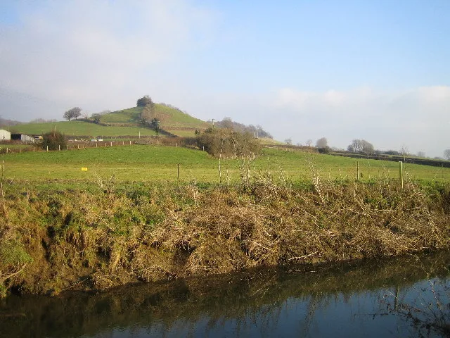
Burrowbridge is a Somerset village with 524 residents. It stands beside the River Parrett at the foot of Burrow Mump, a distinctive natural landmark.

Burrow Mump is associated with St Michael's Church and commands views across the Somerset Levels. The village lies between Bridgwater and Langport.

Stoke St. Mary

Stoke St. Mary is a village and civil parish in Somerset with 483 residents. It lies southeast of Taunton near the northern edge of the Blackdown Hills.

The parish is close to the A358 corridor towards Ilminster. Its rural surroundings connect the Tone valley with the hills of south Somerset.

Trull

Trull is a village in Somerset with 2,275 residents. It lies southwest of Taunton among farmland and orchards near the foothills of the Blackdown Hills.

The village is close to the River Tone and the A38 west of Taunton. Taunton provides the main urban centre for the parish.

Norton Fitzwarren

Norton Fitzwarren is a village and civil parish west of Taunton with 4,069 residents. It lies near the River Tone and the northern edge of the Blackdown Hills.

The settlement is close to Taunton railway station and the M5. Nearby Norton Camp is an Iron Age hillfort on a prominent ridge.

Bradford-on-Tone

Bradford-on-Tone is a village and civil parish in the former Taunton Deane area, with 647 residents. It lies beside the River Tone west of Taunton.

The village is connected with the surrounding agricultural valley and the route towards Wellington. Its location places it between Taunton and the Somerset-Devon border.

Oake

Oake is a village and civil parish in Somerset with 725 residents. It lies west of Taunton near the River Tone and the Blackdown Hills.

The parish is close to Bradford-on-Tone and the A38. Wellington is the nearest major town to the west.

Nynehead

Nynehead is a Somerset village with 424 residents. It lies west of Wellington in a rural area near the Tone valley.

The parish is close to the Grand Western Canal in Devon and the Blackdown Hills. Wellington and Taunton are the principal nearby towns.

Langford Budville

Langford Budville is a village and civil parish in Somerset with 523 residents. It lies west of Wellington near the River Tone.

The parish is situated close to the A38 and the route towards Devon. The Blackdown Hills form the main upland landscape to the south.

Wellington Without

Wellington Without is a Somerset civil parish with 745 residents. It surrounds parts of Wellington and was established in 1933.

The parish lies near the Blackdown Hills and the M5 corridor. Wellington town is the principal settlement, with Taunton to the east.

Sampford Arundel

Sampford Arundel is a Somerset village with 294 residents. It lies near Wellington close to the River Tone and the Devon boundary.

The parish is served by the railway corridor towards Exeter. The Blackdown Hills rise east and south of the village.

West Buckland

West Buckland is a village and civil parish in Somerset with 1,136 residents. It lies south of Wellington near the Blackdown Hills.

The parish is close to the A38 and the Devon border. Taunton lies to the northeast and Wellington to the west.

Pitminster

Pitminster is a village and civil parish south of Taunton with 956 residents. It lies at the northern edge of the Blackdown Hills.

The parish includes countryside around the Fivehead valley and is close to the A358. Taunton is the nearest major town.

Churchstanton

Churchstanton is a Somerset village and civil parish with 889 residents. It lies within the Blackdown Hills, an Area of Outstanding Natural Beauty extending into Devon.

The parish is south of Taunton and close to the Devon boundary. The surrounding valleys drain towards the River Otter and the River Tone.

Otterford

Otterford is a village and civil parish in Somerset with 392 residents. It lies in the Blackdown Hills near the source area of the River Otter.

The parish is close to Churchstanton and the Devon border. Taunton lies to the northwest, while Chard is southeast.

Corfe

Corfe is a Somerset village and civil parish with 253 residents. It lies in the Blackdown Hills between Taunton and Chard.

The parish is near the River Otter catchment and the A358 corridor. Its landscape consists largely of wooded valleys and upland farmland.

Staple Fitzpaine

Staple Fitzpaine is a Somerset village with 165 residents. It lies at the northern edge of the Blackdown Hills, southeast of Taunton.

The parish is close to the A358 and the village of Hatch Beauchamp. The surrounding hills separate the Tone valley from south Somerset.

Bickenhall

Bickenhall is a small village in Somerset with 108 residents. It lies in the Blackdown Hills south of Taunton.

The settlement is near Staple Fitzpaine and the A358 route. The local landscape consists of wooded slopes and narrow rural valleys.

Curland

Curland is a village in the former Taunton Deane area with 126 residents. It lies southeast of Taunton near the Blackdown Hills.

The village is close to the A358 and the parish of Hatch Beauchamp. Chard is one of the nearest towns to the south.

Hatch Beauchamp

Hatch Beauchamp is a Somerset village with 626 residents. It lies southeast of Taunton near the northern boundary of the Blackdown Hills.

The parish is close to the A358, which connects Taunton with Ilminster. The River Tone valley lies to the northwest.

Orchard Portman

Orchard Portman is a village in Somerset with 131 residents. It lies south of Taunton near the foothills of the Blackdown Hills.

The parish is close to the A358 and the villages of Stoke St. Mary and Hatch Beauchamp. Taunton is the nearest urban centre.

West Hatch

West Hatch is a Somerset village with 313 residents. It lies southeast of Taunton in the agricultural landscape north of the Blackdown Hills.

The village is close to Hatch Beauchamp and the A358. The River Tone is north of the parish.

Stawley

Stawley is a village and civil parish in Somerset with 311 residents. It lies west of Wellington near the Blackdown Hills and the Devon boundary.

The parish is close to the River Tone and the A38. Wellington is the nearest town, with Taunton farther east.

Ashbrittle

Ashbrittle is a Somerset village with 207 residents. It lies west of Wellington in the rural landscape between the Blackdown Hills and the Brendon Hills.

The parish is near the River Tone and the Devon border. Wellington provides the nearest significant urban centre.

Chipstable

Chipstable is a Somerset village with 312 residents. It lies west of Wiveliscombe in the foothills of Exmoor.

The parish is close to the River Tone and the Brendon Hills. Taunton lies to the southeast, while Dulverton is farther north.

Bathealton

Bathealton is a village in Somerset with 169 residents. It lies near Wiveliscombe and the southern edge of Exmoor National Park.

The parish is close to the River Tone and the Brendon Hills. The surrounding terrain rises westwards towards Exmoor.

Milverton

Milverton is a village and civil parish in Somerset with 1,422 residents. It lies west of Taunton near the River Tone.

The village is close to the Blackdown Hills and the Brendon Hills. Wellington and Taunton are the principal nearby towns.

Wiveliscombe

Wiveliscombe is a Somerset town and civil parish with 3,064 residents. It lies at the southern edge of Exmoor, surrounded by the Brendon Hills.

The town is west of Taunton and near the River Tone. Wiveliscombe developed as a local market centre for western Somerset.

Fitzhead

Fitzhead is a village in Somerset with 272 residents. It lies north of Wiveliscombe near the southern boundary of Exmoor National Park.

The parish is close to the Brendon Hills and the River Tone. Taunton is the nearest larger town to the southeast.

Cothelstone

Cothelstone is a village and civil parish in Somerset with 111 residents. It lies in the Quantock Hills north of Taunton.

Cothelstone Manor is a notable historic estate in the parish. The River Tone valley is to the south and the Quantock ridge extends westwards.

Halse

Halse is a village and civil parish in the former Taunton Deane area with 296 residents. It lies northwest of Taunton near the Quantock Hills.

The parish is close to Cotford St Luke and the River Tone. The M5 corridor runs east of the village.

Cotford St Luke

Cotford St Luke is a Somerset village with 2,498 residents. It lies northwest of Taunton near the River Tone and the Quantock Hills.

The settlement is close to Halse and Bishops Lydeard. Taunton is the nearest major town, with the M5 to the east.

Wellington

Wellington is a Somerset town and civil parish with 16,678 residents. It lies near the Devon border at the foot of the Blackdown Hills.

The town is served by the M5 and the Bristol-to-Exeter railway line. Wellington Monument, a 53-metre-high triangular obelisk, stands on nearby Wellington Hill.

Ash Priors

Ash Priors is a village and civil parish in Somerset with 164 residents. It lies in the Quantock Hills north of Taunton.

The parish is close to West Bagborough and the A358. The River Tone valley lies southeast of the village.

Combe Florey

Combe Florey is a Somerset village with 241 residents. It lies near the northern edge of the Quantock Hills, west of Taunton.

The parish is close to Bishops Lydeard and the River Tone. The Quantock landscape rises to the west and north.

Bishop's Lydeard

Bishop's Lydeard is a Somerset village with 2,930 residents. It lies at the foot of the Quantock Hills, northwest of Taunton.

The village has a station on the West Somerset Railway, a heritage railway running towards Minehead. The River Tone and the M5 are nearby.

West Bagborough

West Bagborough is a village and civil parish in Somerset with 413 residents. It lies within the Quantock Hills, an Area of Outstanding Natural Beauty.

The parish is west of Bishop's Lydeard and north of Taunton. The Quantock ridge provides the main topographic feature of the area.

Lydeard St. Lawrence

Lydeard St. Lawrence is a Somerset village with 428 residents. It lies on the northern side of the Quantock Hills.

The parish is close to West Bagborough and the Brendon Hills farther west. Taunton lies southeast, while Watchet lies north on the Bristol Channel coast.

Tolland

Tolland is a village and civil parish in the former Taunton Deane area with 85 residents. It lies within the Quantock Hills.

The small parish is north of Taunton and close to the settlements of Lydeard St. Lawrence and West Bagborough. The Quantock ridge dominates the surrounding terrain.

Thurloxton

Thurloxton is a Somerset village with 164 residents. It lies northeast of Taunton near the southern edge of the Quantock Hills.

The parish is close to Bridgwater and the M5 corridor. The River Parrett lies farther north in the lowlands.

Lyng

Lyng is a village and civil parish in Somerset with 322 residents. It lies on the Somerset Levels near the River Tone.

The village is north of Taunton and west of Bridgwater. The low-lying landscape is connected with the drainage channels and wetlands of the Levels.

Upton

Upton is a village and civil parish in the former West Somerset area with 144 residents. It lies in the countryside west of Taunton.

The parish is near the Brendon Hills and the southern edge of Exmoor. The River Tone valley provides the main route east towards Taunton.

Skilgate

Skilgate is a Somerset village with 117 residents. It lies on the southern edge of Exmoor near the Brendon Hills.

The parish is west of Wiveliscombe and close to the route towards Dulverton. Exmoor National Park begins north of the settlement.

Huish Champflower

Huish Champflower is a village and civil parish in Somerset with 240 residents. It lies near the Brendon Hills and the southern boundary of Exmoor.

The parish is west of Wiveliscombe and close to the River Tone. Taunton is the nearest large town to the southeast.

Clatworthy

Clatworthy is a Somerset village and civil parish with 73 residents. It lies in the Brendon Hills west of Wiveliscombe.

Clatworthy Reservoir is a notable water body in the parish, surrounded by upland countryside. Exmoor lies to the north.

Brompton Ralph

Brompton Ralph is a Somerset village and civil parish with 222 residents. It lies in the Brendon Hills west of Wiveliscombe.

The parish is close to Clatworthy Reservoir and the southern edge of Exmoor. The surrounding valleys drain towards the River Tone.

Brompton Regis

Brompton Regis is a village and civil parish in Somerset with 416 residents. It lies on the southern edge of Exmoor near Wimbleball Lake.

Wimbleball Lake is a major reservoir on the River Haddeo. The parish is north of Dulverton and west of the Brendon Hills.

Dulverton

Dulverton is a Somerset town and civil parish with 1,388 residents. It stands at the meeting of the Rivers Barle and Exe on the southern edge of Exmoor National Park.

The town is known as a gateway to Exmoor and lies close to Tarr Steps, an ancient clapper bridge across the River Barle. Taunton is to the south and Minehead is to the northwest.

Brushford

Brushford is a village and civil parish in Somerset with 538 residents. It lies beside the River Exe south of Dulverton.

The parish borders Exmoor National Park and includes countryside around the Exe valley. The railway route through the former Devon and Somerset Railway corridor passed near the village.

Exton

Exton is a Somerset village and civil parish with 229 residents. It lies within Exmoor National Park near the River Exe.

The village is north of Dulverton and close to the Exe valley. The surrounding landscape consists of open moorland, wooded valleys and upland farmland.

Data sources: OpenStreetMap (ODbL), Wikidata (CC0) · Image: Wikimedia Commons

Somerset – Facts

Inhabitants 576852
Area 3450.6 km²
Subregions 326
Located in Somerset
Country United Kingdom
Website https://www.somerset.gov.uk/

Data source: Wikidata (CC0)

Roads in Somerset