
Colby Road in London Borough of Southwark
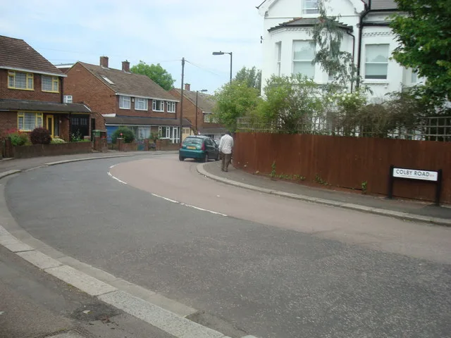
Colby Road in London Borough of Southwark is an asphalted residential street. The road has sidewalks. It runs in a southeast-northwest direction starting from Gipsy Hill and ends at Dulwich Wood Avenue. In the vicinity, there is a restaurant. The nearest stop in the vicinity is Gipsy Hill (approx. 50 m away).
- Road Type
- residential street
- Speed Limit
- 20 mph
- Route
- southeast-northwest
Image
Restaurants
Roads nearby
Mountbatten Close100 m
Forbes CourtShell, Select
150 m
Sainsbury RoadGipsy Hill
200 m
Burma Terrace200 m
Charters Close200 m
Becondale Road250 m
Brabourne Close250 m
Cawnpore Street250 m
Gipsy HillGipsy Hill Station, Central Hill, Highland Road
300 m
St Kitts Terrace300 m
Highlands Court300 m
Bridgetown Close300 m
Thorsden Way300 m
Alexandra Drive300 m
Bristow Road300 m
Oaks Avenue350 m
Alexandra Walk350 m
Battenberg Walk350 m
Georgetown Close350 m
Berridge Road400 m
Victoria Crescent400 m
Montserrat Close450 m
Whiteley Road450 m
Highland Road450 m
Durning Road500 m
Plane Tree Walk500 m
Lunham Road500 m
New Green Place500 m
Northwood Way550 m
Hawke RoadHigh Limes general store
550 m
Wychwood Way600 m
Lambeth prospect600 m
London prospect650 m
Valley prospect650 m
Oakwood Drive650 m
Apartment buildings nearby
Compton Court350 m
Pear Tree House550 m
Buildings nearby
Goodliffe Hall400 m
Central Hill Day Services550 m
Convenience stores nearby
FreshGo100 m
Dry cleaner's nearby
Kensington Dry Cleaners100 m
Fast food restaurants nearby
Fumi Korean & Japanese100 m
Parks nearby
Becondale Road Open Space300 m
Places of worship nearby
Christ Church400 m
Berridge Road Community Church450 m
Kingdom Hall of Jehovah's Witnesses450 m
Pubs nearby
The Colby Arms50 m
The Great Southern150 m
Railway lines nearby
Balham to Beckenham Junction Line100 m
Railway stations nearby
Gipsy Hill Station50 m
| Located in | London Borough of Southwark |
|---|---|
| Country | United Kingdom |
 Public transport map London Borough of Southwark Legend
| Railway | |
| Bus | |
| Tram |
 Cycling map London Borough of Southwark Legend
| Cycle path | |
| Cycle lane on road | |
| Cycling on bus lane | |
| Bicycle street | |
| Cyclists allowed | |
| Cyclists allowed, good surface | |
| No cycling | |
| Cobblestones |
| Long-distance cycle route | (depending on scale) | |
| Long-distance cycle route |
 Walking map London Borough of Southwark Legend
| Path |
| Long-distance hiking trail | (depending on scale) | |
| Long-distance hiking trail | ||
| No pedestrians |