
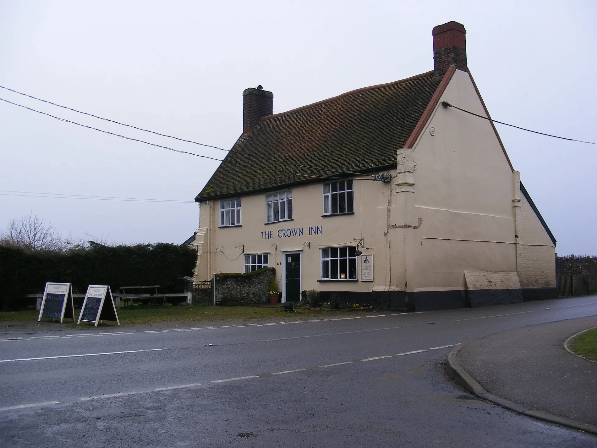
The Crown Inn in Snape, Suffolk
The Crown Inn in Snape in East Suffolk is a pub (opening hours: Mo-Sa 11:00-15:00,18:00-13:00; Su 12:00-23:00), Bridge Road (IP17 1SL). The Crown Inn also exists in Babergh.
- Postal Code
- IP17 1SL
- Street
- Bridge Road
- Amenity
- pub
- Building Type
- building
Image
Car repair shops
Bus stops
Tourist information offices
Roads nearby
Drury Park200 m
Garrett CloseSnape Post Office
300 m
The Terrace300 m
Priory RoadSnape
350 m
Church RoadThe Glebes, Snape Motor Company, Snape Car and Van Hire, Church
350 m
Glebe Court400 m
Stanhope Close400 m
Pryor Close500 m
The Glebes500 m
Bridge RoadThe Crown
500 m
Snape BridgeMalt, The Maltings, The Quay Gallery, Snape Bridge, Maltings Gallery, Earsham Street Delicatessen, The Shed, Asteria Wellbeing Hair & Beauty
500 m
Saxonfields600 m
Gromford LaneSnape Village Sign
750 m
Cundle Green Lane850 m
Farnham RoadChurch Garage
1,3 km
Wadd LaneGromford
1,4 km
Hulver Lane1,7 km
The Sailor's Path1,9 km
Watering LaneSnape Watering
2,1 km
Tunstall RoadIkencliff Crossroads
2,3 km
Redbarn Lane2,5 km
Chase's LaneFriston Baptist Chapel
2,5 km
Donkey Lane2,6 km
Low Road2,7 km
Mill RoadFriston, Old Chequers, Friston Village Sign
2,7 km
The Meadows2,7 km
Church Lane2,8 km
Chequers Row2,8 km
Saxmundham RoadOld Chequers
2,9 km
Amenities nearby
Snape Village Hall300 m
Abandoned railways nearby
Snape Branch850 m
Body of waters nearby
Friston Hall Lake2,3 km
Buildings nearby
Snape Telephone Exchange300 m
Dunningworth Hall1000 m
Acorn Cottage1,7 km
Iken Hall2,5 km
Iken Bay Livery2,5 km
Caravan site nearby
Marsh Farm2,7 km
Chalet nearby
Iken Barns2,5 km
Commercial areas nearby
Ladybird Nurseries1,0 km
Picnic site nearby
Iken Cliff Picnic Site1,9 km
Places of worship nearby
St John the Baptist, Snape1,3 km
Saint Botolph's2,3 km
Pubs nearby
The Golden Key100 m
Railway lines nearby
East Suffolk Line2,0 km
Rivers nearby
River Alde650 m
River Fromus2,0 km
Scrublands nearby
Church Common1,3 km
Woodlands nearby
Greenwood Burial Ground (natural burial ground)2,4 km
| Heritage designation | Grade II listed building |
|---|---|
| Located in | Snape |
| Country | United Kingdom |
 Public transport map Snape Legend
| Railway | |
| Bus | |
| Tram |
 Cycling map Snape Legend
| Cycle path | |
| Cycle lane on road | |
| Cycling on bus lane | |
| Bicycle street | |
| Cyclists allowed | |
| Cyclists allowed, good surface | |
| No cycling | |
| Cobblestones |
| Long-distance cycle route | (depending on scale) | |
| Long-distance cycle route |
 Walking map Snape Legend
| Path |
| Long-distance hiking trail | (depending on scale) | |
| Long-distance hiking trail | ||
| No pedestrians |