
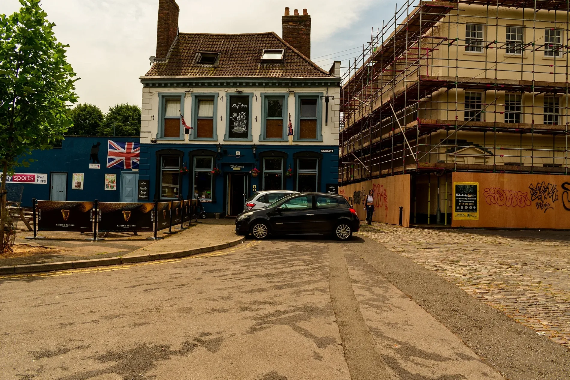
The Ship Inn in City of Bristol
The Ship Inn in City of Bristol is a pub, Cathay 1 (BS1 6PA). The Ship Inn also exists in North East and Hull and East Yorkshire.
- House Number
- 1
- Postal Code
- BS1 6PA
- Street
- Cathay
- Amenity
- pub
- Building Type
- building
Bus stops
Convenience stores
Pharmacy
Tourist information offices
Attraction
Gift shops
Community centre
Clinic
Roads nearby
Ship Lane50 m
Cathay50 m
Pump Lane50 m
Colston ParadeTramway Rail
150 m
Somerset Square150 m
Mede CloseShip Lane
150 m
Burton Close200 m
Guinea StreetSmarty dry cleaners, Redcliffe Premier, The general, The Hub
200 m
Clarence RoadOld Market Lawn, Somerset Street
250 m
Bedminster Bridge Roundabout250 m
Commercial RoadRe-Cycle
250 m
York RoadBath Bridge - Avon New Cut
300 m
Bedminster ParadeMcDonald's, Bedminster Parade
300 m
Whitehouse Place400 m
Whitehouse Street400 m
William StreetBristol Bike Doc, Good Chemistry Brewery
400 m
Nelson Parade400 m
Boot Lane400 m
Sargent Street450 m
Shops nearby
skyburst400 m
Abandoned railways nearby
Redcliffe Tunnel150 m
Apartment buildings nearby
Patterson House100 m
Flour House250 m
Buildings nearby
St Mary Redcliffe Parish Office100 m
noma250 m
Arno350 m
Neagle & Company Ltd400 m
Guide Dogs400 m
Structural Soils Ltd400 m
Secret Compass500 m
Cafés nearby
Olive & Fig350 m
Car repair shops nearby
AP Autocare350 m
Clinics nearby
The Bristol Talking Therapy Rooms200 m
Colleges nearby
Redcliffe Sixth Form Centre100 m
Convenience stores nearby
Redcliffe Stores50 m
Dental practices nearby
Windmill Hill Smiles400 m
Fast food restaurants nearby
Yummy Oriental50 m
SunRa kitchen350 m
Fitness centres nearby
The WIld Box350 m
Sweat Box Gym450 m
Gardens nearby
Garden of Remembrance150 m
Houses nearby
R. Thompson & Co.350 m
F.E. Thorne Metal & Pipe Fabrication450 m
Outdoor shops nearby
Taunton Leisure400 m
Places of worship nearby
Faithspace Community Centre50 m
Pubs nearby
The Little Grosvenor350 m
The Dark Horse400 m
Self-storages nearby
UK Storage Company400 m
Taxi ranks nearby
Yellow Cab Co400 m
| Heritage designation | Grade II listed building |
|---|---|
| Located in | City of Bristol |
| Country | United Kingdom |
 Public transport map City of Bristol Legend
| Railway | |
| Bus | |
| Tram |
 Cycling map City of Bristol Legend
| Cycle path | |
| Cycle lane on road | |
| Cycling on bus lane | |
| Bicycle street | |
| Cyclists allowed | |
| Cyclists allowed, good surface | |
| No cycling | |
| Cobblestones |
| Long-distance cycle route | (depending on scale) | |
| Long-distance cycle route |
 Walking map City of Bristol Legend
| Path |
| Long-distance hiking trail | (depending on scale) | |
| Long-distance hiking trail | ||
| No pedestrians |