
Union Street in Bath and North East Somerset
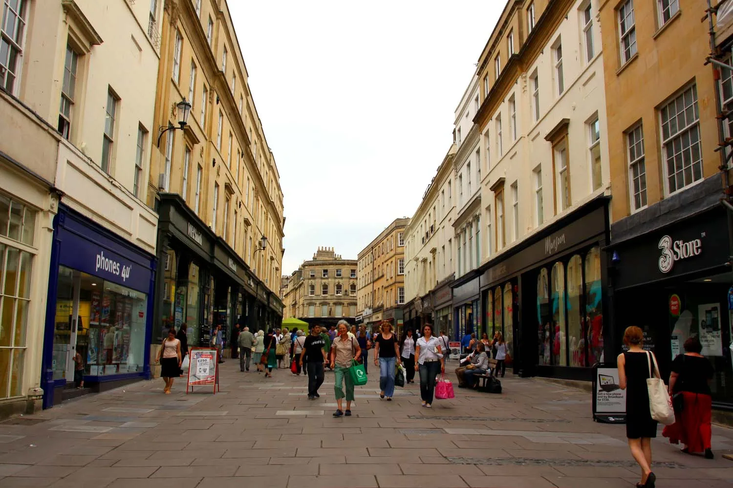
Union Street in Bath and North East Somerset is a lit pedestrian zone. It runs in a north-south direction starting from Burton Street and crosses Upper Borough Walls, Northumberland Place, The Corridor, Cheap Street and Westgate Street and ends at Stall Street. Union Street is also known as Union Street, Bath. This road is part of the hiking trail "Cotswold Way". In the vicinity, there is a post office. The nearest bus stop in the vicinity is Queen Square (Sa) (approx. 200 m away).
- Road Type
- pedestrian zone
- Route
- north-south
Image
Post offices
Roads nearby
Harington Place150 m
Barton StreetBoho Marché
150 m
Saint John's PlaceVaults Restaurant, Theatre Royal Fountain, 1805 Rooms
200 m
Wood Street200 m
Queen SquareQueen Square (Sa), William Oliver M.D., Bath Royal Literary & Scientific Institution, Queen Square Sb, Bath Academy
250 m
Princes Street250 m
Leisure nearby
Harington Club200 m
Art galleries nearby
World Builders of Queen Street150 m
Visage Gallery200 m
The Barton Gallery200 m
Banks nearby
The Coventry200 m
Beauty salons nearby
The Tanning Shop150 m
Saqua150 m
The Health & Beauty Centre250 m
Bookshops nearby
Mr. B's Emporium200 m
Buildings nearby
Reside150 m
Accrue150 m
Marcom250 m
Cafés nearby
Wild Cafe150 m
No. 11 Espresso Bar250 m
Clothing shops nearby
Meadow Kids250 m
Commercial buildings nearby
Trimbridge House150 m
Carter Jonas200 m
Knight Frank200 m
Crisp Cowley200 m
Dental practices nearby
Queen Square Dental Practice250 m
Escape games nearby
Bath Escape250 m
Fast food restaurants nearby
Carter And Phiri200 m
Gardens nearby
Beauford Square200 m
Hairdresser's nearby
Trimmers150 m
Miles250 m
Luna Hair Care250 m
Hotels nearby
Haringtons Hotel150 m
The Francis Hotel200 m
Music shops nearby
Vintage and Rare Guitars150 m
Pubs nearby
The Canon150 m
Garricks Head200 m
Hall & Woodhouse200 m
The Griffin Inn250 m
Residential buildings nearby
Living Map Company250 m
Restaurants nearby
Amarone150 m
PizzaExpress150 m
Pintxo200 m
Babas Mezze200 m
Schools nearby
Best in Bath250 m
Tailors nearby
Xo Tailoring Services150 m
Cisse Dress Making250 m
Theatres nearby
Theatre Royal200 m
The Egg200 m
Ustinov200 m
| Located in | Bath and North East Somerset |
|---|---|
| Country | United Kingdom |
| Location | Bath |
 Public transport map Bath and North East Somerset Legend
| Railway | |
| Bus | |
| Tram |
 Cycling map Bath and North East Somerset Legend
| Cycle path | |
| Cycle lane on road | |
| Cycling on bus lane | |
| Bicycle street | |
| Cyclists allowed | |
| Cyclists allowed, good surface | |
| No cycling | |
| Cobblestones |
| Long-distance cycle route | (depending on scale) | |
| Long-distance cycle route |
 Walking map Bath and North East Somerset Legend
| Path |
| Long-distance hiking trail | (depending on scale) | |
| Long-distance hiking trail | ||
| No pedestrians |