
County Road 1780 in Cullman County, Alabama
County Road 1780 in Cullman County is a residential street. It runs in a north-south direction and ends in a cul-de-sac.
- Road Type
- residential street
- Route
- north-south
Image
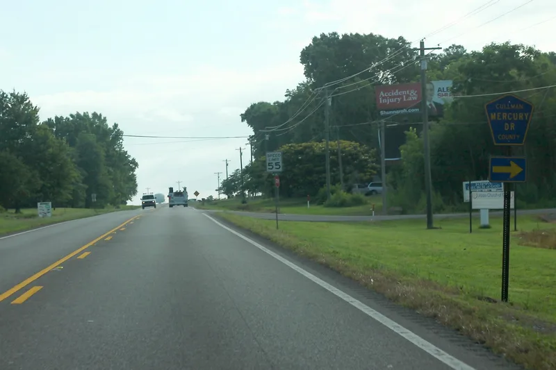
Streets nearby
Mercury Drive0.3 mi
Millbrook Drive0.3 mi
Memory Road0.3 mi
Neptune Drive0.3 mi
Mockingbird Road0.4 mi
County Road 18070.4 mi
Northport Lane0.5 mi
Hill Road0.5 mi
County Road 1779Joppa Church of God
0.5 mi
County Road 1778Joppa United Methodist Church, Joppa Junior High School
0.6 mi
County Road 18080.8 mi
County Road 17760.8 mi
Newton Drive0.8 mi
Barnes Road0.8 mi
Vivian Jarret Circle1.0 mi
County Road 1815Union Hill
1.1 mi
Manchester DriveManchester
1.1 mi
Monarch Drive1.1 mi
Matt Morrow Road1.2 mi
Naples Lane1.2 mi
Midfield Road1.3 mi
Barma Road1.3 mi
Mayapple Road1.3 mi
County Road 18161.4 mi
Menton Road1.4 mi
Marshall County 8471.4 mi
County Road 17721.5 mi
Cut-Off Road1.5 mi
Hulaco RoadRice, Liberty Church, Pleasant Valley Church, Independent Church, Rice School
1.5 mi
May Apple Road Southwest1.5 mi
Stoddard Drive1.5 mi
Lee Anne Lane1.6 mi
Walker Drive Southwest1.6 mi
Julie Lane1.6 mi
Kassidy Drive1.6 mi
Cullman RoadGrace Covenant Baptist Church
1.6 mi
Dusty Drive Southwest1.6 mi
Harwood Drive Northwest1.6 mi
New Home RoadJoppa, Joppa Post Office
1.7 mi
15th Street Northwest1.7 mi
Gottee Drive Southwest1.7 mi
Montana Drive Southwest1.7 mi
McKelvy Drive Northwest1.8 mi
County Road 18141.9 mi
12th Street Southwest1.9 mi
County Road 18191.9 mi
New Harmony RoadNew Harmony Missionary Baptist Church
1.9 mi
 Public transit map Cullman County Legend
| Railway | |
| Bus | |
| Streetcar |
 Bicycle map Cullman County Legend
| Bike path | |
| Bike lane on roadway | |
| Cycling allowed on bus lane | |
| Bicycle street | |
| Open to cyclists | |
| Open to cyclists, good path | |
| Cycling prohibited | |
| Cobblestone |
| Long-distance bike route | (depending on scale) | |
| Long-distance bike route |
 Pedestrian map Cullman County Legend
| Path |
| Long-distance hiking trail | (depending on scale) | |
| Long-distance hiking trail | ||
| Pedestrians prohibited |