
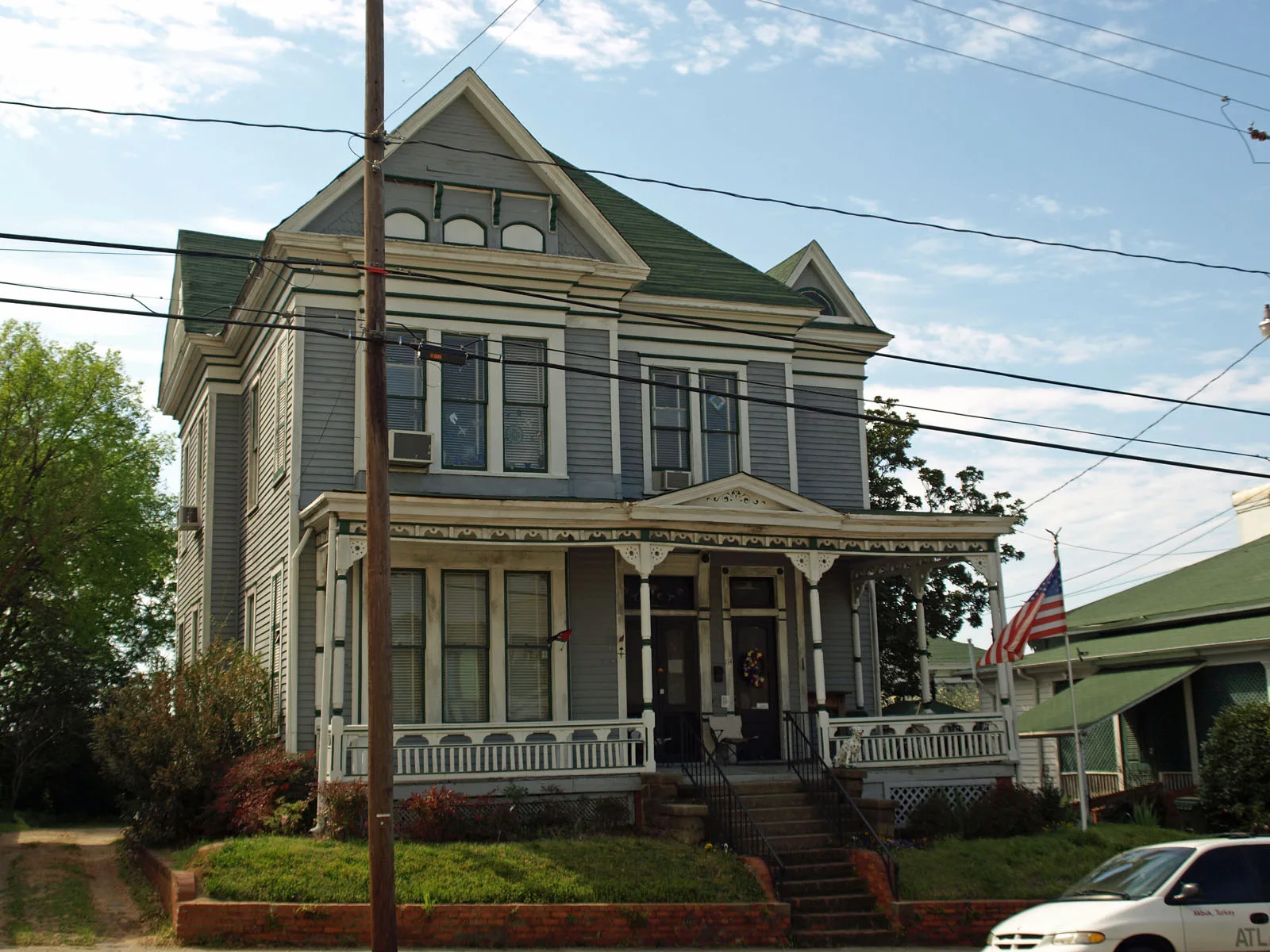
Scott Street in Montgomery, Alabama
Scott Street in Montgomery is a residential street. It runs in an east-west direction starting from Clayton Street and crosses South Court Street, South Perry Street, South Lawrence Street, South McDonough Street, South Hull Street, South Decatur Street and South Bainbridge Street and ends at South Union Street. Scott Street also exists in Colbert County, Covington County, Escambia County, Franklin County and Marshall County.
- Road Type
- residential street
- Route
- east-west
Image
Banks
Studios
Cafes
Clothing stores
Conference centers
Schools
Restaurants
Sporting goods stores
Fast food restaurants
Places of worship
Artworks
Animal trainings
Drugstores
Pubs
Streets nearby
Adams AvenueTrustmark, Grace Lutheran Church
0.1 mi
South Hull Street0.1 mi
South Lawrence Street0.1 mi
South McDonough StreetJones Law School, Baldwin Junior High School
0.1 mi
South Perry Street0.2 mi
High StreetFirst Christian Church
0.2 mi
Washington AvenueCentral Presbyterian Church, Wall of Tolerance
0.2 mi
Alabama StreetSaint Mark Baptist Church, First Baptist Church Montgomery
0.2 mi
Dexter AvenueOff Leash K9 Training Montgomery, WSFA, City Drug, Charlie's Trophies, WSFA News 12, Prevail Union
0.3 mi
Lee StreetFlames Grille
0.3 mi
South Decatur Street0.3 mi
Church Street0.3 mi
North Hull Street0.3 mi
South Court StreetCahawba House
0.3 mi
North Mc Donough Street0.4 mi
Monroe StreetWeil's, The Eagle Institute
0.4 mi
North Lawrence Street0.4 mi
North Perry StreetHero
0.4 mi
Court SquareMontgomery
0.4 mi
Market Plaza0.4 mi
Coosa StreetThe Legacy Museum Gift Shop & Cafe
0.4 mi
Madison AvenueCapitol Heights Church of Christ, McDonald's, Saint John African Methodist Episcopal Church
0.4 mi
Buildings nearby
Alabama Education Association0.3 mi
Frank M. Johnson Jr. Federal Building0.3 mi
Kress on Dexter0.4 mi
Renasant Bank0.4 mi
Retirement Systems of Alabama (RSA) Tower0.4 mi
Clothing stores nearby
Looking Good0.4 mi
Weil's0.4 mi
Courthouses nearby
Montgomery County Courthouse450 ft
Alabama Supreme Court0.3 mi
United States District Court0.3 mi
Fountains nearby
Court Square Fountain0.4 mi
Gas stations nearby
Circle K0.4 mi
Hotels nearby
DoubleTree by Hilton Hotel Montgomery Downtown0.4 mi
Libraries nearby
Montgomery City-County Public Library - Juliette Hampton Mor500 ft
Museums nearby
Civil Rights Memorial Center0.2 mi
Greyhound Bus Station;Freedom Rides Museum0.2 mi
Office buildings nearby
The Alabama Center for Commerce0.2 mi
Parks nearby
Alabama Bicentennial Park0.3 mi
Lowe Dexter Pocket Park0.4 mi
Lister Hill Plaza0.4 mi
Places of worship nearby
Saint Peter Catholic Church0.1 mi
Dexter Avenue King Memorial Legacy0.3 mi
Dexter Avenue King Memorial Baptist Church0.3 mi
Dexter Avenue Methodist Church0.3 mi
Prisons nearby
Montgomery County Jail300 ft
Restaurants nearby
Chris' Famous Hotdogs0.3 mi
Town halls nearby
Montgomery City Hall0.4 mi
Public transit map Montgomery Legend
| Railway | |
| Bus | |
| Streetcar |
Bicycle map Montgomery Legend
| Bike path | |
| Bike lane on roadway | |
| Cycling allowed on bus lane | |
| Bicycle street | |
| Open to cyclists | |
| Open to cyclists, good path | |
| Cycling prohibited | |
| Cobblestone |
| Long-distance bike route | (depending on scale) | |
| Long-distance bike route |
Pedestrian map Montgomery Legend
| Path |
| Long-distance hiking trail | (depending on scale) | |
| Long-distance hiking trail | ||
| Pedestrians prohibited |