
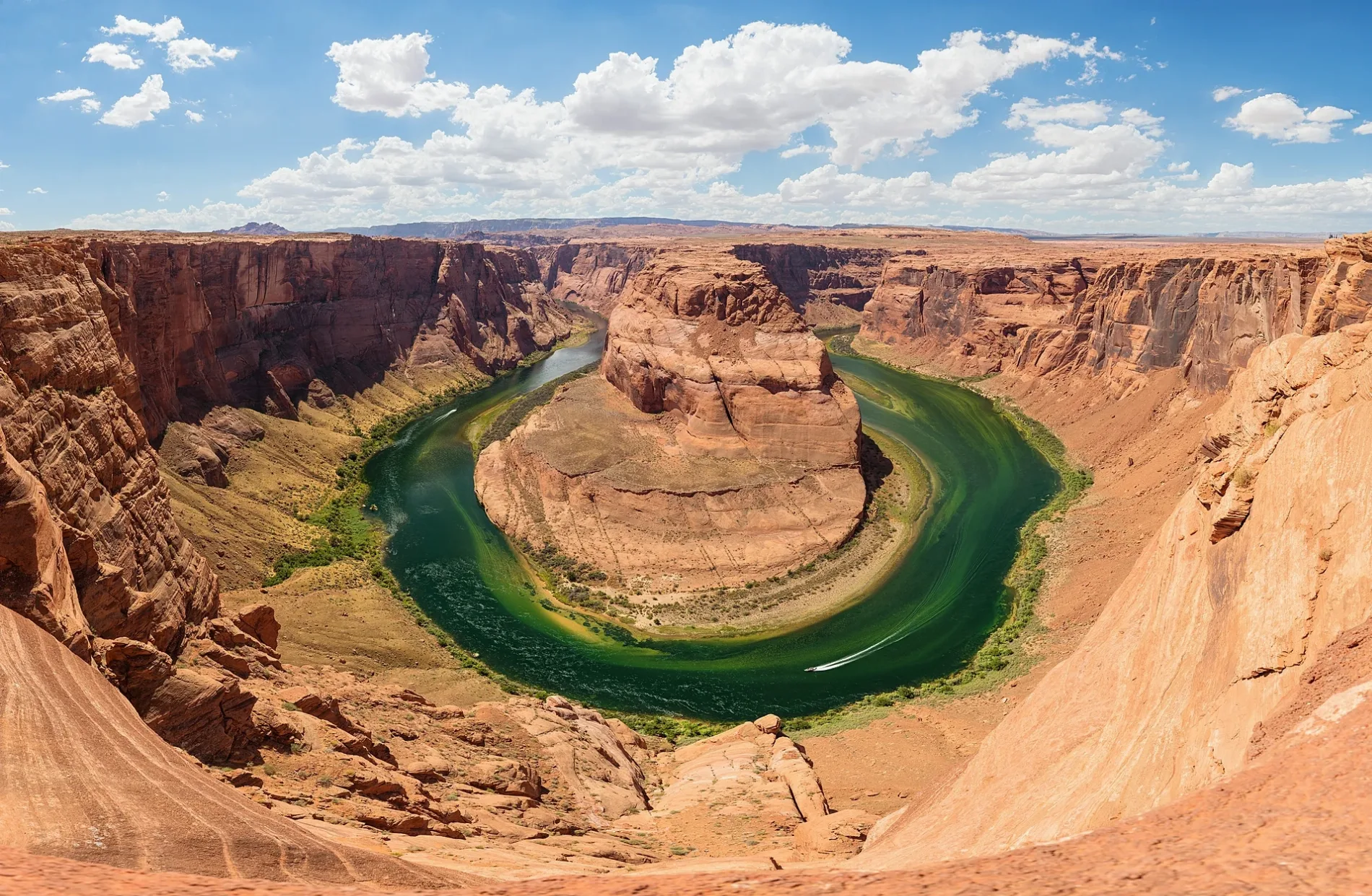
Colorado River in La Paz County, Arizona
Colorado River in La Paz County is a water. Colorado River is also known as Rio Colorado. Colorado River also exists in Coconino County and Yuma County. Ⓦ.
- Nature
- water
Image
Streets nearby
South Lovekin Boulevard0.7 mi
28th Avenue0.9 mi
30th AvenueIndio Hills
1.1 mi
Citrus Grove Boulevard1.2 mi
Peter D McIntyre Avenue1.5 mi
De Frain Boulevard2.2 mi
Citrus Grove2.3 mi
32nd Avenue3.2 mi
22nd Avenue3.3 mi
South Arrowhead Boulevard3.4 mi
26th Avenue3.4 mi
24th Avenue3.5 mi
South C and D Boulevard3.5 mi
Farm Road3.6 mi
Levee RoadAhakhav Tribal Preserve
3.7 mi
South Defrain Boulevard3.7 mi
South Neighbours BoulevardNeighbours & 14th Avenue, Neighbours & 20th Avenue, Neighbours & 18th Avenue, Ripley - Neighbors @ J & J Market
3.8 mi
Industrial Street3.9 mi
Warmington Street4.0 mi
Long Street4.0 mi
Industrial Lane4.0 mi
Intake Boulevard4.0 mi
Lindsay AvenueRipley - 25th Avenue & Lindsay, Ripley - Lindsay & Warmington
4.0 mi
Odell StreetRipley - 25th Avenue & Neighbors, Ripley - 25th Avenue & School Road
4.0 mi
Border Avenue4.0 mi
21st Avenue4.0 mi
Degan Avenue4.2 mi
Main StreetRiverside County Fire Department Station #44, Good Meadow, Catalina Spa RV Park, Ripley - Neighbors & Main, CP Cabazon, Main Country Liquor Deli
4.2 mi
Phillips Street4.2 mi
BroadwayRipley, Ripley - Lindsey & Broadway
4.2 mi
San Juan Avenue4.2 mi
School RoadRipley - Desert Rose Apts, Ripley - CSA School & Main
4.2 mi
Phillips Road4.2 mi
Paloma Avenue4.3 mi
Ramsey Avenue4.3 mi
Kirkwood Street4.3 mi
Broadway StreetBroadway
4.3 mi
Mason Avenue4.3 mi
20th AvenueDenny's, Motel 6
4.8 mi
25th AvenueRipley - 25th Avenue & Borders, Ripley - 25th Avenue & Ramsey
5.0 mi
Stephenson Boulevard5.0 mi
38th Avenue5.1 mi
Center Drive5.1 mi
36th Avenue5.1 mi
South Broadway5.2 mi
County Line Road5.2 mi
Convenience stores nearby
J & J Market4.0 mi
Parks nearby
Jack E. Marlowe Ripley Family Park4.5 mi
Miller Park4.9 mi
| Length | 2334 |
|---|---|
| Located in | Colorado, Utah, Arizona, Nevada, California, Sonora, Baja California |
| Country | United States, Mexico |
| Source | La Poudre Pass |
| Mouth | Gulf of California |
| Tributary | Eagle River, Roaring Fork River, Gunnison River, Dolores River, Range Creek, San Juan River, Little Colorado River, Gila River, Green River, Dirty Devil River, Paria River, Kanab Creek, Virgin River, Blue River, Bill Williams River, Havasu Creek, Little Dolores River, Muddy Creek, Piney River, Plateau Creek, Roan Creek, Williams Fork, Willow Creek, Tapeats Creek, Fraser River, Professor Creek, Mill Creek, Troublesome Creek |
| Native name | Colorado River |
| Described by | Brockhaus and Efron Encyclopedic Dictionary, Small Brockhaus and Efron Encyclopedic Dictionary, Encyclopædia Britannica 11th edition, The American Cyclopædia, Collier's New Encyclopedia, 1921, Encyclopædia Britannica Ninth Edition, New International Encyclopedia, The New Student's Reference Work, Great Soviet Encyclopedia (1926–1947), Meyer’s Universum, Siebzehnter Band |
 Public transit map La Paz County Legend
| Railway | |
| Bus | |
| Streetcar |
 Bicycle map La Paz County Legend
| Bike path | |
| Bike lane on roadway | |
| Cycling allowed on bus lane | |
| Bicycle street | |
| Open to cyclists | |
| Open to cyclists, good path | |
| Cycling prohibited | |
| Cobblestone |
| Long-distance bike route | (depending on scale) | |
| Long-distance bike route |
 Pedestrian map La Paz County Legend
| Path |
| Long-distance hiking trail | (depending on scale) | |
| Long-distance hiking trail | ||
| Pedestrians prohibited |