
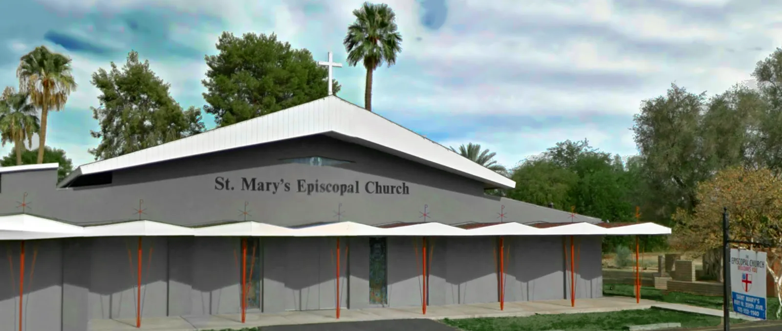
Saint Marys Episcopal Church in Alhambra, Phoenix, Arizona
Saint Marys Episcopal Church in Alhambra in Phoenix is a Church, North 39th Avenue 6533 (85019). Ⓦ.
- House Number
- 6533
- Postal Code
- 85019
- Street
- North 39th Avenue
- Amenity
- place of worship
- Building Type
- church
- Website
- https://www.stmarysphoenix.org/
Image
Auto parts stores
Toy stores
Auto repair shops
Garden centers
ATMs
Colleges
Bus stops
Gas stations
Event venues
Cell phone stores
Furniture stores
Variety stores
Restaurants
Pharmacies
Clinics
Supermarkets
Streets nearby
West Stella LaneAll Saints Episcopal Church, All Saints Episcopal Church Day School
0.1 mi
West Krall Street0.2 mi
North 37th Drive0.2 mi
North 37th AvenueDollar Tree
0.2 mi
West Marlette Avenue0.2 mi
North 40th Drive0.2 mi
West Claremont Street0.3 mi
West Lawrence Road0.3 mi
West Rose LaneVilla Novena, Walmart Tire & Lube Express
0.3 mi
West Sierra Vista Drive0.3 mi
North 41st Drive0.4 mi
North 38th Drive0.4 mi
North 35th Drive0.4 mi
Fleetwood Lane0.4 mi
West Flynn Lane0.4 mi
North 41st Lane0.4 mi
West Keim Drive0.5 mi
North 41st Avenue0.5 mi
North 36th Drive0.5 mi
West Glendale Avenueused tires, Sunrisa Dental, 1st Care Medical Clinic, Moncada WTS, 14447, 14580, Phoenix Fire Station Number 20, Fry's Fuel, Walkers Liquor, Alvin's Smkoe Shop, Anna’s Beauty Salon & Barber Shop, Church of the Beatitudes, T-Mobile, CVS Pharmacy, 76, Athena Bitcoin - 76 W Glendale, Aaron's, Sinbad's Restaurant, Batteries Plus Bulbs, Subway, 14579
0.5 mi
North 35th Avenue12351, Phở Vĩnh Long Vietnamese Restaurant, 12352, 12348, All Aboard Charter School, 12355, 12243, 12250, O'Brien's Sports Pub, 12349, AutoZone, Boost Mobile, 12247, Grand, Teaching and Learning Stuff, 12353, 13836, 12246, 12245, Subway, Cricket Wireless, Future Cuts, 12357, 12356, 12358, 12242, 12240, Metro by T-Mobile, 12236, TitleMax, 12244
0.5 mi
West Ocotillo Road0.5 mi
West Rovey Avenue0.5 mi
West Cactus Wren Drive0.5 mi
West Berridge LaneSalt and Lights Christian Church
0.5 mi
West Lamar Road0.5 mi
North 38th Avenue0.6 mi
West Citrus Way0.6 mi
North 39th Avenue0.6 mi
North 34th Lane0.6 mi
West Bethany Home Road13890, Bitstop at 76, 13842, Desert Sage Family Dental, Jake's Auto, Tiny Teeth, Subway, Señor Muerto’s Mexican Pizza, Oaxaca Restaurant, 13879, Auto Glass Now, Chevron, Olive Garden, Taco Bell, 13877, 13847, 13875, 13882, 13884, Shell, 13840, 13874, Country Boys Restaurant, 13849, Starbucks
0.6 mi
North 34th Drive0.6 mi
West Palo Verde Drive0.6 mi
Row 120.6 mi
North 36th Avenue0.7 mi
Apartment buildings nearby
Saint Marys Manor250 ft
Bike shops nearby
Bike Zone Phoenix0.5 mi
Commercial areas nearby
Anderson Plaza0.5 mi
Fast food restaurants nearby
Taco Mitch0.6 mi
BoSa0.6 mi
Taco Bell0.6 mi
Arby's0.6 mi
Filiberto's Mexican food0.7 mi
Gas stations nearby
QuikTrip0.5 mi
Parks nearby
La Pradera Park0.4 mi
Religious areas nearby
Dormition of the Mother of God Church0.1 mi
El-Bethel Evangelical Missionary Church0.4 mi
Retail areas nearby
Glenn Plaza Center0.5 mi
Other nearby
Alhambra Substation0.7 mi
| Located in | Arizona |
|---|---|
| Country | United States |
 Public transit map Alhambra Legend
| Railway | |
| Bus | |
| Streetcar |
 Bicycle map Alhambra Legend
| Bike path | |
| Bike lane on roadway | |
| Cycling allowed on bus lane | |
| Bicycle street | |
| Open to cyclists | |
| Open to cyclists, good path | |
| Cycling prohibited | |
| Cobblestone |
| Long-distance bike route | (depending on scale) | |
| Long-distance bike route |
 Pedestrian map Alhambra Legend
| Path |
| Long-distance hiking trail | (depending on scale) | |
| Long-distance hiking trail | ||
| Pedestrians prohibited |