
Doolittle Maintenance and Storage Facility in Oakland, California
Doolittle Maintenance and Storage Facility in Oakland ist ein Gebäude, Hegenberger Road 70. Doolittle Maintenance and Storage Facility is also known as Doolittle station. Ⓦ.
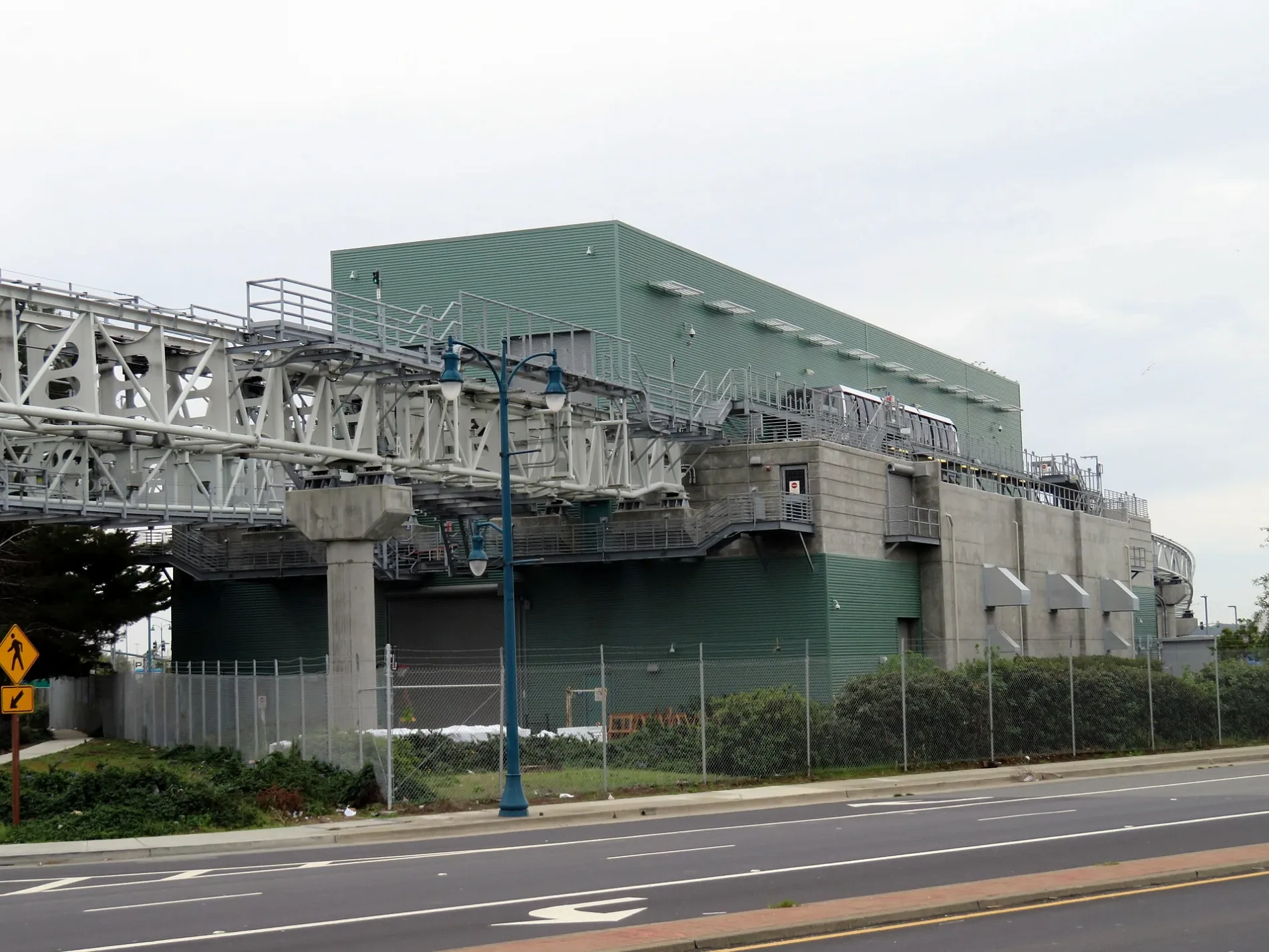
- House Number
- 70
- Street
- Hegenberger Road
- Building Type
- military depot
Restaurants
Bus stops
Cafes
Fast food restaurants
Gas stations
Motorcycle shops
Convenience stores
Streets nearby
Airport Access RoadDoolittle
0.1 mi
Hegenberger Place0.2 mi
Hegenberger Road675 Hegenberger Road, Shell, Hegenberger Road & Leet Drive, Hegenberger Road & Airport Drive, CP Coliseum, Hegenberger Road & Baldwin Street, Mountain Mike's, Bab Al-Yemen, Hegenberger Road & Doolittle Drive, Hegenberger Road & Edgewater Drive, Hegenberger Road & Pardee Drive, Hegenberger Road & Hegenberger Loop (North Junction), Hegenburger, La Chicharronda Colombiana, Hegenberger Road & Hegenberger Place, Harley-Davidson, Hegenberger Road & Collins Drive, Bank of America, Hegenberger Road & Hegenberger Loop (South Junction), Hegenberger Road & Edes Avenue, Chubby Freeze, T-Mobile, Chipotle, Chevron
0.2 mi
98th Avenue98th Avenue & Railroad Avenue, Grace Baptist Church, 98th Avenue & B Street, 98th Avenue & Bancroft Avenue, 98th Avenue & Las Vegas Avenue, 98th Avenue & Stearns Avenue (Bishop O'Dowd High School), 98th Avenue & MacArthur Boulevard, Sojourner Truth Independent Study School, 98th Avenue & Lawlor Street, Oakland Tire pros, 98th Avenue & Olive Street, 98th Avenue & Denslowe Street, 98th Avenue & Maddux Drive, 98th Avenue & San Leandro Street, 98th Avenue & Edes Avenue, Latinos Unidos, Champion Smokehouse, McDonald's, 98th Avenue & International Boulevard, Bottleneck, 98th Avenue & E Street, 98th Avenue & Railroad Crossing, 98th Avenue & Cherry Street, 98th Avenue & Walnut Street, Arco
0.2 mi
Pardee Drive0.2 mi
San Leandro Creek TrailChevron, Wendy's, Royal Kitchen, Starbucks, ExtraMile, Subway
0.2 mi
Kitty Lane0.3 mi
Leet Drive0.3 mi
Doolittle DriveWatermelon Rock
0.3 mi
Bigge Street0.3 mi
Swan Way0.4 mi
Empire Court0.4 mi
Hegenberger LoopHegenberger Loop & Hegenberger Road
0.4 mi
Empire RoadEmpire Road & Wistar Road, Empire Road & Tunis Road, Empire Road & Coral Road, Empire Road & Cairo Road
0.4 mi
Tunis Road0.4 mi
Nort Field0.4 mi
Arrowhead Marsh TrailBufflehead, Egret, Duplex Cone
0.5 mi
De Havilland StreetAlameda County Sheriff
0.5 mi
Earhart RoadGate O, Oakland Airport CNG Station
0.5 mi
Bessie Coleman Drive0.5 mi
Ron Cowan ParkwayGate C2
0.7 mi
Airport DriveOakland International Airport, Tay Ho, Oakland Supply Co., Shop The Town, Bank of America, Wells Fargo
0.8 mi
John Glenn DriveInternational Arrivals
0.8 mi
Buildings nearby
Comcast0.2 mi
Aviation Institute of Maintenance0.2 mi
Port of Oakland0.2 mi
Civil Air Patrol Squadron 1880.3 mi
JetSuiteX0.3 mi
FedEx0.3 mi
Independent Institute0.4 mi
Horizon Beverage Company0.5 mi
General Bottle Supply0.6 mi
Car rentals nearby
Enterprise0.2 mi
Convenience stores nearby
Shell0.3 mi
Copy shops nearby
UPS Customer Center0.3 mi
Fire stations nearby
Oakland Fire Station 270.1 mi
Funiculars nearby
BART Coliseum–Oakland International Airport50 ft
H-Line0.2 mi
Hangars nearby
KaiserAir Jet Center0.6 mi
Hotels nearby
Holiday Inn Hotel & Suites Oakland Airport300 ft
Oakland Airport Executive Hotel0.1 mi
Holiday Inn Express Hotel & Suites Oakland-Airport0.2 mi
Springhill Suites Oakland Airport0.2 mi
Industrial areas nearby
Cresco Equipment Rentals0.3 mi
Motels nearby
Econo Lodge Inn & Suites Oakland Airport400 ft
Parks nearby
Scott Lindsey Park0.5 mi
Post offices nearby
Airport Station Oakland Post Office0.2 mi
Specialty stores nearby
Grainger0.6 mi
Streams nearby
San Leandro Creek0.3 mi
| Official opening | 2014 |
|---|---|
| Operator | Bay Area Rapid Transit |
| Located in | Oakland |
| Country | United States |
 Public transit map Oakland Legend
| Railway | |
| Bus | |
| Streetcar |
 Bicycle map Oakland Legend
| Bike path | |
| Bike lane on roadway | |
| Cycling allowed on bus lane | |
| Bicycle street | |
| Open to cyclists | |
| Open to cyclists, good path | |
| Cycling prohibited | |
| Cobblestone |
| Long-distance bike route | (depending on scale) | |
| Long-distance bike route |
 Pedestrian map Oakland Legend
| Path |
| Long-distance hiking trail | (depending on scale) | |
| Long-distance hiking trail | ||
| Pedestrians prohibited |