
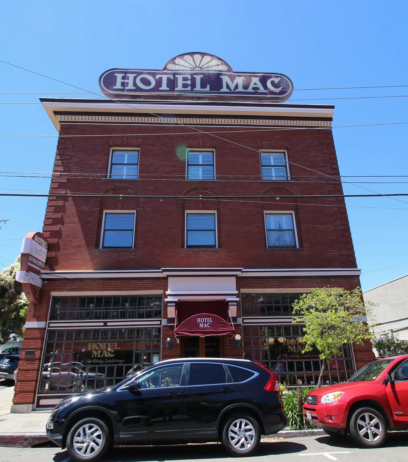
Hotel Mac in Richmond, California
Hotel Mac in Richmond is a hotel. Hotel Mac is located near Tewksbury Avenue. Ⓦ.
- Building Type
- hotel
- Tourism
- hotel
- Website
- https://www.hotelmac.net/
Image
Fast food restaurants
Post offices
Cafes
Stations
Restaurants
Theaters
Hair salons
Bus stops
Convenience stores
Places of worship
Community centers
Streets nearby
Washington AvenueEl Sol, Santa Fe Market, Point Richmond Market, Kao Sarn, Jin Ye, New Leaf Salon, Point Richmond Community Center
200 ft
Santa Fe Avenue250 ft
Delfino Avenue250 ft
Cottage AvenuePoint Richmond Station Richmond Post Office
500 ft
Tewksbury AvenueTewksbury Avenue & Castro Street, Tewksbury Avenue & Washington Avenue
0.1 mi
Park PlaceExtreme Pizza, Masquers Playhouse, Kaleidoscope Coffee
0.1 mi
Richmond Court0.1 mi
Railroad AvenueRaymond's Pizza, Maya Tacqueria
0.1 mi
Tunnel Avenue0.1 mi
Martina StreetFirst Methodist Church
0.2 mi
Nicholl AvenueThe Point Gospel Chapel
0.2 mi
West Richmond AvenueOur Lady of Mercy Church, Up and Under, Masa
0.2 mi
West Cutting Boulevard0.2 mi
Summit Street path0.2 mi
Castro StreetTewksbury Avenue & Castro Street, Tewksbury Turnaround
0.2 mi
East Richmond AvenueMechanics Bank, Mechanics bank
0.2 mi
South Garrard BoulevardSouth Garrard Boulevard & West Cutting Boulevard, Roma Caffé & Bar, Hak5 Warehouse, South Garrard Boulevard & Canal Boulevard
0.2 mi
Piedmont Place0.2 mi
Summit Street0.2 mi
Golden Gate Ave.0.2 mi
Golden Gate Avenue path0.2 mi
Eddy Street0.2 mi
Oregon StreetGreat American Burger and Pie
0.2 mi
Terrace Avenue0.2 mi
Water Street0.2 mi
Mono Street0.2 mi
West Scenic Avenue0.2 mi
High Street0.3 mi
Vine Avenue0.3 mi
Chevron Way0.3 mi
Vacca Street0.3 mi
Crest Avenue0.3 mi
Bishop AvenuePoint Richmond
0.3 mi
Tremont Avenue0.3 mi
Pacific Avenue0.3 mi
Western Drive0.4 mi
Calol Street0.4 mi
Midway Street0.4 mi
John T. Knox FreewayCP Stege
0.4 mi
Frontage Road0.4 mi
Marine StreetRetail gasoline filling station
0.4 mi
Mill Street0.4 mi
Commercial areas nearby
Point Richmond0.2 mi
Fire stations nearby
Richmond Fire Station 61500 ft
Libraries nearby
Richmond Public Library - Westside Branch400 ft
Museums nearby
Point Richmond History Association Museum450 ft
Parks nearby
Judge George D. Carroll Park0.2 mi
Places of worship nearby
Point Richmond Baptist Church0.2 mi
Swimming pools nearby
Richmond Plunge0.2 mi
| Year built | 1911 |
|---|---|
| Heritage designation | National Register of Historic Places contributing property |
| Located in | California |
| Country | United States |
| Location | Point Richmond Historic District |
 Public transit map Richmond Legend
| Railway | |
| Bus | |
| Streetcar |
 Bicycle map Richmond Legend
| Bike path | |
| Bike lane on roadway | |
| Cycling allowed on bus lane | |
| Bicycle street | |
| Open to cyclists | |
| Open to cyclists, good path | |
| Cycling prohibited | |
| Cobblestone |
| Long-distance bike route | (depending on scale) | |
| Long-distance bike route |
 Pedestrian map Richmond Legend
| Path |
| Long-distance hiking trail | (depending on scale) | |
| Long-distance hiking trail | ||
| Pedestrians prohibited |