
Kern Valley Airport in Kernville, CA 93238
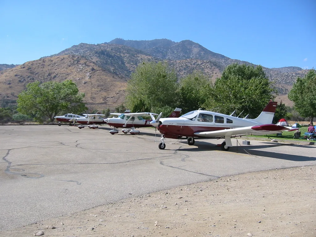
Kern Valley Airport in Kernville, CA 93238 (Kern County) is an airfield. Kern Valley Airport is also known as L05. Ⓦ.
- Operator
- County of Kern
Image
Streets nearby
Luxton Lane0.6 mi
Sierra WayKern River Brewing Company, Mobil, Primo's, Sierra Gateway Market, Starlite Lounge, Kern River's Edge Campground, Trailhead, Sequoia Lodge, Riverkern General Store and Deli
0.6 mi
Bass Road0.6 mi
Road 24600.7 mi
Trout Road0.7 mi
Bowman Road0.7 mi
Road 15170.8 mi
Dawn Lane0.9 mi
Plater Road1.1 mi
Maxs Landing1.3 mi
Mac Hill Drive1.7 mi
Gilbert Lane1.7 mi
Wofford Heights BoulevardVista Point
1.7 mi
Terrace Way1.7 mi
Sandidge Lane1.7 mi
Paloma Court1.7 mi
Cyrus Canyon Road1.8 mi
Kern River DriveShell, Riverside One Stop
1.8 mi
Tierra-del-Rio Lane1.8 mi
Grove Park Way1.8 mi
Mountain Drive1.9 mi
Silver Mine Road1.9 mi
Valley View DrivePizza Barn
1.9 mi
Piute DriveBank of America
1.9 mi
Kernville RoadKernville Cowork, Cheryl's Diner, Kern County Fire Department Station 76, Kernville, The Hut
1.9 mi
Burlando Road1.9 mi
Whitney Road1.9 mi
Frontier Road1.9 mi
Big Blue RoadKernville Post Office, Kern Valley Museum
2.0 mi
Sirretta StreetKernville United Methodist Church
2.0 mi
Tobias StreetKernville Branch Kern County Library, Kernville Saloon
2.0 mi
Scodie Road2.0 mi
Mount Drive2.0 mi
Sierra Drive2.0 mi
Panorama Drive2.0 mi
South Frontier Trail2.0 mi
Buena Vista DriveFastrip, Ewings on the Kern
2.1 mi
James Road2.2 mi
Waterways nearby
Kern River1.3 mi
Buildings nearby
Kernville Inn1.9 mi
Campgrounds nearby
Frandy Park Campground1.7 mi
Golf courses nearby
Kern Valley Golf Course1.1 mi
Hotels nearby
Kern River Front Lodge1.8 mi
The Kern Lodge2.0 mi
Motels nearby
Piazza's Pine Cone Inn2.0 mi
Parks nearby
Riverside Park1.8 mi
Circle Park1.9 mi
Streams nearby
Caldwell Creek1.7 mi
Other nearby
Kernville Heliport0.5 mi
| Elevation | 2614 |
|---|---|
| Located in | California |
| Country | United States |
 Public transit map Kern County Legend
| Railway | |
| Bus | |
| Streetcar |
 Bicycle map Kern County Legend
| Bike path | |
| Bike lane on roadway | |
| Cycling allowed on bus lane | |
| Bicycle street | |
| Open to cyclists | |
| Open to cyclists, good path | |
| Cycling prohibited | |
| Cobblestone |
| Long-distance bike route | (depending on scale) | |
| Long-distance bike route |
 Pedestrian map Kern County Legend
| Path |
| Long-distance hiking trail | (depending on scale) | |
| Long-distance hiking trail | ||
| Pedestrians prohibited |