
Corcoran Airport in Corcoran, CA 93212
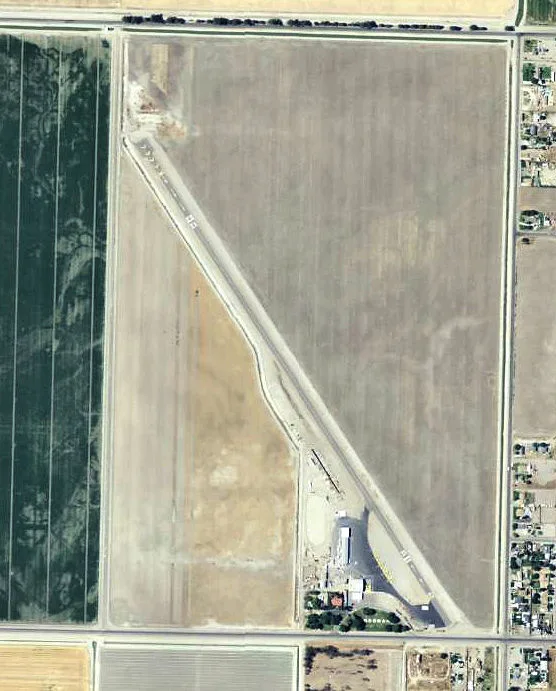
Corcoran Airport in Corcoran, CA 93212 (Kings County) is an airfield. Corcoran Airport is also known as CRO. Ⓦ.
Image
Streets nearby
7 1/2 Avenue0.3 mi
Chester Avenue0.3 mi
Hanna AvenueOur Lady of Lourdes Catholic Church, Adventist Health Medical Office - Corcoran
0.4 mi
James Avenue0.4 mi
Omaha AvenueMurray
0.4 mi
Brokaw AvenueFirst Missionary Baptist Church
0.4 mi
Bethel Avenue0.4 mi
Olympic Avenue0.5 mi
Doran Avenue0.5 mi
Bainum AvenueCarnitas La Prieta
0.6 mi
Branum Avenue0.6 mi
Bell Avenue0.7 mi
Miller Avenue0.7 mi
Garvey Avenue0.7 mi
Reagan Avenue0.8 mi
Regency Avenue0.8 mi
Benrus Avenue0.8 mi
Strepy Avenue0.8 mi
Keegan Avenue0.8 mi
1st Street0.9 mi
Gable Avenue0.9 mi
Anderson Lane0.9 mi
Rickover Court0.9 mi
Perry Avenue0.9 mi
6 1/2 Avenue1.0 mi
Denton Avenue1.0 mi
Nimitz Avenue1.0 mi
Patterson Avenue1.0 mi
Doolittle Court1.0 mi
Deer Creek Avenue1.0 mi
Tule River Avenue1.0 mi
Halsey Avenue1.0 mi
Macarthur Avenue1.0 mi
Kern River Avenue1.0 mi
Lorina AvenueFirst United Presbyterian Church
1.1 mi
Sequoia Avenue1.1 mi
North Court1.1 mi
Lemay Court1.1 mi
Orange Avenue1.1 mi
Hume Lake Avenue1.1 mi
Airington Circle1.1 mi
Patton Avenue1.1 mi
Lake Isabella Avenue1.1 mi
Whitley AvenueCorcoran, McDonald's
1.1 mi
Soto Avenue1.1 mi
Ditches nearby
Daulton Ditch250 ft
Parks nearby
Walking Park0.9 mi
Streams nearby
East Branch Cross Creek1.3 mi
Swimming pools nearby
Corcoran City Swimming Pool1.2 mi
| Named after | Corcoran |
|---|---|
| Elevation | 60 m |
| Located in | California |
| Country | United States |
 Public transit map Kings County Legend
| Railway | |
| Bus | |
| Streetcar |
 Bicycle map Kings County Legend
| Bike path | |
| Bike lane on roadway | |
| Cycling allowed on bus lane | |
| Bicycle street | |
| Open to cyclists | |
| Open to cyclists, good path | |
| Cycling prohibited | |
| Cobblestone |
| Long-distance bike route | (depending on scale) | |
| Long-distance bike route |
 Pedestrian map Kings County Legend
| Path |
| Long-distance hiking trail | (depending on scale) | |
| Long-distance hiking trail | ||
| Pedestrians prohibited |