
Henness Ridge Fire Lookout in Yosemite National Park, CA 95389
Henness Ridge Fire Lookout in Yosemite National Park, CA 95389 (Mariposa County) is a tower (Observation tower, built in 1939). Henness Ridge Fire Lookout is also known as Henness Ridge Lookout. Henness Ridge Fire Lookout is located near Lake Cherry Lane. Henness Ridge Fire Lookout is built in the National Park Service rustic style. Ⓦ.
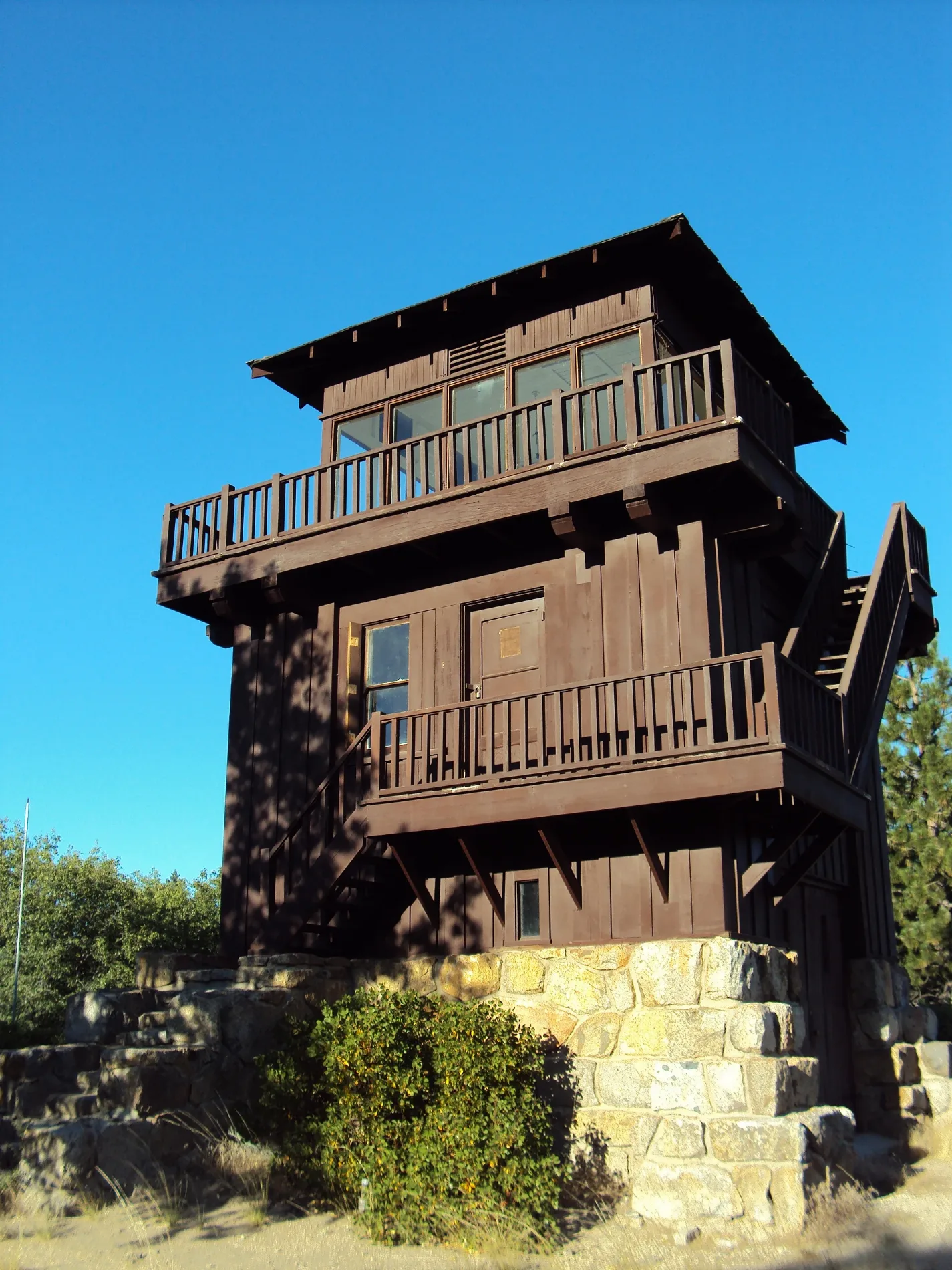
- Building Type
- tower
Viewpoints
Charging stations
Post offices
Attractions
Bus stops
Restaurants
Museums
Tourist information centers
Hotels
ATMs
Picnic areas
Streets nearby
Lake Cherry Lane0.4 mi
Azilia0.5 mi
Manzanita Lane0.6 mi
Azalea Lane0.6 mi
Henness Circle0.6 mi
Dogwood Lane0.6 mi
Yosemite Park WayYosemite West Lodging, Inc.
0.8 mi
Henness Ridge RoadYosemite West
0.8 mi
Black Oak Lane0.8 mi
Buck Brush Lane0.9 mi
Henness Ridge Drive1.0 mi
Wawona RoadAlder Creek-Mosquito Creek Trailhead, Tunnel View, Yosemite Valley Geology, Rewards of Travel, A Varied View, A View Through Time, Chevron, Wawona Store, Yosemite National Park, CA - Wawona (YOH), Stud Horse Trailhead
2.0 mi
Deer Camp RoadDeer Camp Trailhead, Deer Camp
2.6 mi
Rush Creek TrailRush Creek Trailhead
3.3 mi
El Portal RoadHetch Hetchy Railroad Museum, The Cascades Viewpoint, The Gateway, Viewpoint, Hwy 140, Yosemite NP
3.3 mi
South Fork Merced TrailPeachtree Bar, Devil Gulch
3.3 mi
Chinquapin Trail3.4 mi
Glacier Point RoadSummit Meadow, Washburn Point, The Clark Range, Sentinel Dome Trailhead
3.5 mi
Central Yosemite HighwayStage Stop, Don Ruben's Mexican Food, Mariposa Hair Salon, Cedar House Restaurant, Canyon Bar & Grill, Midpines, Highway 140 Autocamp;Midpines, CA (MDP), Midpines Post Office (Inbound), Midpines Post Office (Outbound), Yosemite Bug Resort, Cedar Lodge, Incline, The River Restaurant & Lounge, Yosemite View Lodge (Outbound), West America Bank, Park Side Pizza, Yosemite View Lodge (Inbound);El Portal, CA (EPL), Tesla Supercharger, Chocolate Soup, Grizzly Gas, Pizza Factory, Sugar Pine Café, Yosemite Sweet Tooth, Coast Hardware, Mariam & Co, Sierra Foothills Homes, Anahata, Yosemite Ale Werks, Costa Livos, Brick Wall Botique, Yosemite Gifts, Epic Alpacas, The Fremont House Clothing, Grace Note Chimes, The Alley, Our Country Home, The Company Store, Bette's Gold Coin Restaurant & Sports Tavern, Mariposa Marketplace, Bling N Things, Sweetwater, Midtown Mariposa (inbound);Mariposa, CA - Midtown YARTS Bus Stop (MRM), Midtown Mariposa (outbound), Lone Wolf Designs, Mariposa Hotel Inn, Catheys Valley, The Oasis, The Oasis Market & Cafe, Cathey's Valley (Outbound), Cathey's Valley (Inbound), Circle of Hope Ministry, Rock Shop, Roadhouse 140, Zephyr
4.0 mi
Bishop Creek TrailBishop Creek Trailhead
4.2 mi
Buildings nearby
Badger Pass Ski Lodge3.6 mi
Badger Pass Ski Area Equiptment Rental3.6 mi
Sequoia3.6 mi
Manzanita3.6 mi
Badger Pass Ski Area Cross Country Ski Equipment3.6 mi
Maple3.6 mi
Juniper3.7 mi
Grasslands nearby
Elevenmile Meadow1.1 mi
Hotels nearby
Redbud3.6 mi
Dogwood3.6 mi
Motels nearby
Yosemite Blue Butterfly Inn3.6 mi
Yosemite View Lodge3.6 mi
Residential areas nearby
Yosemite West Condominiums0.7 mi
Ridges nearby
Henness Ridge2.1 mi
Rivers nearby
Merced River2.8 mi
Streams nearby
Indian Creek1.4 mi
Elevenmile Creek1.8 mi
Rail Creek1.9 mi
Strawberry Creek2.0 mi
Zipp Creek2.1 mi
Avalanche Creek2.2 mi
Bishop Creek2.5 mi
Henness Branch3.4 mi
Grouse Creek3.7 mi
Swimming pools nearby
Pool3.6 mi
Spa3.6 mi
Ticket offices nearby
Arch Rock Entrance Station3.3 mi
Vacation homes nearby
enchanted forest0.5 mi
Valleys nearby
Merced Gorge3.7 mi
| Architectural style | National Park Service rustic |
|---|---|
| Operator | National Park Service |
| Owned by | National Park Service |
| Protected area | Yosemite National Park |
| Located in | Mariposa County |
| Country | United States |
| Location | Yosemite West |
 Public transit map Mariposa County Legend
| Railway | |
| Bus | |
| Streetcar |
 Bicycle map Mariposa County Legend
| Bike path | |
| Bike lane on roadway | |
| Cycling allowed on bus lane | |
| Bicycle street | |
| Open to cyclists | |
| Open to cyclists, good path | |
| Cycling prohibited | |
| Cobblestone |
| Long-distance bike route | (depending on scale) | |
| Long-distance bike route |
 Pedestrian map Mariposa County Legend
| Path |
| Long-distance hiking trail | (depending on scale) | |
| Long-distance hiking trail | ||
| Pedestrians prohibited |