
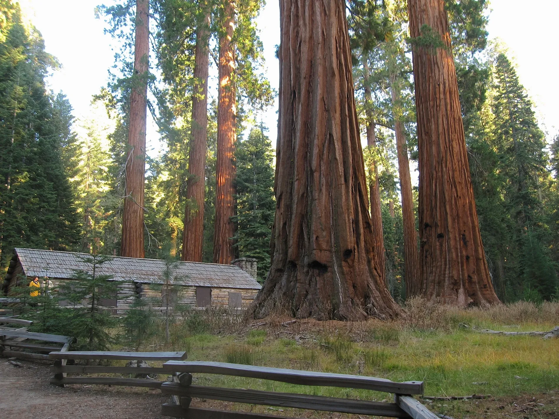
Mariposa Grove Museum in Mariposa County, California
Mariposa Grove Museum in Mariposa County is a museum (National Park Service). Mariposa Grove Museum is also known as Mariposa Grove Cabin. Mariposa Grove Museum is located near Guardians Loop Trail. Mariposa Grove Museum is built in the National Park Service rustic style.
- Building Type
- building
- Operator
- National Park Service
- Tourism
- museum
Image
Restaurants
Gift shops
Charging stations
Fountains
Viewpoints
Campgrounds
Coffee shops
Gas stations
Bus stops
Attractions
Post offices
Tourist information centers
Streets nearby
Guardians Loop Trail0.1 mi
Mariposa Grove Trail0.2 mi
Permineter Trail0.3 mi
Grizzly Giant Loop TrailBachelor and Three Graces, Mariposa Grove Trailhead, Grizzly Giant
0.7 mi
Wawona Trail0.8 mi
Big Trees Loop TrailFallen Monarch
0.9 mi
Biledo Meadow Trail1.3 mi
Mount Raymond Road1.5 mi
Grizzly Trail1.6 mi
Washburn TrailWashburn Trailhead
1.7 mi
Mariposa Grove RoadMariposa Grove Shuttle Stop, Mariposa Grove, Mariposa County, CA, USA, The Depot, Mariposa Welcome Plaza, Yosemite National Park, CA - Mariposa Grove (YOM)
1.8 mi
Wawona RoadTunnel View, Yosemite Valley Geology, Rewards of Travel, A Varied View, A View Through Time, Chevron, Alder Creek-Mosquito Creek Trailhead, Wawona Store, Yosemite National Park, CA - Wawona (YOH), Stud Horse Trailhead
1.8 mi
Four Mile Road2.0 mi
Wawona Meadow Loop TrailMeadow Loop Trailhead
2.2 mi
Swinging Bridge Trail2.3 mi
Sunnydale Campground Loop2.4 mi
Bill's Hill Road2.5 mi
SDA Camp Road2.5 mi
Buffin Meadow Road2.6 mi
Sunnydale Campground2.6 mi
Southern Yosemite HighwayYosemite Mountain Sugar Pine Historical Railroad, Happy Camp, Thornberry Museum, Buffalo Bar, Aroma Restaurant, Timberloft Pizzaria, Tenaya Lodge;Fish Camp, CA (FSH)
2.6 mi
Dutchman Lake Trail2.8 mi
6S07Big Sandy Campground, Little Sandy Campground
2.9 mi
River Street2.9 mi
Pine Avenue2.9 mi
Star Lakes OHV Route3.0 mi
Cedar Avenue3.0 mi
Vine Street3.0 mi
Left Meadow Trail3.1 mi
Chilnualna Falls RoadNorth Wawona, Sierra Nevada Research Station's (SNRS) Yosemite Field Station, (View from the Bridge), Swinging Bridge Trailhead
3.1 mi
Van Campen Way3.1 mi
Rivet Street3.1 mi
Larke Street3.2 mi
Chilnualna Falls Stock TrailChilnualna Falls Horse Trailhead
3.2 mi
Campgrounds nearby
Summerdale Campground2.4 mi
Camp Wawona2.6 mi
Forests nearby
Mariposa Grove0.9 mi
Grasslands nearby
Buffin Meadow1.8 mi
Long Meadow2.2 mi
Meadows nearby
Biledo Meadow1.9 mi
Goat Meadow2.1 mi
Rivers nearby
South Fork Merced River1.8 mi
Streams nearby
Rainier Creek1.6 mi
Big Creek2.5 mi
Long Meadow Creek2.5 mi
White Chief Branch3.1 mi
Swimming pools nearby
SDA Camp Swimming Pool2.4 mi
Waters nearby
Star Lakes2.9 mi
Winter sports areas nearby
Goat Meadow Snow Play Area2.1 mi
| Architectural style | National Park Service rustic |
|---|---|
| Heritage designation | National Register of Historic Places listed place |
| Protected area | Yosemite National Park |
| Located in | Mariposa County |
| Country | United States |
 Public transit map Mariposa County Legend
| Railway | |
| Bus | |
| Streetcar |
 Bicycle map Mariposa County Legend
| Bike path | |
| Bike lane on roadway | |
| Cycling allowed on bus lane | |
| Bicycle street | |
| Open to cyclists | |
| Open to cyclists, good path | |
| Cycling prohibited | |
| Cobblestone |
| Long-distance bike route | (depending on scale) | |
| Long-distance bike route |
 Pedestrian map Mariposa County Legend
| Path |
| Long-distance hiking trail | (depending on scale) | |
| Long-distance hiking trail | ||
| Pedestrians prohibited |