
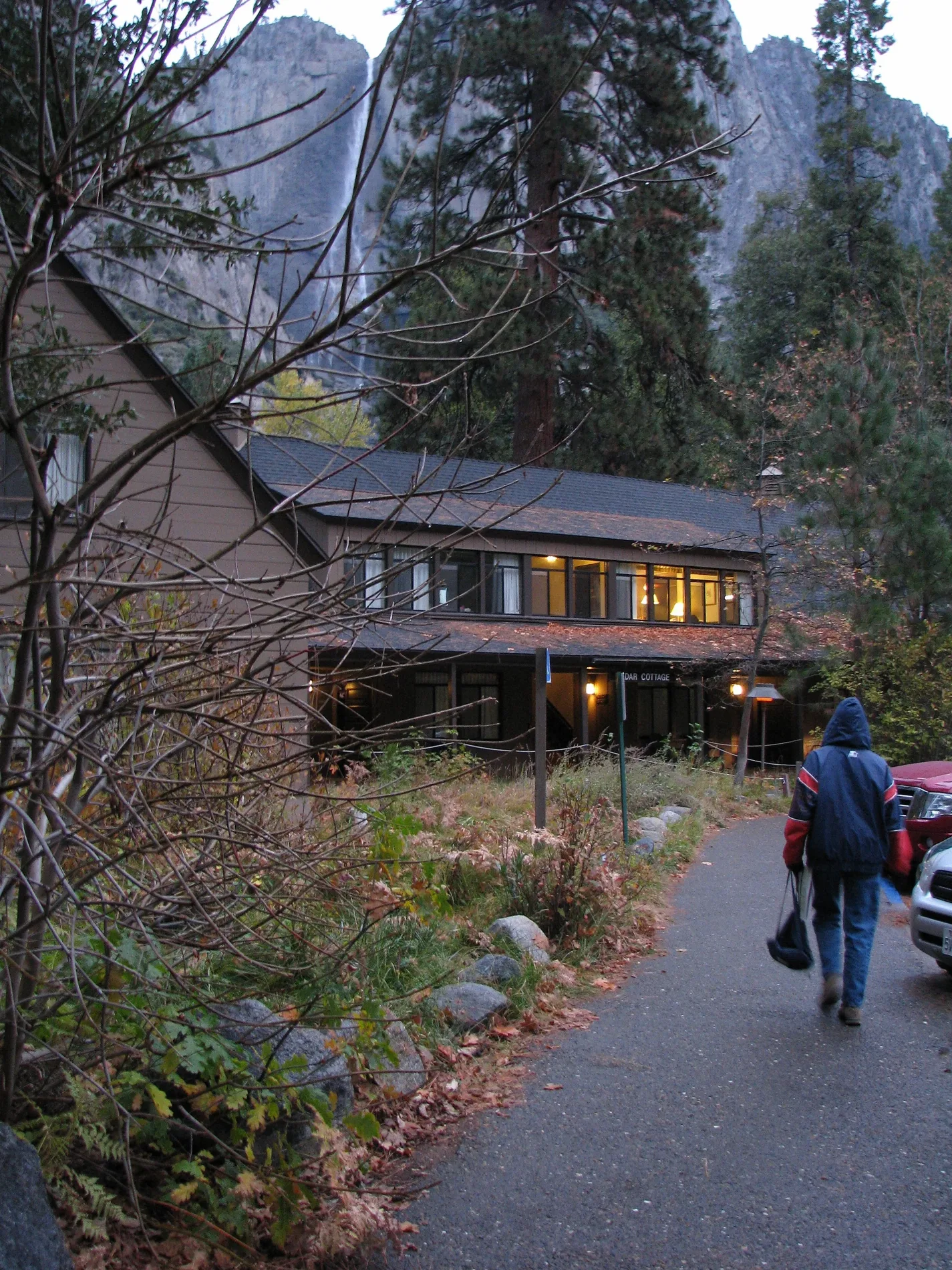
Yosemite Valley Lodge in Yosemite National Park, CA 95389
Yosemite Valley Lodge in Yosemite National Park, CA 95389 (Mariposa County) is a hotel, Yosemite Lodge Drive 9004 (95389). Ⓦ.
- House Number
- 9004
- Postal Code
- 95389
- Street
- Yosemite Lodge Drive
- Land Use
- retail area
- Operator
- Aramark NPS Authorized Concessioner
- Tourism
- hotel
- Website
- https://www.travelyosemite.com/lodging/yosemite-valley-lodge
Image
Viewpoints
Theaters
Attractions
Schools
Tourist information centers
Parking lots
Bus stops
Benches
Picnic areas
Streets nearby
Swan Slab Climber's Descent0.1 mi
Yosemite Lodge DriveYosemite Valley Lodge/Laurel Cottage;Yosemite National Park, CA - Yosemite Valley Lodge (YOS), Outdoor Theater
0.1 mi
Meadow LaneYosemite Valley Lodge, Lush Meadows Market
0.2 mi
Upper Yosemite Fall TrailYosemite Falls Trailhead, Oh My Gosh Point, Columbia Rock, Upper Yosemite Fall, Yosemite Falls Overlook
0.2 mi
Valley Loop TrailRockslides Trailhead, Selling the sublime, Visitors at Mirror Lake, Happy Isles Trailhead, Medial Moraine, Gates of the Valley: El Capitan, Gates of the Valley: Glaciers at the Gate, Carabiner Post, Happy Isles
0.2 mi
Five Open Books Descent Trail0.2 mi
Five Open Books ApproachCarabiner Post
0.3 mi
Munginella Approach Scramble0.3 mi
Cook's Meadow TrailYosemite Valley, Sentinel Bridge Parking & Lookout
0.4 mi
Lower Yosemite Fall TrailProfile of a Waterfall, James Hutchings, Early Tourism, Shaping Yosemite Valley, Falls View, Galen Clark Memorial Bench, John Muir... The Woodcutter
0.4 mi
Chapel Boardwalk0.4 mi
Bike PathHousekeeping Camp
0.5 mi
Northside DriveValley View, Horsetail Fall viewing position, Yosemite Lodge, Lower Yosemite Fall View, El Cap Shuttle Stop #E2, Lower Yosemite Fall #6, Yosemite Village Parking
0.5 mi
Jamcrack Approach0.5 mi
Southside DriveFour Mile Trail Trailhead, Four Mile Trailhead, Swinging Bridge Picnic Area, Cathedral Beach Picnic Area, Housekeeping Camp Store, Bridalveil Moraine
0.5 mi
Village DriveYosemite Village, Valley Visitor Center & Museum, Yosemite National Park, CA - Visitor Center(YOV), Degnan's Loft, Degnan's Kitchen, Peet's Coffee
0.5 mi
Lost Arrow Drive0.6 mi
Oak LaneYosemite School
0.6 mi
Amenities nearby
Yosemite National Park Child Care Center0.6 mi
Boulders nearby
Sloth Boulder350 ft
Bachar Cracker Boulder0.2 mi
Kor Boulder0.2 mi
The Glass Pyramid Boulder0.2 mi
Columbia Boulder0.3 mi
Wine Boulder0.3 mi
Little Columbia Boulder0.3 mi
Cocaine Boulder0.3 mi
Campgrounds nearby
Camp 4200 ft
Grasslands nearby
Leidig Meadow0.3 mi
Hotels nearby
Azalea150 ft
Birch250 ft
Yosemite Valley Lodge Registration Building450 ft
Manzanita450 ft
Cedar500 ft
Cottonwood500 ft
Elderberry550 ft
Willow0.1 mi
Alder0.1 mi
Juniper0.2 mi
Maple0.2 mi
Hemlock0.2 mi
Aspen0.2 mi
Dogwood0.2 mi
Laurel0.2 mi
Tamarack0.2 mi
Places of worship nearby
Yosemite Valley Chapel0.5 mi
Rental services nearby
Bike Stand550 ft
School buildings nearby
Yosemite Valley School0.6 mi
Waters nearby
Merced River0.3 mi
| Protected area | Yosemite National Park |
|---|---|
| Located in | Yosemite Valley |
| Country | United States |
 Public transit map Mariposa County Legend
| Railway | |
| Bus | |
| Streetcar |
 Bicycle map Mariposa County Legend
| Bike path | |
| Bike lane on roadway | |
| Cycling allowed on bus lane | |
| Bicycle street | |
| Open to cyclists | |
| Open to cyclists, good path | |
| Cycling prohibited | |
| Cobblestone |
| Long-distance bike route | (depending on scale) | |
| Long-distance bike route |
 Pedestrian map Mariposa County Legend
| Path |
| Long-distance hiking trail | (depending on scale) | |
| Long-distance hiking trail | ||
| Pedestrians prohibited |