
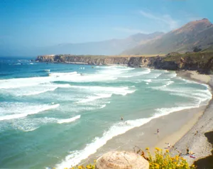
Sand Dollar Beach in Monterey County, California
Sand Dollar Beach in Monterey County is a beach. Ⓦ.
- Nature
- beach
Image
Streets nearby
Jade Cove Bluff Trail0.5 mi
Pacific Valley Station0.8 mi
Plaskett Ridge RoadPlaskett
1.3 mi
Prewitt Ridge Trail2.3 mi
FR 23S102.7 mi
Prewitt Loop Trail2.9 mi
Prewitt Ridge Road3.3 mi
Los Burros Road3.3 mi
Usf Route 23S143.4 mi
Kinder Road3.4 mi
Cabrillo HighwayWhale Watchers Cafe, 10.0, 11.0, 8.0, Gorda, Gorda General Store, Coast Gallery Café, Coast Gallery Big Sur, 41.0, 42.0, 43.0, 1.0, 2.0, Rest Area CA-1, Crossroad Shopping Center- Safeway, 69.5, Carmel Highlands Chevron, Highway 1 / Highlands Drive, Surf City Coffee, Highway 1 / Dolan Road (Pr), Highway 1 / Dolan Road, 70.0, Highway 1 / Point Lobos, Carmel Meadows Trailhead, 72.0, Highway 1 / Ribera Road, Pfeiffer School, 46.0, Highway 1 / Ranger Station, Esalen Institute, 35.0, 34.0, 33.0, Motorcycle from license plates, Bixby Creek Bridge Viewpoint, Highway 1 / Bixby Creek Bridge, Notleys Landing, Palo Colorado School, 61.0, 62.0, Kasler Point, private property, Highway 1 / Palo Colorado Road, Hurricane View Point, 57.0, 58.0, 59.0, Sea Otter Refuge View Point, 40.0, Seaview School, 36.0, 37.0, 29.0, 30.0, 31.0, Puente Big Creek Bridge, South Gate, Rigdon Drinking Fountain (disused), 26.0, 27.0, 28.0, Free Camping. Sunset - Sunrise, 32.0, 21.0, Sand Dollar Picnic Area and Beach, Pacific Valley Drinking Fountain (disused), 12.0, 13.0, 14.0, 38.0, 39.0, Mill Creek Day Use Area, 17.0, 15.0, 16.0, Drinking Fountain (abandoned), 19.0, 20.0, Gate 7, Gate 8, Gate 9, 65.0, 67.0, Granite Canyon Bridge, 18.0, Highway 1 / Yankee Point Drive, Highway 1 / Mal Paso Creek, Highway 1 / North Harbor, Highway 1 / Little Baja, Highway 1 / Molera, Highway 1 / Potrero, Willow Creek Picnic Ground, 63.3, Highway 1 / Garrapata Beach, Lucia, 23.0, 24.0, 25.0, 22.0, Highway 1 / Pfeiffer Beach, Point Sur State Historic Park, Big Sur Village, Sur School (Abandoned), Glen Oaks Motel, Big Sur Library, Big Sur Roadhouse, Chevron, Ripplewood Cafe, Fernwood Grill, 47.0, 48.0, 49.0, 50.0, 51.0, 52.0, 53.0, 54.0, 55.0, 56.0, The Village, Highway 1 / River Inn, Highway 1 / Ripplewood, Highway 1 / Point Sur Lt Stn, Highway 1 / Big Sur State Park, Highway 1 / Fernwood, Highway 1 / Andrew Molera Park, 44.0, Highway 1 / Struve, 76, Highway 1 / Springfield, 5.0, 6.0, 7.0, 3.0, 4.0, Nepenthe, Highway 1 / Nepenthe, Highway 1 / Ventana, Shell, USPS Post Office, 45.0, Big Sur Bakery, Big Sur Taphouse, Loma Vista Gardens, Highway 1 / Post Office, Big Sur Deli, Julia Pfieffer Burns Vista Point, Red Giants: Trees of the Mist, Condors: Returning to Our Skies
4.2 mi
Alms Ridge Road4.3 mi
Mill Creek Road4.4 mi
FR 23S01B4.5 mi
Mill Creek TrailMill Creek trailhead
4.8 mi
South Coast Ridge RoadApple Campground, Chalk Peak Camp
4.8 mi
Kirk Creek Campground4.9 mi
Nature nearby
Plaskett Rock0.5 mi
San Martin Rock2.3 mi
Campgrounds nearby
Plaskett Creek Campground0.3 mi
Plaskett Creek Group Campground0.4 mi
Prewitt Ridge Campground3.6 mi
Fire stations nearby
Pacific Valley Fire Station0.7 mi
Hotels nearby
Treebones Resort2.7 mi
Whale Watchers Cafe3.4 mi
Industrial areas nearby
Construction Staging Area1.7 mi
Caltrans Willow Springs Maintenance Station3.0 mi
Streams nearby
Plaskett Creek0.9 mi
Prewitt Creek2.0 mi
Willow Creek2.5 mi
South Fork Prewitt Creek2.6 mi
Wild Cattle Creek3.3 mi
South Fork Willow Creek3.8 mi
North Fork Willow Creek3.9 mi
Spruce Creek4.0 mi
Negro Fork Nacimiento River4.1 mi
Mud Creek4.4 mi
San Miguel Creek4.6 mi
Mill Creek4.6 mi
Alder Creek5.4 mi
Negro Fork5.6 mi
Kirk Creek6.0 mi
| Located in | Monterey County |
|---|---|
| Country | United States |
| Website | http://www.parks.ca.gov/?page_id=545 |
 Public transit map Monterey County Legend
| Railway | |
| Bus | |
| Streetcar |
 Bicycle map Monterey County Legend
| Bike path | |
| Bike lane on roadway | |
| Cycling allowed on bus lane | |
| Bicycle street | |
| Open to cyclists | |
| Open to cyclists, good path | |
| Cycling prohibited | |
| Cobblestone |
| Long-distance bike route | (depending on scale) | |
| Long-distance bike route |
 Pedestrian map Monterey County Legend
| Path |
| Long-distance hiking trail | (depending on scale) | |
| Long-distance hiking trail | ||
| Pedestrians prohibited |