
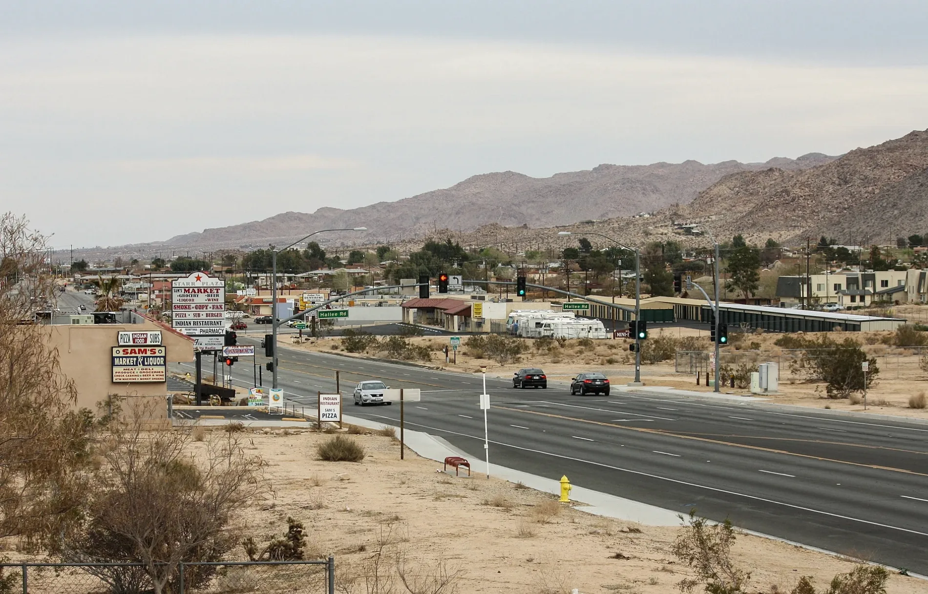
Hallee Road in Joshua Tree, CA 92252
Hallee Road in Joshua Tree, CA 92252 (San Bernardino County) is a residential street. It runs in a north-south direction starting from Verbena Road and crosses Chollita Road and ends at 29 Palms Highway. Nearby you can find a place of worship and a post office.
- Road Type
- residential street
- Route
- north-south
Image
Streets nearby
Outpost Road0.1 mi
Hill View Road0.2 mi
Verbena Road0.2 mi
Desert Air Road0.2 mi
Hillview Road0.2 mi
Chollita Road0.3 mi
Rocky Vista StreetMincing Mockingbird
0.4 mi
29 Palms HighwayBoo's Organic Oven, Valero, Morongo Valley, Morongo Valley Post Office, MV Circle K (Hwy 62 & Rosella) southbound, MV Circle K (Hwy 62 & Rosella) Northbound, Palm Wells, Nomad Ventures, Joshua Tree, Willie Boy's Saloon, Old Dale, MV Country Market (Hwy 62 & Lanning Lane) Southbound, Hwy 62 & Sunfair Rd., Hwy 62 & Sunfair, Hwy 62 & Bonair, JT Glass and Door, Hwy 62 & Sunburst, JT Trading Post, Crossroads Cafe, Mojave Desert Land Trust, Sam's Market & Liquor, Hwy 62 & Joshua Tree Memorial Park, Country Kitchen, White Feather Rd. & Hwy 62 (Medical Buildings), Bloom, Hwy 62 & Park Blvd, Joshua Tree Saloon Bar & Grill, Hwy 62 & Cascade Rd., Hwy 62 & Cascade, San Bernardino County Probation - Joshual Tree Services, Hwy 62 & Senilis- southbound
0.4 mi
Saddleback Road0.4 mi
El Reposo StreetCircle K, 76
0.4 mi
Capilla DriveFirst Baptist Church of Joshua Tree
0.4 mi
Veterans WayVeterans of Foreign Wars, Sky High Pie, Joshua Tree Coffee
0.4 mi
Elwood Street0.4 mi
Division StreetHigh Gravity Rentals
0.4 mi
La Jolla Drive0.5 mi
Park BoulevardCoyote Corner, West Entrance Station, Memorial Fire, Quail Springs Picknic area, Woodland Bounty, Sunset, Barren of Bountiful
0.5 mi
Commercial StreetJoshua Tree Branch San Bernardino County Library, J T Automotive, Way Station, Subway, Dollar General, Redbox
0.5 mi
Conejo Avenue0.5 mi
Valley View Drive0.5 mi
El Reposo Circle0.5 mi
Palm Vista Drive0.6 mi
Sunnyhill Road0.6 mi
Wahl Terrace0.6 mi
Sunburst DriveSaint Christopher of the Desert Church
0.6 mi
Valley View Circle0.6 mi
El Cajon Drive0.7 mi
Sunset RoadJoshua Tree Outfitters, The Natural Sisters, Joshua Tree Fleamarket
0.7 mi
Granada Drive0.7 mi
Auto repair shops nearby
Monument Motors0.4 mi
Clothing stores nearby
Ricochet Vintage Wears0.4 mi
Commercial buildings nearby
Desert Escrow0.5 mi
Fire stations nearby
San Bernardino County Fire Station 360.6 mi
Galleries nearby
Beatnik Lounge0.3 mi
Joshua Tree Art Gallery0.3 mi
Gallery 620.3 mi
Gas stations nearby
Valero0.5 mi
Health food stores nearby
Grateful Desert0.3 mi
Kindergartens nearby
Joshua Tree Preschool0.6 mi
Laundries nearby
Joshua Tree Laundry0.3 mi
Liquor stores nearby
Mike's Liquor0.4 mi
Motels nearby
High Desert Motel0.1 mi
Joshua Tree Inn0.2 mi
Residential areas nearby
Yucca Trails Apartments0.2 mi
Sunset Village Apartments0.4 mi
Restaurants nearby
Royal Siam Cuisine Thai Restaurant0.3 mi
Castañeda's Mexican Food0.4 mi
Retail areas nearby
Starr Plaza300 ft
Tattoo studios nearby
Ink & Steel0.3 mi
Tourist information centers nearby
Joshua Tree Visitor Center0.5 mi
 Public transit map San Bernardino County Legend
| Railway | |
| Bus | |
| Streetcar |
 Bicycle map San Bernardino County Legend
| Bike path | |
| Bike lane on roadway | |
| Cycling allowed on bus lane | |
| Bicycle street | |
| Open to cyclists | |
| Open to cyclists, good path | |
| Cycling prohibited | |
| Cobblestone |
| Long-distance bike route | (depending on scale) | |
| Long-distance bike route |
 Pedestrian map San Bernardino County Legend
| Path |
| Long-distance hiking trail | (depending on scale) | |
| Long-distance hiking trail | ||
| Pedestrians prohibited |