
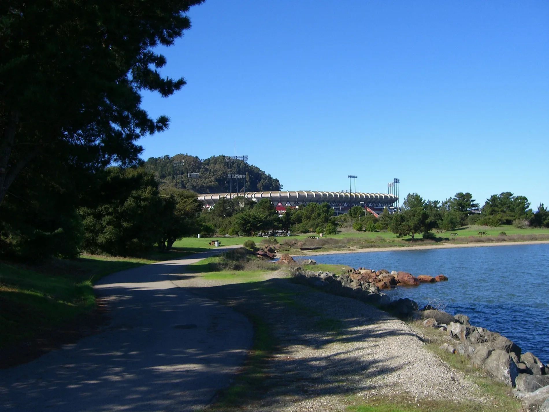
Candlestick Point State Recreation Area in San Francisco
Candlestick Point State Recreation Area in San Francisco is a park (California Department of Parks and Recreation) 🌐. Candlestick Point State Recreation Area is also known as Candlestick Point SRA. Candlestick Point State Recreation Area is located near Harney Way. Ⓦ.
- Leisure
- park
- Operator
- California Department of Parks and Recreation
- Website
- https://www.parks.ca.gov/candlestickpoint/
Image
Streets nearby
Harney Way150 ft
Crescent Court0.1 mi
Jamestown AvenueCouchSurfing - Keisar
0.2 mi
Crescent Way0.2 mi
Hunters Point Expressway0.3 mi
Sandpiper Cove Way0.3 mi
Donner Avenue0.3 mi
Donahue StreetDonahue Street & Innes Avenue
0.4 mi
Thomas Mellon Circle50 Thomas Mellon Circle
0.4 mi
Ignacio Avenue0.4 mi
Bill Walsh Way0.4 mi
Ingerson AvenueIngerson Avenue & Griffith Street, Arthur H. Coleman medical center, Ingerson Avenue & Hawes Street
0.4 mi
Diamond Cove Terrace0.4 mi
Gilroy Street0.4 mi
Pelican Cove Terrace0.4 mi
East Crystal Cove Terrace0.4 mi
Candlestick Cove Way0.4 mi
Earl StreetInnes Avenue & Earl Street, Earl Street & Kirkwood Avenue
0.4 mi
Gilman AvenueGilman Avenue & Griffith Street, Gilman/Paul, Gilman Avenue & Jennings Street, Gilman Avenue & 3rd Street, Gilman Avenue & Bill Walsh Way, FranDeljA Enrichment Center, Gilman Avenue & Ingalls Street
0.4 mi
Seal Cove Terrace0.4 mi
Alana WayAlana Way & Executive Park Boulevard
0.4 mi
West Crystal Cove Terrace0.4 mi
Emerald Cove Terrace0.4 mi
Executive Park BoulevardExecutive Park Boulevard & Blanken Avenue, Executive Park Boulevard & Thomas Mellon Circle, Odoo Inc.
0.5 mi
Otter Cove Terrace0.5 mi
Coronado Street0.5 mi
Key Avenue0.5 mi
Arelious Walker Drive0.5 mi
Egbert Avenue0.5 mi
Giants Drive0.5 mi
Fitzgerald AvenueCandlestick RV Park, Fitzgerald Avenue & Hawes Street, Fitzgerald Avenue & Ingalls Street, Alice Griffith, Fitzgerald Avenue & Jennings Street, Fitzgerald Avenue & Keith Street
0.6 mi
Bayview Park RoadIndian Head Rock
0.6 mi
Hollister Avenue0.6 mi
Griffith StreetInnes Avenue & Griffith Street
0.6 mi
Nichols Way0.6 mi
Redondo Street0.6 mi
Carroll AvenueCarroll
0.7 mi
Ingalls StreetIngalls Street & Harbor Road, Middle Point Road & Innes Avenue, Ingalls Street & Palou Avenue, Ingalls Street & Oakdale Avenue, Ingalls Street & Van Dyke Avenue, Ingalls Street & Thomas Avenue, Ingalls Street & La Salle Avenue, Ingalls Street & Beatrice Lane, Gilman Avenue & Ingalls Street, Ingalls Street & Revere Avenue
0.7 mi
Hawes StreetHawes Street & Gilman Avenue
0.7 mi
Double Rock Street0.7 mi
Cameron Way0.7 mi
Apartment buildings nearby
Ashton0.3 mi
Buildings nearby
Literacy For Environmental Justice0.7 mi
Commercial areas nearby
San Francisco Executive Park0.3 mi
Construction sites nearby
Candlestick Point Development0.3 mi
Parks nearby
Bayview Park0.2 mi
Gilman Playground0.4 mi
Playgrounds nearby
Gilman Children's Play Area0.4 mi
Residential areas nearby
Candlestick Point0.2 mi
| Named after | Candlestick Point |
|---|---|
| Year built | 1972 |
| Located in | San Francisco |
| Country | United States |
 Public transit map San Francisco Legend
| Railway | |
| Bus | |
| Streetcar |
 Bicycle map San Francisco Legend
| Bike path | |
| Bike lane on roadway | |
| Cycling allowed on bus lane | |
| Bicycle street | |
| Open to cyclists | |
| Open to cyclists, good path | |
| Cycling prohibited | |
| Cobblestone |
| Long-distance bike route | (depending on scale) | |
| Long-distance bike route |
 Pedestrian map San Francisco Legend
| Path |
| Long-distance hiking trail | (depending on scale) | |
| Long-distance hiking trail | ||
| Pedestrians prohibited |