
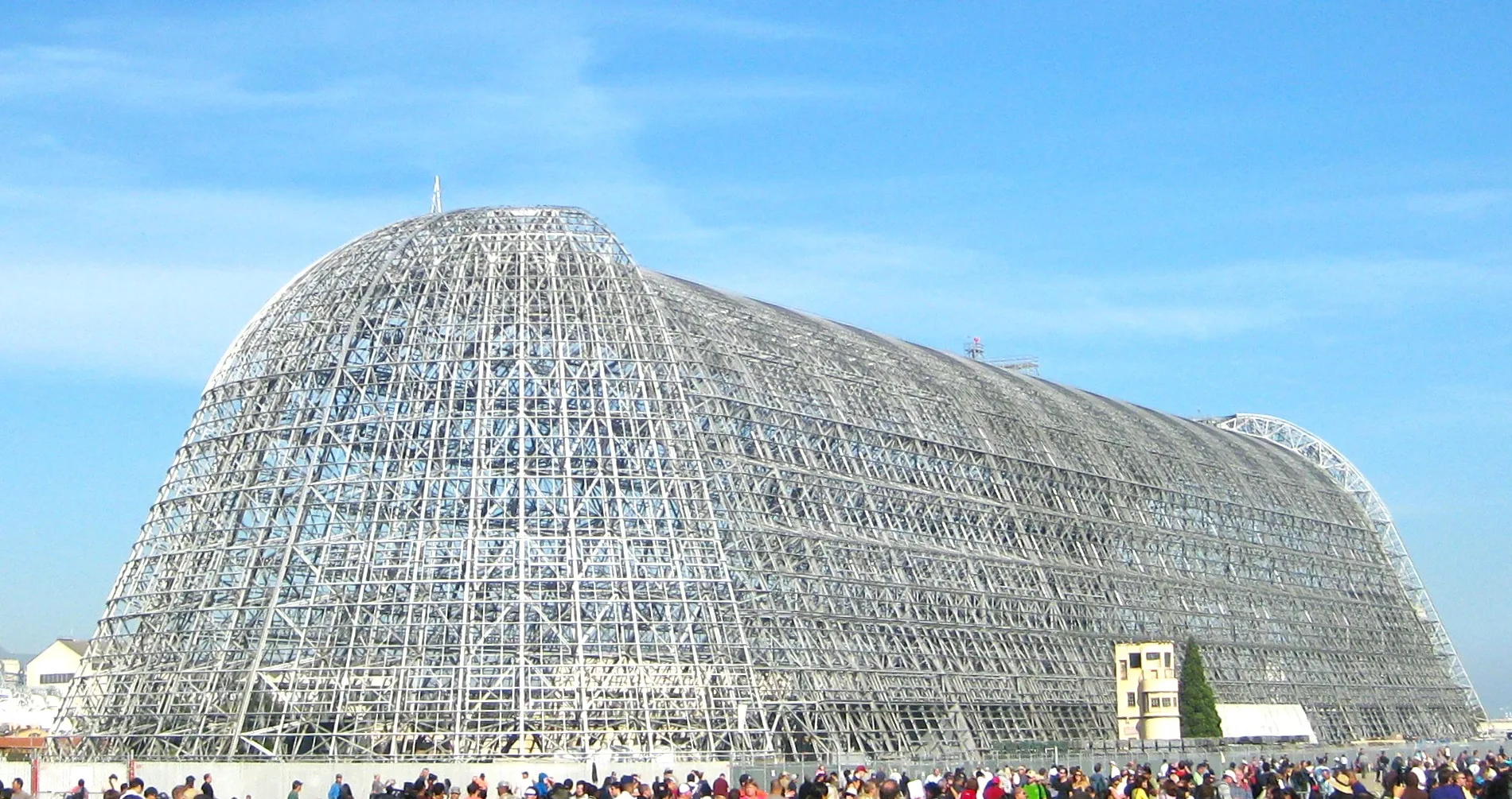
Hangar 1 in Mountain View, CA 94043
Hangar 1 in Mountain View, CA 94043 (Santa Clara County) is a hangar. Ⓦ.
- Building Type
- building
Image
Streets nearby
Cummins Avenue550 ft
South Akron RoadThe SpaceBar, South Akron Road & Wescoat Avenue
0.1 mi
Severyns AvenueMoffett Field Model Railroad Club
0.2 mi
Dugan Road0.2 mi
Cody Road0.2 mi
North Akron RoadMenlo Survey Federal Credit Union, North Akron Road & McCord Avenue, Moffett Field Post Office
0.2 mi
Edquiba Road0.2 mi
Kaiser Road0.2 mi
McCord Avenue0.2 mi
Sayre Avenue0.2 mi
Carroll DriveLockheed P-3 Orion
0.2 mi
Cooper Loop0.3 mi
Gorsey Road0.3 mi
Bushnell Road0.3 mi
Zook Road0.3 mi
Bettio Road0.3 mi
Girard Road0.3 mi
Buildings nearby
33200 ft
Building 126400 ft
Aquila Space Garage (503)0.1 mi
Boiler Plant0.2 mi
NASA Ames Conference Center (BLD 3)0.2 mi
320.2 mi
NASA Flight Operations0.2 mi
Public Works0.2 mi
Moffett Federal Airfield Control Tower0.2 mi
1070.2 mi
4930.3 mi
Scale House0.3 mi
9490.3 mi
3310.3 mi
5260.3 mi
3290.3 mi
5740.3 mi
4000.3 mi
4590.3 mi
Convenience stores nearby
Moon Mart0.2 mi
Fire stations nearby
NASA Ames Fire Department0.3 mi
Fitness centers nearby
Moffett Field Gymnasium0.3 mi
Laundries nearby
547B0.3 mi
Museums nearby
Moffett Field Historical Society Museum500 ft
Police stations nearby
Moffett Field Security Office0.2 mi
Ruins nearby
547E (Abandonded Barracks)0.3 mi
512a (Abandonded Barracks)0.3 mi
512C (Abandonded Barracks)0.3 mi
512B (Abandonded Barracks)0.3 mi
547C (Abandonded Barracks)0.3 mi
Sports centers nearby
NASA Ames Swim Center0.3 mi
Supermarkets nearby
Moffett Field Commissary0.2 mi
| Length | 345.3 m |
|---|---|
| Area | 32516 m² |
| Operator | United States Navy, Ames Research Center, Google |
| Owned by | United States Navy, National Aeronautics and Space Administration |
| Heritage designation | National Register of Historic Places contributing property, America's Most Endangered Historic Places |
| Located in | Santa Clara County |
| Country | United States |
| Key event | construction, removal |
| Location | Moffett Federal Airfield |
| Part of | Ames Research Center |
 Public transit map Santa Clara County Legend
| Railway | |
| Bus | |
| Streetcar |
 Bicycle map Santa Clara County Legend
| Bike path | |
| Bike lane on roadway | |
| Cycling allowed on bus lane | |
| Bicycle street | |
| Open to cyclists | |
| Open to cyclists, good path | |
| Cycling prohibited | |
| Cobblestone |
| Long-distance bike route | (depending on scale) | |
| Long-distance bike route |
 Pedestrian map Santa Clara County Legend
| Path |
| Long-distance hiking trail | (depending on scale) | |
| Long-distance hiking trail | ||
| Pedestrians prohibited |