
Page Mill Road in Los Altos Hills, California
Page Mill Road in Los Altos Hills is a two-lane, asphalted local road (Road number CR G3). The street has a bike lane (bike lane). The road consists of separate carriageways in sections. It runs in a South direction and continues as Old Page Mill Road. It crosses Christophers Lane, Berryhill Court, Arastradero Road, Baleri Ranch Road, Paseo del Roble, Moon Lane, Fawn Creek Court, Lupine Road, Via Feliz, Three Forks Lane, Story Hill Lane and Matadero Creek Lane. Page Mill Road is also known as Page Mill Rd.. This street is part of the highway "G3" as well as the Bicycle routes Dumbarton - East - West Connector, El Monte Alignment and San Antonio/Arastradero Corridor. Page Mill Road also exists in Palo Alto.
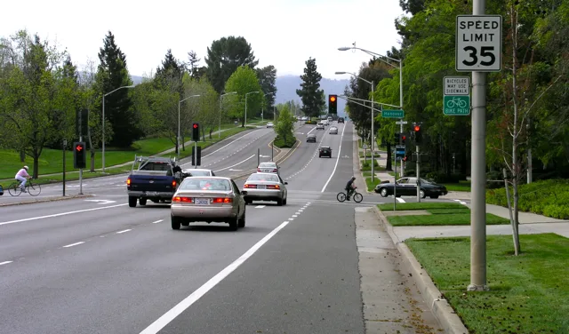
- Road Type
- expressway
- Speed Limit
- 50 mph
- Lanes
- 2
- Route
- north-south
Bus stops
- bus lines 101, 102, 103
Fast food restaurants
Attractions
Kindergartens
Bookstores
Cafes
Town halls
Doctor's offices
Police stations
Streets nearby
Gerth Lane300 ft
Christophers Lane350 ft
Linda Lane0.2 mi
Matadero Creek Pedestrian Trail0.2 mi
Arastradero Road0.3 mi
Yale Court0.3 mi
Liddicoat Circle0.3 mi
Jarvis Way0.4 mi
Harvard Court0.4 mi
Berry Hill Lane0.5 mi
Amherst Court0.5 mi
Stirrup Way0.5 mi
Berryhill Court0.5 mi
Redtail Loop TrailBench
0.5 mi
Liddicoat Drive0.5 mi
connecting path between Baleri Ranch and Saddle Court0.5 mi
Stanford Court0.5 mi
Saddle Mountain Drive0.5 mi
Radcliffe Lane0.6 mi
Baleri Ranch Road0.6 mi
Saddle Court0.6 mi
50.6 mi
60.6 mi
70.6 mi
80.6 mi
Page Mill to Saddle Court path0.7 mi
Junipero Serra Freeway0.7 mi
Slalom Path0.7 mi
Matadero Creek Trail0.7 mi
E0.7 mi
F0.7 mi
D0.7 mi
C0.7 mi
Carillo Lane0.7 mi
A0.8 mi
B0.8 mi
Horseshoe Lane0.8 mi
Deer Creek RoadDeer Creek Road & Arastradero Road, 3475 Deer Creek Road
0.8 mi
Horseshoe Court0.8 mi
Coyote Hill Road0.8 mi
Old Page Mill Road0.9 mi
Buildings nearby
Frenchman's Tower0.2 mi
Grasslands nearby
Coyote Hill Meadow0.6 mi
Industrial areas nearby
Caltrans Page Mill Rd Maintenance Station0.2 mi
Office buildings nearby
Tesla Motors0.7 mi
Parking lots nearby
Page Mill Park And Ride0.4 mi
Streams nearby
Matadero Creek400 ft
Arastradero Creek0.7 mi
Deer Creek0.7 mi
| Named after | Page Mill |
|---|---|
| Located in | Palo Alto, Los Altos Hills |
| Country | United States |
Public transit map Los Altos Hills Legend
| Railway | |
| Bus | |
| Streetcar |
Bicycle map Los Altos Hills Legend
| Bike path | |
| Bike lane on roadway | |
| Cycling allowed on bus lane | |
| Bicycle street | |
| Open to cyclists | |
| Open to cyclists, good path | |
| Cycling prohibited | |
| Cobblestone |
| Long-distance bike route | (depending on scale) | |
| Long-distance bike route |
Pedestrian map Los Altos Hills Legend
| Path |
| Long-distance hiking trail | (depending on scale) | |
| Long-distance hiking trail | ||
| Pedestrians prohibited |