
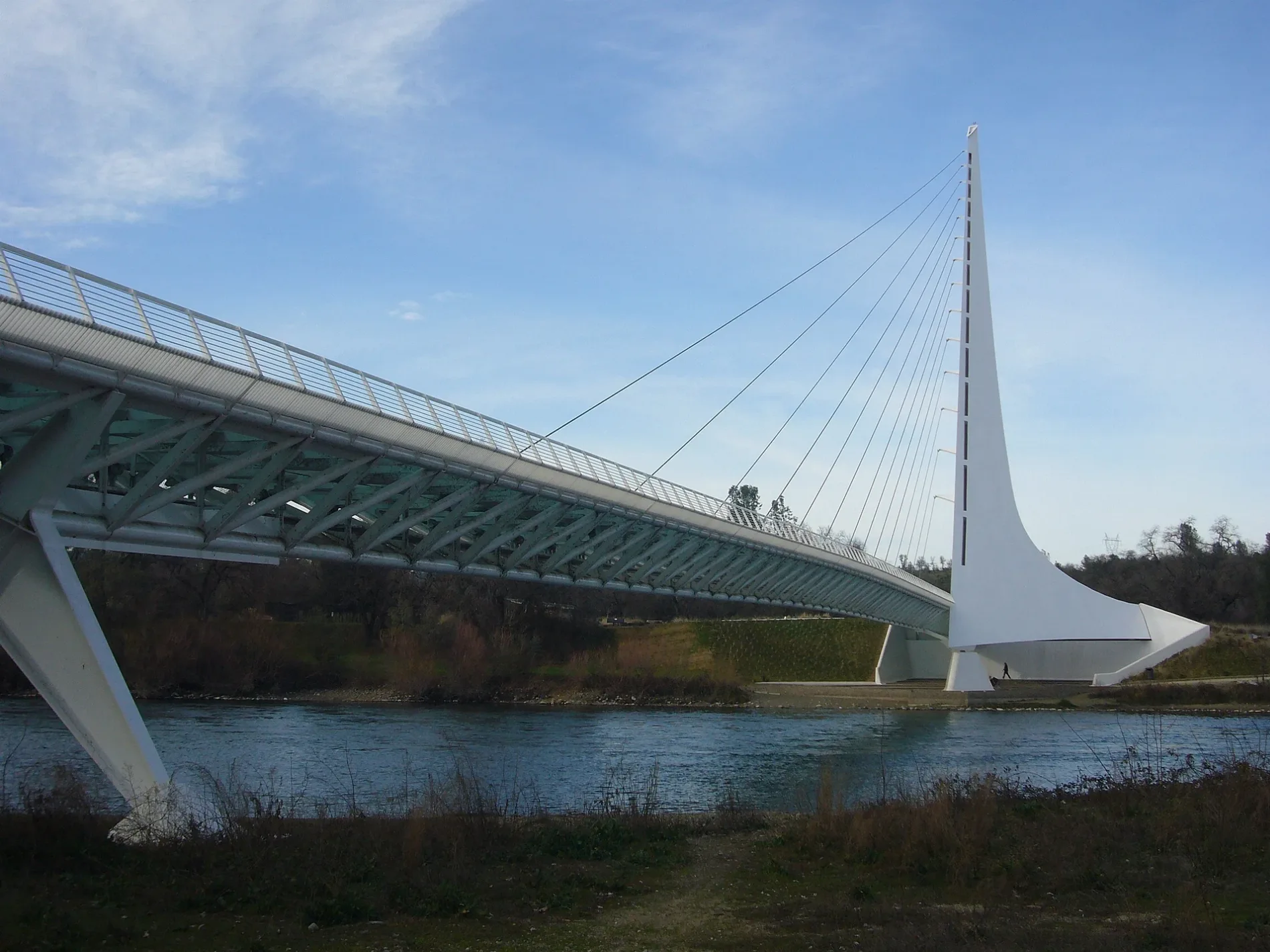
Sundial Bridge in Redding, California
Sundial Bridge in Redding is a lit footpath. The street has a width of 7.0104. It runs in a north-south direction and ends in a cul-de-sac. Ⓦ.
- Bicycle
- yes
- Road Type
- footpath
- Speed Limit
- 5 mph
- Route
- north-south
Image
Bus stops
Bike rentals
Charging stations
Artworks
Bookstores
Tourist information centers
Restaurants
Fountains
Public bookcases
Galleries
Benches
Hotels
Streets nearby
Arboretum Loop Trail0.1 mi
Willow Pond Trail0.2 mi
Charlotte's Crossing0.3 mi
Auditorium Drive0.3 mi
Sacramento River TrailSpecies Dependency, Branch House Riverfront Bistro, Bald Eagle Vista, Art Gallery, Rusty Red Dirt, Plumbing the Northstate, Restoration Information Sign, Migratory Birds, Birds, Little Free Library, BCycle, Riparian Woodland, Chaunay Carroll Bush, Human Sundial, Turtle Bay's Namesake, A River of Rocks, Perennial Companion Display Garden
0.3 mi
Sundial Bridge DriveRedding Civic Auditorium, ChargePoint, Turtle Bay Visitor Center
0.4 mi
Butte StreetA.Organics Massage, Caffe Pagato, The Lost Era, San Marzano Market, 32 Below, Hey Babe Florals
0.4 mi
Arboretum DriveAncient Wisdom for the Contemporary Architect, Green Building from the Ground Up
0.4 mi
Aboretum Loop Trail0.4 mi
Park Marina DriveBentronics, Diversified Office Systems, Sunsational Tanning, Budgetel River Inn, Park Marina Dr at Olympus Ave, Park Marina Dr at Sundial Bridge Dr, Park Marina Dr at Locust St
0.4 mi
Highway 44 BikewayTrail Information Sign
0.4 mi
Sequoia StreetSequoia St at Sacramento St, Sequoia St at Placer St
0.5 mi
Attractions nearby
McConnell Botanical Gardens0.3 mi
Buildings nearby
Parrot Playhouse0.2 mi
Railroad Exhibits0.2 mi
The Monolith0.2 mi
Shasta EDC0.3 mi
Viking Skate Country0.4 mi
W.M. Beatty & Associates, Inc.0.5 mi
Canals nearby
Anderson Cottonwood Canal0.4 mi
Commercial areas nearby
Park Marina Plaza0.5 mi
Conference centers nearby
Redding Civic Auditorium0.2 mi
Convenience stores nearby
Chevron0.4 mi
Dance floors nearby
Redding Dance Center0.5 mi
Fitness centers nearby
Shasta Athletic Club0.6 mi
Gardens nearby
South African Garden0.2 mi
Australian Garden0.2 mi
Chilean Garden0.3 mi
Medicinal Garden0.3 mi
Hotels nearby
Sheraton Redding at Sundial Bridge0.2 mi
Industrial buildings nearby
Aramark Uniform Services0.5 mi
Meadows nearby
Carl and Leah's Meadow0.3 mi
Museums nearby
Turtle Bay Museum550 ft
Mill Building0.2 mi
Parks nearby
River Side Park0.1 mi
Turtle Bay Exploration Park South0.2 mi
Residential areas nearby
Sequoia Apartments0.5 mi
Restaurants nearby
Thai Cafe0.5 mi
Retail buildings nearby
Soleus Dance and Fitness Wear0.5 mi
Secondhand stores nearby
Rags - New & Resale Clothing0.4 mi
Service buildings nearby
North Market Lift Station0.4 mi
Stadiums nearby
Redding Rodeo Grounds0.2 mi
Streams nearby
Sulphur Creek0.4 mi
Theaters nearby
Bridge Amphitheater500 ft
Waters nearby
Turtle Pond0.3 mi
Willow Pond0.3 mi
Zoos nearby
Turtle Bay Exploration Park0.3 mi
Other nearby
Sundial Bridge North Plaza0.1 mi
Veteran's Memorial Grove0.2 mi
| Year built | 2004 |
|---|---|
| Official opening | 2004 |
| Length | 66 m |
| Located in | Redding |
| Country | United States |
| Crosses | Sacramento River |
| Location | Redding |
 Public transit map Redding Legend
| Railway | |
| Bus | |
| Streetcar |
 Bicycle map Redding Legend
| Bike path | |
| Bike lane on roadway | |
| Cycling allowed on bus lane | |
| Bicycle street | |
| Open to cyclists | |
| Open to cyclists, good path | |
| Cycling prohibited | |
| Cobblestone |
| Long-distance bike route | (depending on scale) | |
| Long-distance bike route |
 Pedestrian map Redding Legend
| Path |
| Long-distance hiking trail | (depending on scale) | |
| Long-distance hiking trail | ||
| Pedestrians prohibited |