
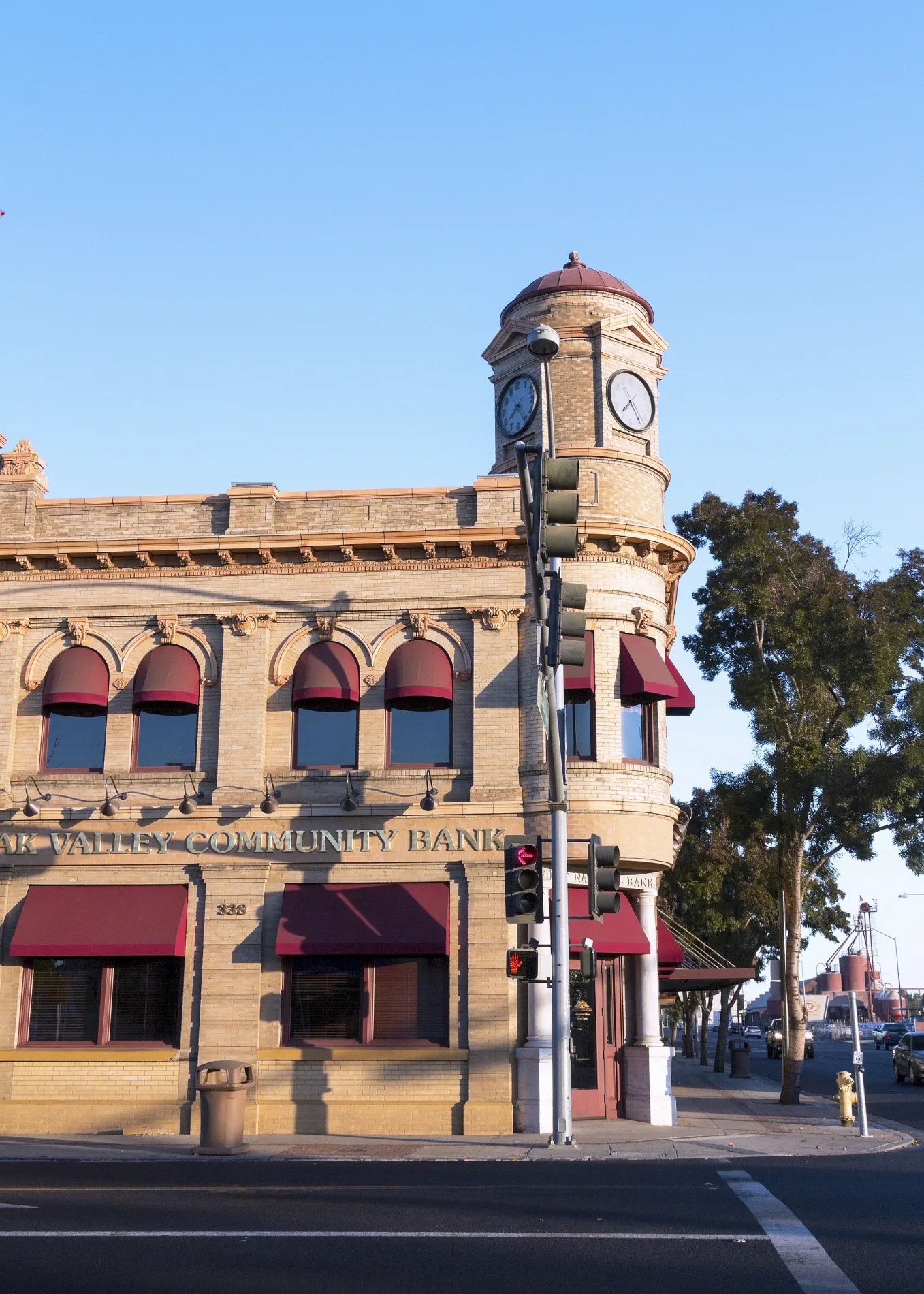
East F Street in Oakdale, California
East F Street in Oakdale is a two-lane main road (Road number CA 108;CA 120). It runs in a northeast-southwest direction starting from West F Street and crosses North 1st Avenue, South 1st Avenue, North 2nd Avenue, North 3rd Avenue, South 3rd Avenue, North Yosemite Avenue, South Yosemite Avenue, South Sierra Avenue, North Sierra Avenue, North 4th Avenue and South 4th Avenue. This street is part of the highways 120 and 108. Nearby you can find among others 5 fast food restaurants, 5 restaurants, 2 cafes and 2 banks.
- Road Type
- main road
- Lanes
- 2
- Route
- northeast-southwest
Image
Cafes
Places of worship
Museums
- The Cowboy Museum (opening hours: Wed–Sat 10–15, Web) at East F Street 355 (95361).
Hair salons
Tire dealers
Convenience stores
Fast food restaurants
Banks
Bars
Ice cream shops
Liquor stores
Restaurants
Auto parts stores
Electronics stores
Supermarkets
Car dealerships
Streets nearby
North 3rd AvenueChurch of Christ
350 ft
Lottie Street0.1 mi
East E Street0.1 mi
South 1st AvenueOakdale Branch Stanislaus County Free Library
0.1 mi
South Yosemite AvenueChase, Starbucks, Corona Market
0.1 mi
North Yosemite AvenueOakdale Feed & Seed, Cafe Bliss, Oakdale Chamber of Commerce, Cindy's, Sno-white Drive In
0.1 mi
North 2nd AvenueFirst Baptist Church
0.2 mi
South 3rd AvenueBank of America
0.2 mi
West G StreetOakdale High School, Oakdale Adult Education School
0.2 mi
East D StreetFirst Church of Christ Scientist, Oakdale City Hall
0.2 mi
South 2nd Avenue0.2 mi
Davitt AvenueTruth for Today Church
0.2 mi
Pinkston Avenue0.2 mi
Church Avenue0.2 mi
West AvenueSaint Lukes Lutheran Church
0.2 mi
South 4th AvenueOakdale Bike Shop
0.2 mi
West H Street0.2 mi
East H Street0.3 mi
North Sierra AvenuePentecostal Church of God
0.3 mi
OakdaleOakdale
0.3 mi
North 1st Avenue0.3 mi
North 4th Avenue0.3 mi
East C Street0.3 mi
North 5th AvenueSeventh Day Adventist Church, Jack in the Box
0.3 mi
South 5th Avenue0.4 mi
North 6th Avenue0.4 mi
South 6th Avenue0.4 mi
Grove Avenue0.4 mi
East I Street0.4 mi
South Sierra AvenueBachi's Resturant
0.4 mi
East J StreetChurch of Christ
0.4 mi
Loma Lane0.4 mi
North 7th Avenue0.4 mi
East AvenueRyderz
0.4 mi
Taco Bell Drive-ThroughTaco Bell
0.5 mi
North 8th Avenue0.5 mi
East B Street0.5 mi
Banks nearby
Wells Fargo450 ft
Cemeteries nearby
Oaklawn Memorial Park0.4 mi
Community centers nearby
Gene Bianchi Community Center200 ft
Gas stations nearby
Oakdale 760.3 mi
Hotels nearby
Holiday Inn Express Oakdale0.4 mi
Motels nearby
Motel 6 Oakdale, CA0.4 mi
Museums nearby
Oakdale Museum & History Center0.1 mi
Parks nearby
Clarence E. Wood Park0.2 mi
Dorada Park0.4 mi
Santa Fe park0.4 mi
Railways nearby
Oakdale Branch0.2 mi
Sonora Subdivision0.3 mi
Public transit map Oakdale Legend
| Railway | |
| Bus | |
| Streetcar |
Bicycle map Oakdale Legend
| Bike path | |
| Bike lane on roadway | |
| Cycling allowed on bus lane | |
| Bicycle street | |
| Open to cyclists | |
| Open to cyclists, good path | |
| Cycling prohibited | |
| Cobblestone |
| Long-distance bike route | (depending on scale) | |
| Long-distance bike route |
Pedestrian map Oakdale Legend
| Path |
| Long-distance hiking trail | (depending on scale) | |
| Long-distance hiking trail | ||
| Pedestrians prohibited |