
Image
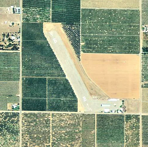
Streets nearby
Avenue 2040.6 mi
Road 236Goodale, Elmco, Terra Bella Post Office
0.8 mi
Road 232Strathmore Continuation High School
0.8 mi
Nissa Court1.0 mi
Road 2311.0 mi
Avenue 1971.0 mi
Guthrie Court1.0 mi
Lawson DriveSaint Andrews Presbyterian Church
1.0 mi
Guthrie Drive1.1 mi
Burns Drive1.1 mi
Orange Belt DriveFull Gospel Assembly of God Church, Strathmore Post Office, Orange Belt Drive & Avenue 196, Orange Belt Drive & Avenue 196 - Martinez Auto Repair, Zante, Lois, Orange Belt Drive. & Tepot Dome Avenue - El Tapatio Restaurant
1.1 mi
Wallace Road1.1 mi
Balfour Drive1.1 mi
Bruce DriveUnited Pentecostal Church
1.1 mi
Taylor Road1.2 mi
Road 2301.2 mi
Avenue 2001.2 mi
Road 2341.2 mi
Avenue 2081.2 mi
Avenue 2121.2 mi
Harper Avenue1.2 mi
Road 2441.2 mi
Avenue 198Strathmore Elementary School, First Baptist Church of Strathmore
1.2 mi
Meredith Drive1.2 mi
Avenue 1941.3 mi
Richardson Road1.3 mi
Avenue 1951.3 mi
Bishop Avenue1.3 mi
Rea Road1.3 mi
Road 2461.3 mi
Preston Avenue1.3 mi
Ward Avenue1.4 mi
198th Avenue1.4 mi
White Avenue1.4 mi
Roth Road1.4 mi
Road 228Naranjo
1.4 mi
Road 2261.5 mi
Avenue 1921.5 mi
Avenue 2061.6 mi
Avenue 196Strathmore
1.6 mi
Road 2481.6 mi
Avenue 216Stout
1.6 mi
Hall Avenue1.7 mi
Abandoned railways nearby
Exeter Branch1.1 mi
Visalia Electric Railroad1.5 mi
Porterville-Orosi District1.5 mi
Canals nearby
Friant-Kern Canal0.8 mi
Libraries nearby
Strathmore Branch Library1.1 mi
Other nearby
Strathmore Substation1.1 mi
| Elevation | 426 |
|---|---|
| Located in | California |
| Country | United States |
 Public transit map Tulare County Legend
| Railway | |
| Bus | |
| Streetcar |
 Bicycle map Tulare County Legend
| Bike path | |
| Bike lane on roadway | |
| Cycling allowed on bus lane | |
| Bicycle street | |
| Open to cyclists | |
| Open to cyclists, good path | |
| Cycling prohibited | |
| Cobblestone |
| Long-distance bike route | (depending on scale) | |
| Long-distance bike route |
 Pedestrian map Tulare County Legend
| Path |
| Long-distance hiking trail | (depending on scale) | |
| Long-distance hiking trail | ||
| Pedestrians prohibited |