
Exeter Airport in Lindsay, CA 93247
Exeter Airport in Lindsay, CA 93247 (Tulare County) is an airfield. Exeter Airport is also known as Thunderhawk Field. Ⓦ.
- Alternate Name
- Thunderhawk Field
Image
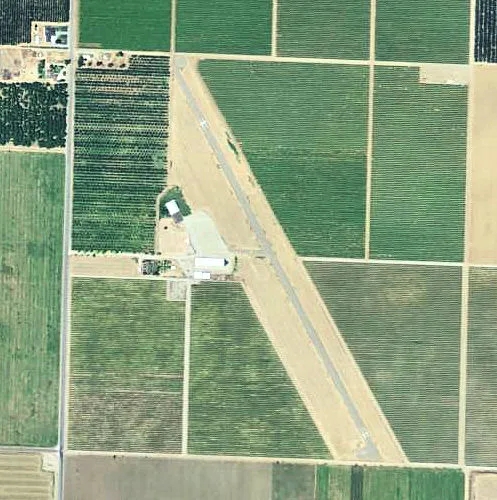
Streets nearby
Avenue 2420.8 mi
Avenue 240Vance
1.0 mi
Road 2001.2 mi
Avenue 2481.2 mi
Avenue 2411.5 mi
Avenue 2391.5 mi
Avenue 236Linder School
1.5 mi
Road 180Venice School
1.5 mi
North Spruce Avenue1.6 mi
Avenue 2371.7 mi
Avenue 2341.7 mi
Road 2581.7 mi
Avenue 2561.9 mi
Avenue 2602.0 mi
Road 1882.0 mi
Avenue 2642.0 mi
Avenue 232Avenue 232 & Cairns Avenue
2.0 mi
Avenue 2582.0 mi
Avenue 2442.0 mi
Cairns AvenueChurch of the Brethren, Plainview, Cairns Avenue & Avenue 195 - Family Market
2.1 mi
Avenue 2472.1 mi
Avenue 2622.2 mi
Black Drive2.2 mi
South Filbert Road2.2 mi
Belmont Road2.3 mi
Road 1842.3 mi
Road 2012.4 mi
Road 192Redbanks, Poplar Post Office, Community Service Center - Poplar, Road 192 & Avenue 150 - Auto Parts, Poplar, Church of Christ of Poplar, Poplar Market
2.4 mi
Road 1962.5 mi
Ash Avenue2.5 mi
Road 2082.6 mi
West Myer Avenue2.6 mi
Tuohy Avenue2.7 mi
Cedar Avenue2.7 mi
South Kaweah Avenue2.7 mi
Spruce Avenue2.7 mi
Avenue 2262.7 mi
East Myer Avenue2.7 mi
West Balaam Avenue2.8 mi
Oak Avenue2.8 mi
Road 2032.8 mi
South Belmont Road2.9 mi
Vista Grande Road2.9 mi
Avenue 228East Tulare Villa
2.9 mi
Avenue 2243.0 mi
Canals nearby
Locust Grove Ditch1.9 mi
Ditches nearby
Lewis Creek1.5 mi
Railways nearby
Exeter Subdivision1.8 mi
Porterville Subdivision2.9 mi
| Named after | Exeter |
|---|---|
| Elevation | 104 m |
| Located in | California |
| Country | United States |
 Public transit map Tulare County Legend
| Railway | |
| Bus | |
| Streetcar |
 Bicycle map Tulare County Legend
| Bike path | |
| Bike lane on roadway | |
| Cycling allowed on bus lane | |
| Bicycle street | |
| Open to cyclists | |
| Open to cyclists, good path | |
| Cycling prohibited | |
| Cobblestone |
| Long-distance bike route | (depending on scale) | |
| Long-distance bike route |
 Pedestrian map Tulare County Legend
| Path |
| Long-distance hiking trail | (depending on scale) | |
| Long-distance hiking trail | ||
| Pedestrians prohibited |