
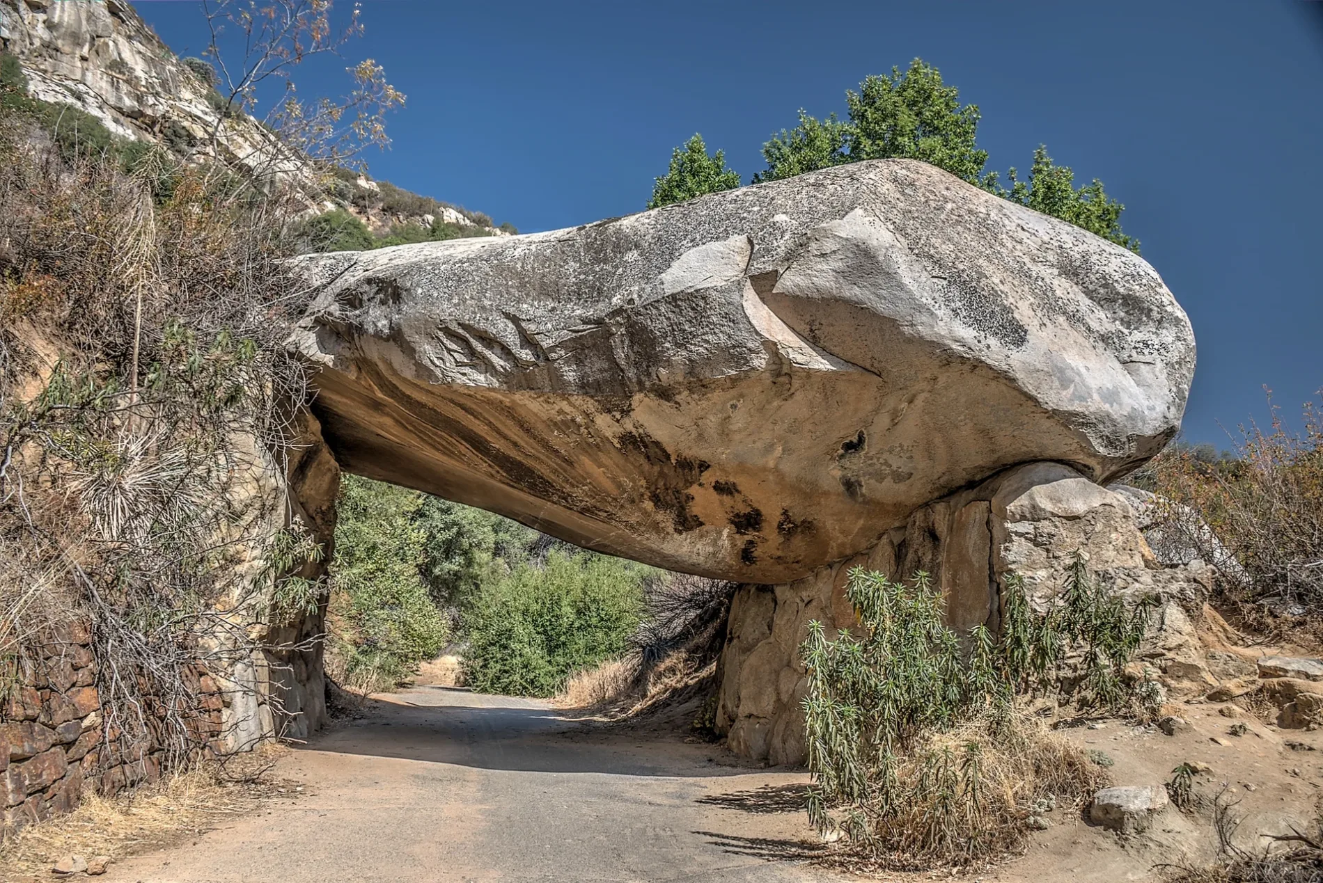
Tunnel Rock in Three Rivers, CA 93271
Tunnel Rock in Three Rivers, CA 93271 (Tulare County) is an attraction. Tunnel Rock is located near Swinging Bridge. Tunnel Rock also exists in Placer County.
- Nature
- boulder
- Tourism
- attraction
Image
Streets nearby
Swinging Bridge1.0 mi
Ash Lane1.1 mi
Drury Lane1.1 mi
Mather Drive1.2 mi
Cammerer Way1.3 mi
Sycamore Drive1.4 mi
Potwisha Hospital Rock Trail1.8 mi
Overlook2.0 mi
Canyon View Drive2.1 mi
Sierra View Lane2.1 mi
Foxtail Drive2.1 mi
Marble Falls TrailMarble Falls Trailhead
2.3 mi
Oak Grove Drive2.9 mi
Buckeye Flat Campground Access2.9 mi
Paradise Creek TrailParadise Creek Trailhead
3.0 mi
Dinely Drive3.1 mi
Mineral King RoadNPS Hammond Fire Station, Oak Grove, Pay Station, Sequoia National Park Entrance, Silver City, Silver City Store, Mineral King, Farewell Gap - Franklin Lakes Trailhead
3.2 mi
Crest Lane3.2 mi
Hammond Drive3.2 mi
Sierra King Drive3.3 mi
Sierra DriveHammond, Riverside Inn & Cabins, Totem Deli & Bar, Sequoia Cider Mill, Heart's Desire, The River View Grill and Bar, Kaweah Oaks Campground, Prince Mart, Sierra Drive & Avenue 334 - Texaco, Lemon Cove Post Office, Gateway Restaurant, The Gateway Bar, Three Rivers Post Office, Kaweah Coffee Roasters, Slick Rock, Lake Kaweah, Sierra Drive & Skyline Drive - Memorial Building, Three Rivers, Casa Mendoza, Chevron, Healthmart Pharmacy, Pizza Factory, Riverfront Cabins, The Thingerie Thrift Shop, Three Rivers Market, Valley Oak Credit Union, Sierra Subs & Salads, Shell, Ol' Buckaroo, Sequoia Coffee Co., Bank Of Sierra - Three Rivers, Casa Mendoza - Three Rivers, Gathered, Three Rivers Village Antiques, Try Tacos, Three Rivers Brewery
3.5 mi
Admiration Point TrailAdmiration Point
3.6 mi
Colony Mill Trail3.6 mi
Overlook Pullout4.0 mi
Generals HighwayPinewood, Sentinel Tree, Kaweah River Overlook, Eleven Range Overlook, Amphitheater Point, Ash Mountain Park Entrance, Stony Creek Village, Stony Creek Gasoline, Stony Creek Market, Lower Stony Creek, Kings Canyon, Kings Canyon Overlook, Redwood Mountain Overlook, The Wye, Red Fir, Ash Mountain Entrance Sign, Halstead Meadow Picnic Area
4.0 mi
Bare rocks nearby
Moro Rock3.8 mi
Hanging Rock4.0 mi
Campgrounds nearby
Potwisha Campground1.3 mi
Buckeye Flats Campground3.1 mi
Industrial areas nearby
Kaweah 3 Power Station1.7 mi
Kaweah 1 Power Station3.7 mi
Motels nearby
Buckeye Tree Lodge2.1 mi
Gateway Lodge2.1 mi
Sequoia Inn2.1 mi
Picnic areas nearby
Hospital Rock Picnic Site2.6 mi
Ridges nearby
Ash Peaks Ridge2.8 mi
Deer Ridge3.3 mi
Rivers nearby
Kaweah River1.0 mi
Marble Fork Kaweah River1.1 mi
Middle Fork Kaweah River1.4 mi
East Fork Kaweah River3.7 mi
Streams nearby
Elk Creek1.2 mi
Paradise Creek3.2 mi
Grunigen Creek3.3 mi
Cedar Creek3.5 mi
Maple Creek3.6 mi
Tourist information centers nearby
Foothills Visitor Center1.0 mi
Valleys nearby
Deep Canyon3.2 mi
Other nearby
Ash Mountain Heliport1.8 mi
| Elevation | 1991 |
|---|---|
| Protected area | Sequoia National Park |
| Located in | Tulare County |
| Country | United States |
 Public transit map Tulare County Legend
| Railway | |
| Bus | |
| Streetcar |
 Bicycle map Tulare County Legend
| Bike path | |
| Bike lane on roadway | |
| Cycling allowed on bus lane | |
| Bicycle street | |
| Open to cyclists | |
| Open to cyclists, good path | |
| Cycling prohibited | |
| Cobblestone |
| Long-distance bike route | (depending on scale) | |
| Long-distance bike route |
 Pedestrian map Tulare County Legend
| Path |
| Long-distance hiking trail | (depending on scale) | |
| Long-distance hiking trail | ||
| Pedestrians prohibited |