This City map of Florida shows the state’s streets, roads, paths, waterways and places across approximately 170,304 square kilometres in the United States. Florida had 21,538,187 residents in 2020, compared with 18,801,310 in 2010, and the state lies at an elevation of about 30 metres. Florida was admitted to the Union in 1845 and is divided into 69 counties, including Orange County, Seminole County, Osceola County, Brevard County, Volusia County and Lake County.The state extends from the Gulf of Mexico to the Atlantic Ocean and includes the Florida Peninsula, the Florida Panhandle, the Everglades and the Florida Keys. Major urban areas include Miami, Jacksonville, Tampa, Orlando and Tallahassee, while the St. Johns, Suwannee, Apalachicola and Kissimmee rivers cross different parts of the state. Five long-distance cycling routes are recorded in Florida, including the East Coast Greenway.
Orange County had 1,429,908 residents and covers approximately 2,601 square kilometres. The county was established in 1824, and Orlando is its county seat and largest city.
Lake County borders Orange County to the north, Osceola County lies to the south, and Seminole County lies to the northeast. The county includes the central Florida urban area around Orlando and the headwaters of the Kissimmee River basin.
Seminole County had 470,856 residents and an area of approximately 893 square kilometres. The county was established in 1913, with Sanford as its county seat.
Seminole County lies north of Orange County and includes communities such as Sanford, Altamonte Springs and Winter Springs. The St. Johns River forms a major drainage corridor along the county’s eastern side.
Osceola County had 388,656 residents and covers approximately 3,901 square kilometres. The county was established in 1887, and Kissimmee is its county seat.
Osceola County lies south of Orange County and extends toward Lake Okeechobee. The county contains extensive areas of the central Florida flatwoods and wetlands, including parts of the Kissimmee River watershed.
Brevard County had 568,088 residents according to the supplied regional data. Its Atlantic coast includes the cities of Melbourne, Palm Bay and Titusville.
The county is widely associated with the Space Coast and the Kennedy Space Center area on Merritt Island. The Indian River Lagoon runs parallel to much of the barrier-island coast, while the Atlantic Ocean forms Brevard County’s eastern boundary.
Volusia County had 553,543 residents and was established in 1854. Its county seat is DeLand, while Daytona Beach is a major city on the Atlantic coast.
The county includes the Atlantic barrier island, the Halifax River and inland areas around the St. Johns River. Daytona International Speedway in Daytona Beach is associated with major stock-car racing events.
Lake County had 383,956 residents and covers approximately 2,995 square kilometres. The county was established in 1887, and Tavares is its county seat.
The county is named for its numerous lakes and includes Clermont, Eustis and Mount Dora. Lake County lies west and northwest of Orange County and contains parts of the Harris Chain of Lakes.
Madison County had 17,968 residents and covers approximately 1,854 square kilometres. It was established in 1827, and Madison is the county seat.
The county lies in northern Florida near the Georgia border. The Suwannee River system drains the region, and the landscape includes agricultural land and forest areas around Madison.
Jackson County had 47,319 residents and covers approximately 2,472 square kilometres. The county was established in 1822, and Marianna is its county seat.
Jackson County lies in the Florida Panhandle along the Alabama border. The Chipola River passes through the county, and Florida Caverns State Park is located near Marianna.
Saint Johns County had 273,425 residents and covers approximately 2,127 square kilometres. The county was established in 1821, and St. Augustine is its county seat.
St. Augustine, founded in 1565, is the oldest continuously inhabited European-established settlement in the continental United States. Saint Johns County borders the Atlantic Ocean and includes the coastal communities of Ponte Vedra Beach and St. Augustine Beach.
Manatee County had 399,710 residents and covers approximately 2,312 square kilometres. It was established in 1855, and Bradenton is the county seat.
The county lies on the Gulf Coast near Tampa Bay and includes Anna Maria Island and Longboat Key. The Manatee River flows through Bradenton before reaching Tampa Bay.
Okaloosa County had 211,668 residents and covers approximately 2,802 square kilometres. The county was established in 1917, and Crestview is its county seat.
Its Gulf Coast includes Destin, Fort Walton Beach and parts of the Santa Rosa Island barrier island. Eglin Air Force Base occupies a large area of the county between the Gulf of Mexico and inland forests.
Miami-Dade County had 2,701,767 residents and covers approximately 6,297 square kilometres. The county was established in 1836, and Miami is its county seat and largest city.
The county includes the Atlantic coast, Biscayne Bay, Miami Beach and the northern Florida Keys approach. Everglades National Park begins west and southwest of the urban area, while the Miami River flows through the metropolitan region.
Liberty County is a county in Florida with administrative level 6. Bristol is the county seat.
The county lies in the Florida Panhandle between the Apalachicola River and the Gulf Coast. The Apalachicola National Forest covers large areas south and east of Bristol.
Gulf County had 15,871 residents and lies on Florida’s Gulf Coast. Port St. Joe is the county seat.
The county includes St. Joseph Bay and coastal areas near the Gulf of Mexico. The Apalachicola River reaches the Gulf east of Gulf County, while the St. Joseph Peninsula extends south of Port St. Joe.
DeSoto County had 33,976 residents and covers approximately 1,656 square kilometres. The county was established in 1887, and Arcadia is its county seat.
The county lies in south-central Florida between the Peace River and the Caloosahatchee basin. Arcadia is known for its historic downtown and its position along inland routes between central and southwest Florida.
Saint Lucie County had 329,226 residents and covers approximately 1,782 square kilometres. The county was established in 1905, and Fort Pierce is its county seat.
The Atlantic coast includes Fort Pierce Inlet and beaches on the barrier island. The Indian River Lagoon borders the mainland and is connected with the St. Lucie River system.
Gadsden County had 43,826 residents and covers approximately 1,369 square kilometres. The county was established in 1832, and Quincy is its county seat.
Gadsden County lies west of Tallahassee in the Florida Panhandle. The Ochlockonee River forms part of the regional drainage network, and the landscape includes rolling agricultural areas uncommon in much of peninsular Florida.
Martin County had 156,283 residents according to the supplied regional data. Stuart is the county seat and lies on the St. Lucie River near the Atlantic coast.
The county includes the communities of Stuart, Jensen Beach and Hobe Sound. The St. Lucie River and the Indian River Lagoon connect inland drainage with the Atlantic Ocean.
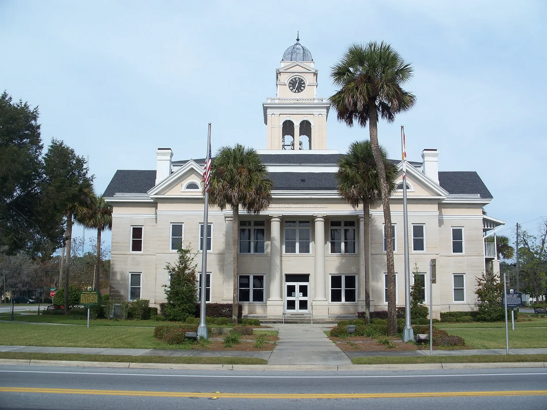
Lafayette County had 8,226 residents and covers approximately 1,419 square kilometres. The county was established in 1853, and Mayo is its county seat.
The county lies in north-central Florida near the Suwannee River. Rural forests, farms and waterways surround Mayo, with the Suwannee forming a major regional river corridor.
Hernando County had 194,515 residents and covers approximately 1,526 square kilometres. The county was established in 1843, and Brooksville is its county seat.
The county lies on the Gulf Coast north of Tampa Bay and includes the city of Spring Hill. The Withlacoochee State Forest extends through inland parts of Hernando County.
Hillsborough County had 1,459,762 residents and covers approximately 3,279 square kilometres. The county was established in 1834, and Tampa is its county seat.
Tampa lies on Hillsborough Bay, while the Hillsborough River crosses the city and supplies part of the local watershed. The county also includes Plant City and the eastern shore of Tampa Bay near Apollo Beach.
Highlands County had 101,235 residents and covers approximately 2,865 square kilometres. The county was established in 1921, and Sebring is its county seat.
Lake Placid and Sebring are major communities in the county’s interior lake district. Highlands County lies within the Kissimmee River watershed, with Lake Istokpoga among its notable inland water bodies.
Taylor County had 21,796 residents and covers approximately 3,191 square kilometres. The county was established in 1856, and Perry is its county seat.
The county occupies a section of Florida’s Big Bend Gulf coast. The Aucilla River reaches the Gulf near the county’s western side, while forests and marshes extend inland from Perry.
Collier County had 375,752 residents and covers approximately 5,970 square kilometres. The county was established in 1923, and Naples is its county seat.
The county includes Naples, Marco Island and the southwestern edge of the Everglades. Everglades National Park and Big Cypress National Preserve occupy extensive wetland areas east and south of the urban Gulf Coast.
Santa Rosa County had 188,000 residents and covers approximately 3,040 square kilometres. The county was established in 1842, and Milton is its county seat.
The county extends from the inland Panhandle to Santa Rosa Sound and the Gulf of Mexico. Navarre and Gulf Breeze lie on or near the barrier-island coast, while the Blackwater River passes through Milton.
Pasco County had 561,891 residents and covers approximately 2,248 square kilometres. The county was established in 1887, and Dade City is its county seat.
The county lies north of the Tampa metropolitan area and includes New Port Richey, Zephyrhills and parts of the Gulf Coast. The Withlacoochee River and the Starkey Wilderness Preserve are prominent features of the inland landscape.
Putnam County had 73,321 residents and covers approximately 2,142 square kilometres. The county was established in 1849, and Palatka is its county seat.
The St. Johns River runs through Palatka and forms a major transportation and drainage corridor. Crescent Lake and Lake George lie close to the county’s eastern and southern boundaries.
Dixie County had 16,759 residents and covers approximately 2,237 square kilometres. The county was established in 1921, and Cross City is its county seat.
The county occupies a sparsely developed section of Florida’s Big Bend coast. The Suwannee River reaches the Gulf near the county’s southern coastal area, where marshes and tidal creeks dominate the shoreline.
Indian River County had 159,788 residents and covers approximately 1,598 square kilometres. Vero Beach is the county seat and its largest coastal community.
The county lies along the Indian River Lagoon and the Atlantic Ocean. Barrier-island communities include Indian River Shores and Sebastian Inlet, while the mainland contains citrus-growing areas around Vero Beach.
Franklin County is a county in Florida with administrative level 6. Apalachicola is the county seat.
The county includes Apalachicola Bay, St. George Island and a long section of the Gulf Coast. The Apalachicola River reaches the bay east of the city, and Tate’s Hell State Forest covers inland wetland areas.
Bradford County had 28,303 residents and covers approximately 777 square kilometres. The county was established in 1858, and Starke is its county seat.
The county lies in north-central Florida between Gainesville and Jacksonville. The Santa Fe River flows through the region, and Starke is connected to the wider north Florida road network.
Broward County had 1,944,375 residents and covers approximately 3,418 square kilometres. The county was established in 1915, and Fort Lauderdale is its county seat.
The Atlantic coast includes Fort Lauderdale, Hollywood and Pompano Beach, while the western county extends into the Everglades. The New River flows through Fort Lauderdale, and Port Everglades is a major maritime facility.
Clay County had 218,245 residents and covers approximately 1,667 square kilometres. The county was established in 1858, and Green Cove Springs is its county seat.
The county lies southwest of Jacksonville and includes Fleming Island, Orange Park and Middleburg. The St. Johns River forms the eastern boundary, with Black Creek draining central parts of Clay County.
Walton County had 75,305 residents and was established in 1824. DeFuniak Springs is the county seat.
The county stretches from inland forests to the Gulf Coast and includes the coastal communities of Santa Rosa Beach and Miramar Beach. Choctawhatchee Bay and the Choctawhatchee River are major water features in the county.
Wakulla County had 33,764 residents and was established in 1843. Crawfordville is the county seat and the county’s principal inland community.
The county lies south of Tallahassee on the Gulf Coast and includes St. Marks and the St. Marks National Wildlife Refuge. The Wakulla River rises from Wakulla Spring, one of the largest freshwater springs in the United States.
Bay County had 175,216 residents and covers approximately 2,676 square kilometres. The county was established in 1913, and Panama City is its county seat.
Panama City Beach lies on the Gulf of Mexico, while St. Andrews Bay and North Bay extend inland from the coast. Tyndall Air Force Base occupies a large coastal area east of Panama City.
Duval County had 995,567 residents and covers approximately 2,378 square kilometres. The county was established in 1822, and Jacksonville is its county seat and largest city.
Jacksonville lies on the St. Johns River near the Atlantic Ocean and forms the centre of northeast Florida’s metropolitan area. The river, Jacksonville Port and the coastal community of Atlantic Beach define major geographic zones of the county.
Nassau County had 90,352 residents and covers approximately 1,880 square kilometres. The county was established in 1824, and Fernandina Beach is its county seat.
The county occupies Florida’s northeastern corner along the Georgia border and the Atlantic coast. Amelia Island, the Amelia River and the Nassau River are prominent geographic features around Fernandina Beach.
Levy County had 42,915 residents and covers approximately 3,658 square kilometres. The county was established in 1845, and Bronson is its county seat.
The Gulf Coast includes Cedar Key and marshy areas around the Suwannee River mouth. Inland Levy County contains the Goethe State Forest and parts of the Lower Suwannee National Wildlife Refuge.
Charlotte County had 173,115 residents according to the supplied regional data. Punta Gorda is the county seat on the northern shore of Charlotte Harbor.
The county includes Port Charlotte, Englewood and barrier-island areas near the Gulf of Mexico. The Peace River flows into Charlotte Harbor, which separates Charlotte County from parts of Lee County.
Marion County had 375,908 residents and covers approximately 4,307 square kilometres. The county was established in 1844, and Ocala is its county seat.
Ocala lies in the centre of the Florida horse country, while the Ocala National Forest occupies a large area east of the city. The Ocklawaha River and Silver Springs are major natural features in Marion County.
Lee County had 760,822 residents and covers approximately 3,139 square kilometres. The county was established in 1887, and Fort Myers is its county seat.
The Gulf Coast includes Fort Myers Beach, Sanibel Island, Captiva Island and Cape Coral. The Caloosahatchee River flows through Fort Myers and connects the inland Lake Okeechobee region with the Gulf of Mexico.
Pinellas County had 959,107 residents and covers approximately 1,574 square kilometres. The county was established in 1911, and Clearwater is its county seat.
The county occupies a peninsula between Tampa Bay and the Gulf of Mexico and includes St. Petersburg, Clearwater and Dunedin. The Gulf beaches extend along the western barrier-island chain from Sand Key to Fort De Soto Park.
Glades County had 12,126 residents and covers approximately 2,555 square kilometres. The county was established in 1921, and Moore Haven is its county seat.
The county lies on the western shore of Lake Okeechobee, the largest lake in Florida. The Caloosahatchee Canal begins near Moore Haven and connects Lake Okeechobee with the Gulf Coast.
Suwannee County had 43,474 residents and covers approximately 1,792 square kilometres. The county was established in 1858, and Live Oak is its county seat.
The Suwannee River forms the county’s western boundary in several sections and is joined by the Withlacoochee River near the regional river system. Live Oak lies at the intersection of north Florida roads and agricultural areas.
Jefferson County had 14,510 residents and covers approximately 1,649 square kilometres. The county was established in 1827, and Monticello is its county seat.
The county lies in the eastern Florida Panhandle between Tallahassee and the Gulf coast. The Aucilla River crosses the region, and the landscape around Monticello includes farms, forests and limestone features.
Columbia County had 69,698 residents and covers approximately 2,075 square kilometres. The county was established in 1832, and Lake City is its county seat.
Lake City lies at the junction of major north Florida routes near the Suwannee River basin. The county includes Alligator Lake and parts of the Osceola National Forest.
Sarasota County had 434,006 residents and covers approximately 1,878 square kilometres. The county was established in 1921, and Sarasota is its county seat.
The Gulf Coast includes Sarasota Bay, Siesta Key, Longboat Key and Venice. The barrier islands and bays separate the urban mainland from the Gulf of Mexico and form the county’s principal coastal landscape.
Baker County had 28,259 residents and covers approximately 1,525 square kilometres. The county was established in 1861, and Macclenny is its county seat.
The county lies west of Jacksonville along the Georgia border. The St. Marys River forms part of the northern boundary, while the Osceola National Forest extends across eastern Baker County.
Leon County had 292,198 residents and covers approximately 1,818 square kilometres. The county was established in 1824, and Tallahassee is its county seat and Florida’s capital.
Tallahassee lies in the rolling Red Hills of the eastern Panhandle, north of Lake Jackson. The Ochlockonee River drains the western part of the county before reaching the Gulf of Mexico farther south.
Escambia County had 311,003 residents according to the supplied regional data. Pensacola is the county seat and lies at the western end of Florida’s Panhandle.
The county borders Alabama to the north and includes Pensacola Bay, Perdido Bay and the Gulf of Mexico. The Escambia River flows south through the county, while Pensacola Beach lies on Santa Rosa Island.
Hardee County had 25,327 residents and covers approximately 1,653 square kilometres. The county was established in 1921, and Wauchula is its county seat.
The county lies inland between central and southwest Florida and is crossed by the Peace River. Wauchula is surrounded by agricultural land, including citrus and cattle-producing areas.
Alachua County had 278,468 residents and covers approximately 2,510 square kilometres. The county was established in 1824, and Gainesville is its county seat.
Gainesville is home to the University of Florida, while the county includes Paynes Prairie Preserve State Park south of the city. The Santa Fe River and numerous springs drain the karst landscape around Alachua County.
Citrus County had 141,058 residents according to the supplied regional data. Inverness is the county seat, and Crystal River is a major community on the Gulf Coast.
The county includes the Crystal River, Homosassa River and extensive Gulf marshes. The Withlacoochee State Forest occupies inland areas east of the coastal communities.
Gilchrist County had 17,864 residents and covers approximately 921 square kilometres. The county was established in 1925, and Trenton is its county seat.
The county lies west of Gainesville in north-central Florida. The Santa Fe River forms a major southern drainage corridor, and the area around Trenton includes farms, forests and freshwater springs.
Hamilton County had 14,004 residents and covers approximately 1,345 square kilometres. The county was established in 1827, and Jasper is its county seat.
The county lies in northern Florida near the Suwannee River and the Georgia border. The Withlacoochee River crosses the eastern part of Hamilton County before joining the Suwannee system.
Calhoun County had 14,462 residents according to the supplied regional data. Blountstown is the county seat.
The county lies in the Florida Panhandle along the Apalachicola River. The river valley and forests around Blountstown connect Calhoun County with Gulf Coast wetlands farther south.
Hendry County had 39,119 residents according to the supplied regional data. LaBelle is the county seat on the Caloosahatchee River.
The county lies east of Fort Myers and north of the Everglades agricultural region. The Caloosahatchee River crosses Hendry County, while Clewiston lies on the southern shore of Lake Okeechobee.
Union County had 16,147 residents and covers approximately 647 square kilometres. The county was established in 1921, and Lake Butler is its county seat.
The county lies in north-central Florida near Bradford County and the Santa Fe River basin. Forests, farms and small lakes surround Lake Butler, the principal settlement of Union County.
Monroe County had 82,874 residents and covers approximately 9,679 square kilometres. The county was established in 1823, and Key West is its county seat.
The county includes the Florida Keys, Key West, the Dry Tortugas and the southern tip of the Florida mainland. Florida Bay, the Gulf of Mexico and the Atlantic Ocean surround the county’s islands and coastal waters.
Data sources: OpenStreetMap (ODbL), Wikidata (CC0) · Image: Wikimedia Commons
Florida – Facts
Population
21538187
Area
170304 km²
Subregions
70
Named after
Easter
Year built
1845
Elevation
30 m
Located in
United States
Country
United States
Body of water
Gulf of Mexico, Atlantic Ocean, Florida Strait
Nickname
The Sunshine State
Native name
Florida
Official name
State of Florida
Described by
The Catholic Encyclopedia, The Nuttall Encyclopædia, Jewish Encyclopedia of Brockhaus and Efron, Small Brockhaus and Efron Encyclopedic Dictionary, Brockhaus and Efron Encyclopedic Dictionary, 1922 Encyclopædia Britannica, Encyclopædia Britannica 11th edition, The American Cyclopædia, Collier's New Encyclopedia, 1921, Encyclopædia Britannica Ninth Edition, New International Encyclopedia, The New Student's Reference Work