Georgia

This City map of Georgia in the United States shows streets, paths and places across a state covering approximately 153,909 square kilometres. Georgia had 10,711,908 residents in 2020, compared with 9,687,653 in 2010, and its mapped regional elevation is given as 180 metres. The state was founded in 1788 and is divided into 192 mapped subregions, including municipalities and counties. The Savannah River, the Chattahoochee River, the Appalachian Mountains and the Atlantic coast are major geographical features of Georgia; long-distance cycling routes include the East Coast Greenway and March to the Sea.

City map Georgia
Dsdugan, CC0 – Wikimedia Commons
City map College Park
Tn8r8r, CC BY-SA 4.0 – Wikimedia Commons

College Park

College Park is an admin_level=8 municipality in Georgia, United States, with a recorded population of 14,959. It lies in the Atlanta metropolitan area, near Hartsfield-Jackson Atlanta International Airport and the Chattahoochee River.

The city is associated with Fulton County and has direct urban connections to Atlanta and East Point. Its streets and local paths are represented in the Georgia City map.

City map Palmetto
Thomson200, CC0 – Wikimedia Commons

Palmetto

Palmetto is an admin_level=8 municipality in Georgia with a recorded population of 4,718. The city is located southwest of Atlanta in the area of Fulton and Coweta counties.

Palmetto is connected to the Chattahoochee River corridor and the rural landscapes of west-central Georgia. The map records its roads, paths and settled places.

City map Blythe
David Gilmour Blythe, Public domain – Wikimedia Commons

Blythe

Blythe is an admin_level=8 city in Burke and Richmond counties, Georgia. Its recorded population is 744, its area is 7,327,065 square metres and its elevation is 138 metres.

The city lies in eastern Georgia near Augusta and the Savannah River region. County roads and local streets connect Blythe with settlements in Burke and Richmond counties.

City map Mountain Park
John Trainor from Roswell, GA, USA, CC BY 2.0 – Wikimedia Commons

Mountain Park

Mountain Park is an admin_level=8 municipality in Georgia with a recorded population of 579. It is located in the northern Atlanta metropolitan area.

The community is associated with suburban landscapes near the Chattahoochee River and the foothills of north Georgia. Its local street network is included in the map.

City map Social Circle
Related names: Mathis, Deborah, transmitter, Public domain – Wikimedia Commons

Social Circle

Social Circle is an admin_level=8 settlement in Newton and Walton counties, Georgia. It has a recorded population of 4,974, an area of 37,075,105 square metres and an elevation of 270 metres.

The city lies east of Atlanta in the Georgia Piedmont, near the Alcovy River basin. Roads connect Social Circle with Covington, Monroe and other communities in Newton and Walton counties.

City map Bogart
HowlRound Theatre Commons, CC BY 3.0 – Wikimedia Commons

Bogart

Bogart is an admin_level=8 town in Clarke and Oconee counties, Georgia. Its recorded population is 1,326, its area is 6,162,432 square metres and its elevation is 253 metres.

The town is situated west of Athens in the northeastern Georgia Piedmont. Local roads link Bogart with Athens-Clarke County, Oconee County and the Oconee River region.

City map Rest Haven
Thomson200, CC0 – Wikimedia Commons

Rest Haven

Rest Haven is an admin_level=8 town in Gwinnett and Hall counties, Georgia. It has a recorded population of 45, an area of 911,722 square metres and an elevation of 336 metres.

The town was established in 1938 and lies northeast of Atlanta near Lake Lanier and the Chattahoochee River basin. Its small local street network is shown on the map.

City map Martin
Brian Stansberry, CC BY 4.0 – Wikimedia Commons

Martin

Martin is an admin_level=8 municipality in Georgia, United States. The available regional record identifies the place as a Georgia administrative unit without a supplied population, area or elevation.

Martin is located in the northeastern part of the state near the South Carolina border and the Tugaloo River watershed. The map shows its streets and connections to surrounding communities.

City map Vidalia
Geogre at English Wikipedia, Public domain – Wikimedia Commons

Vidalia

Vidalia is an admin_level=8 city in Toombs and Montgomery counties, Georgia. It has a recorded population of 10,785, an area of 45,878,562 square metres and an elevation of 91 metres.

The city stands in southeastern Georgia near the Altamaha River basin. Vidalia is widely associated with the Vidalia onion, a crop protected by a defined production area in the state.

City map Baldwin
Thomson200, CC0 – Wikimedia Commons

Baldwin

Baldwin is an admin_level=8 municipality in Georgia, United States. The available record provides no population, area or elevation for the city.

It lies in the northeastern Georgia mountain foothill region, near Habersham and Banks counties. The map includes Baldwin’s local roads and settled area.

City map Alto
Thomson M, CC BY 3.0 – Wikimedia Commons

Alto

Alto is an admin_level=8 municipality in Georgia, United States. No population, area or elevation is supplied in the available record.

The town is in northeastern Georgia near Habersham and Banks counties, within the upper Chattahoochee region. Its streets and paths are represented in the regional map.

City map Royston
Brian Stansberry, CC BY 4.0 – Wikimedia Commons

Royston

Royston is an admin_level=8 municipality in Georgia with a recorded population of 2,576. It is situated in the northeastern part of the state near Franklin and Hart counties.

The town lies in the Georgia Piedmont between the Broad River and Lake Hartwell region. Local roads connect Royston with Canon, Hartwell and nearby communities.

City map Danville
Mx. Granger, CC0 – Wikimedia Commons

Danville

Danville is an admin_level=8 municipality in Georgia with a recorded population of 215. The town is in central Georgia, in the region between Macon and Milledgeville.

Danville is associated with Twiggs and Wilkinson county landscapes. Its local streets are included in the Georgia City map.

City map Allentown
The Mebane Greeting Card Co., Wilkes-Barre, PA., Public domain – Wikimedia Commons

Allentown

Allentown is an admin_level=8 municipality in Georgia with a recorded population of 158. The town is located in central Georgia near the boundary of Wilkinson, Twiggs and Laurens counties.

Roads through the surrounding Piedmont and fall-line region connect Allentown with Macon and smaller settlements. The map records the town’s local street network.

City map Braswell
Thomson200, CC0 – Wikimedia Commons

Braswell

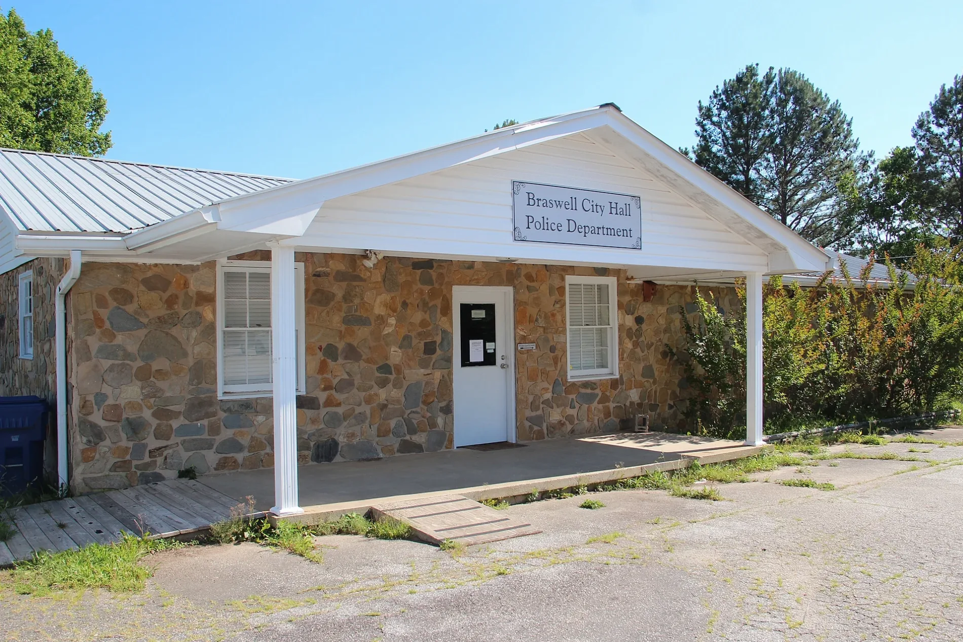
Braswell is an admin_level=8 municipality in Georgia with a recorded population of 383. It lies in northwestern Georgia near Paulding and Bartow counties.

The community is situated in the foothills south of the Appalachian Ridge and Valley region. Local roads connect Braswell with Rockmart, Dallas and nearby rural areas.

City map Nelson
Thomson200, CC0 – Wikimedia Commons

Nelson

Nelson is an admin_level=8 municipality in Georgia with a recorded population of 1,365. It is located in the foothills of the North Georgia mountains near Cherokee and Pickens counties.

The town lies close to the Georgia Marble Country around Ball Ground and Tate. Its streets and surrounding roads are shown in the map.

City map Keysville
Jwb23974, CC BY-SA 3.0 – Wikimedia Commons

Keysville

Keysville is an admin_level=8 municipality in Georgia, United States. No population, area or elevation is supplied for the place in the available record.

The community lies in east-central Georgia near Burke and Jefferson counties. The map identifies Keysville and its local road connections.

City map Taylorsville
Melissa J from Douglasville, GA, USA, CC BY 2.0 – Wikimedia Commons

Taylorsville

Taylorsville is an admin_level=8 town in Bartow and Polk counties, Georgia. It has a recorded population of 252, an area of 3,864,923 square metres and an elevation of 223 metres.

The town is located northwest of Atlanta in the transition between the Piedmont and the Ridge and Valley province. Nearby roads connect Taylorsville with Cartersville, Rockmart and the Etowah River region.

City map Adrian
War Department. The Adjutant General's Office. 3/4/1907-9/18/1947, Public domain – Wikimedia Commons

Adrian

Adrian is an admin_level=8 municipality in Georgia with a recorded population of 645. It lies in east-central Georgia near Emanuel and Johnson counties.

The town is situated within the Altamaha River drainage basin. Its roads and built-up area are included in the regional map.

City map Haralson
User:Username2016, CC BY-SA 3.0 – Wikimedia Commons

Haralson

Haralson is an admin_level=8 municipality in Georgia with a recorded population of 187. The town is located in the west-central part of the state near Coweta and Meriwether counties.

Haralson lies south of the Atlanta metropolitan area in the Piedmont. Local streets connect it with Senoia, Newnan and surrounding rural communities.

City map Pine Mountain
Rivers Langley; SaveRivers, CC BY-SA 3.0 – Wikimedia Commons

Pine Mountain

Pine Mountain is an admin_level=8 municipality in Georgia with a recorded population of 1,374. It lies in Harris County near the Alabama state line and the Pine Mountain ridge.

The town is adjacent to Franklin D. Roosevelt State Park and is close to Callaway Gardens. The Pine Mountain landscape forms part of the southernmost Appalachian foothills.

City map Barwick
Michael Rivera, CC BY-SA 3.0 – Wikimedia Commons

Barwick

Barwick is an admin_level=8 city in Brooks and Thomas counties, Georgia. Its recorded population is 363, its area is 1,940,377 square metres and its elevation is 81 metres.

The city is located in southwestern Georgia near the Florida border. Roads connect Barwick with Thomasville, Quitman and the agricultural plains of the Ochlockonee River region.

City map Pavo
Michael Rivera, CC BY-SA 3.0 – Wikimedia Commons

Pavo

Pavo is an admin_level=8 city in Brooks and Thomas counties, Georgia. It has a recorded population of 622, an area of 4,572,222 square metres and an elevation of 78 metres.

The town lies in the coastal plain near Thomasville and the Ochlockonee River watershed. Its streets serve a small agricultural community in southwestern Georgia.

City map Meigs
Michael Rivera, CC BY-SA 3.0 – Wikimedia Commons

Meigs

Meigs is an admin_level=8 municipality in Georgia, United States. The available record does not provide a population, area or elevation.

The town is located in southwest Georgia near Thomas and Mitchell counties. Its local streets and roads are represented on the regional map.

City map Scotland
Michael Rivera, CC BY-SA 4.0 – Wikimedia Commons

Scotland

Scotland is an admin_level=8 municipality in Georgia, United States. No population, area or elevation is included in the supplied record.

The community lies in south-central Georgia near Telfair and Wheeler counties. Roads through the Ocmulgee River region connect Scotland with nearby settlements.

City map Milan
Mklbell, CC BY-SA 3.0 – Wikimedia Commons

Milan

Milan is an admin_level=8 city in Dodge and Telfair counties, Georgia. Its recorded population is 613, its area is 8,163,448 square metres and its elevation is 95 metres.

The city lies in the coastal plain near the Ocmulgee River. Local roads connect Milan with McRae-Helena, Eastman and other communities in central-southern Georgia.

City map West Point
SaveRivers, Public domain – Wikimedia Commons

West Point

West Point is an admin_level=8 city in Harris and Troup counties, Georgia. It has a recorded population of 3,719 and an area of 29,632,323 square metres.

The city stands on the Chattahoochee River at West Point Lake, close to the Alabama border. Its location links the industrial Piedmont with LaGrange and eastern Alabama.

City map Gillsville
Upstateherd, CC BY-SA 3.0 – Wikimedia Commons

Gillsville

Gillsville is an admin_level=8 municipality in Georgia with a recorded population of 243. It lies in the northeastern part of the state near Hall and Banks counties.

The town is located in the foothills north of Gainesville and near the upper Chattahoochee watershed. Its roads and local places are shown on the map.

City map Maysville
Rupert Clayton, CC BY-SA 3.0 – Wikimedia Commons

Maysville

Maysville is an admin_level=8 municipality in Georgia with a recorded population of 1,938. It is situated in northeastern Georgia near Banks and Jackson counties.

The town lies west of the foothills leading toward the Blue Ridge Mountains and near the North Oconee River basin. Roads connect Maysville with Commerce, Jefferson and Gainesville.

City map Tallulah Falls
Popular Graphic Arts, Public domain – Wikimedia Commons

Tallulah Falls

Tallulah Falls is an admin_level=8 municipality in Georgia. The available record gives no population, area or elevation for the town.

The community is known for Tallulah Gorge, a deep canyon carved by the Tallulah River in Rabun County. Tallulah Gorge State Park contains the river, waterfalls and a suspension bridge over the gorge.

City map Arlington
Michael Rivera, CC BY-SA 4.0 – Wikimedia Commons

Arlington

Arlington is an admin_level=8 municipality in Georgia, United States. No population, area or elevation is supplied in the available record.

The town lies in southwestern Georgia near Calhoun, Early and Baker counties. Local roads connect Arlington with the lower Chattahoochee and Flint river regions.

City map Canon
Brian Stansberry, CC BY 4.0 – Wikimedia Commons

Canon

Canon is an admin_level=8 settlement in Franklin and Hart counties, Georgia. It has a recorded population of 643, an area of 8,100,107 square metres and an elevation of 280 metres.

The community lies in the northeastern Georgia Piedmont near the Broad River and Lake Hartwell. Roads connect Canon with Royston, Hartwell and Lavonia.

City map Perry
Michael Rivera, CC BY-SA 4.0 – Wikimedia Commons

Perry

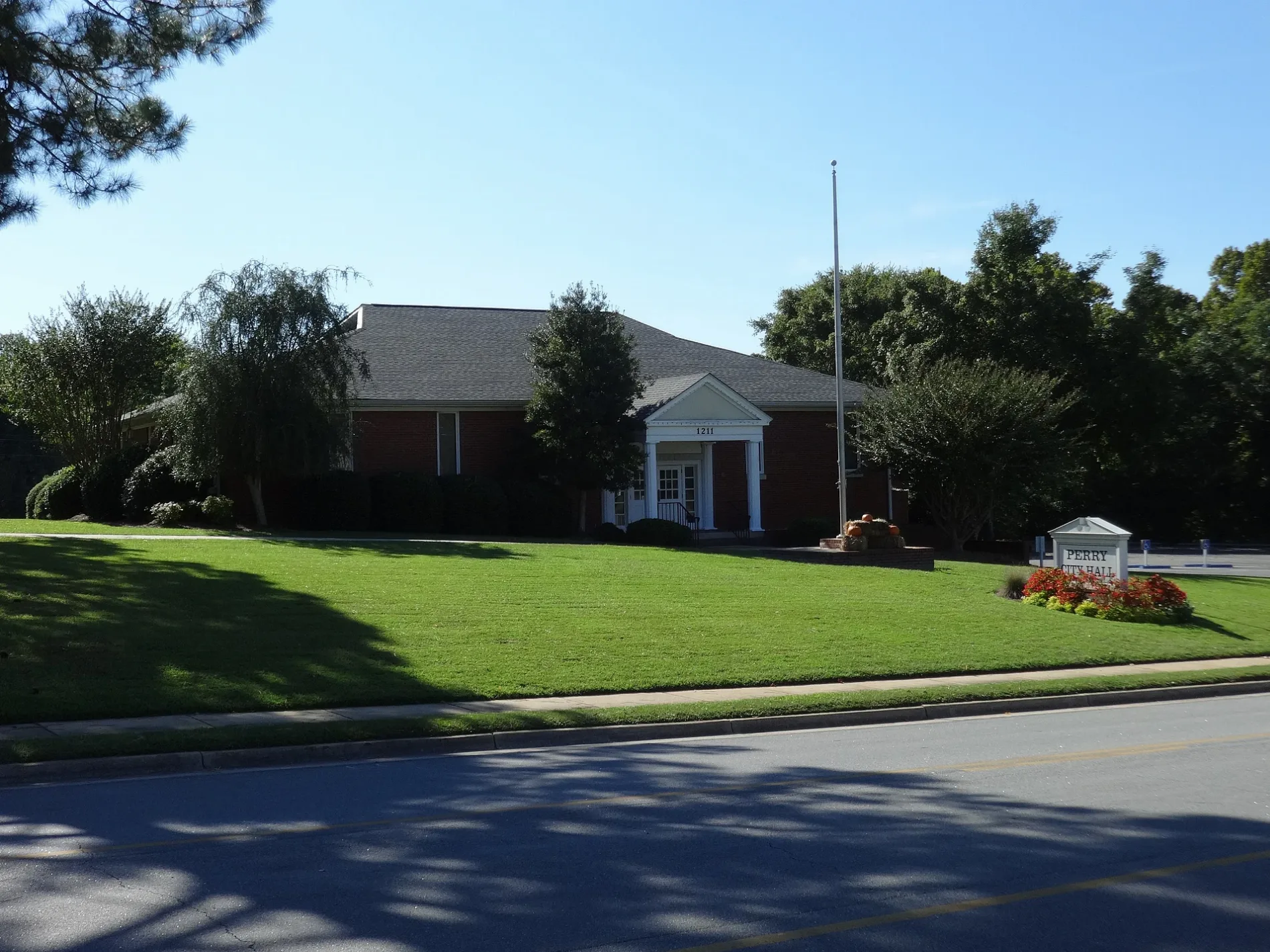
Perry is an admin_level=8 city in Houston and Peach counties, Georgia. Its recorded population is 20,624, its area is 68,509,570 square metres and its elevation is 111 metres.

The city lies in central Georgia near the fall line and the Ocmulgee River basin. Perry is the county seat of Houston County and is connected by Interstate 75 to Macon and Valdosta.

City map Effingham County
Bubba73 (Jud McCranie), CC BY-SA 4.0 – Wikimedia Commons

Effingham County

Effingham County is an admin_level=6 county in Georgia with 64,769 recorded residents. It covers approximately 1,250 square kilometres and was established in 1777.

The county lies northwest of Savannah along the Savannah River and the coastal plain. Springfield is the county seat, while the county’s roads connect communities around Rincon, Guyton and Port Wentworth.

City map Screven County
Boston Public Library, Public domain – Wikimedia Commons

Screven County

Screven County is an admin_level=6 county in Georgia with a recorded population of 14,067. Its area is approximately 1,698 square kilometres, and the county was established in 1793.

The county is located in eastern Georgia between the Ogeechee and Savannah river basins. Sylvania is the county seat, with roads extending toward Statesboro and Augusta.

City map Burke County
Stephen Matthew Milligan, CC BY-SA 3.0 – Wikimedia Commons

Burke County

Burke County is an admin_level=6 county in eastern Georgia with a recorded population of 22,745. Waynesboro is the county seat, and the county includes the city of Blythe.

The county lies along the Savannah River near the South Carolina border. Its landscape includes the eastern Georgia coastal plain and rural areas around Waynesboro and Sardis.

City map Charlton County
JERRYE & ROY KLOTZ MD, CC BY-SA 3.0 – Wikimedia Commons

Charlton County

Charlton County is an admin_level=6 county in southeastern Georgia with 12,518 recorded residents. It covers approximately 2,028 square kilometres and was established in 1854.

The county contains much of the Okefenokee Swamp, one of the largest wetlands in North America. Folkston is the county seat, and the St. Marys River forms part of the Georgia–Florida boundary.

City map Chatham County
DXR, CC BY-SA 4.0 – Wikimedia Commons

Chatham County

Chatham County is an admin_level=6 county with a recorded population of 295,291. Its area is approximately 1,638 square kilometres, and it was established in 1777.

The county includes Savannah, Georgia’s oldest major city, and reaches the Atlantic coast through tidal marshes and barrier islands. The Savannah River forms its northern boundary and supports the Port of Savannah.

City map Camden County
Michael Rivera, CC BY-SA 4.0 – Wikimedia Commons

Camden County

Camden County is an admin_level=6 county in coastal Georgia with 54,768 recorded residents. It covers approximately 2,027 square kilometres and was established in 1777.

Woodbine is the county seat, while St. Marys lies on the Cumberland Sound near Cumberland Island National Seashore. The St. Marys River marks the southern boundary with Florida.

City map Richmond County
Thomson200, CC0 – Wikimedia Commons

Richmond County

Richmond County is an admin_level=6 county with a recorded population of 206,607. It covers approximately 851 square kilometres and was established in 1777.

The county is consolidated with the city of Augusta on the Savannah River. Augusta is a major inland port and the host city of the Masters Tournament at Augusta National Golf Club.

City map Ware County
Bubba73 (Jud McCranie), CC BY-SA 4.0 – Wikimedia Commons

Ware County

Ware County is an admin_level=6 county in southeastern Georgia with a recorded population of 36,251. It was established in 1824.

Waycross is the county seat and an important rail centre near the Okefenokee Swamp. The Satilla River and extensive pine forests define much of the surrounding coastal plain.

City map Columbia County
Stephen Sullivan Sr, CC BY 2.0 – Wikimedia Commons

Columbia County

Columbia County is an admin_level=6 county in eastern Georgia with 156,010 recorded residents. Its area is approximately 797 square kilometres, and it was established in 1790.

The county lies west of Augusta along the Savannah River and includes Evans and Martinez. Clarks Hill Lake, also known as Lake Strom Thurmond, occupies the northern boundary area.

City map Lincoln County
JERRYE & ROY KLOTZ MD, CC BY-SA 3.0 – Wikimedia Commons

Lincoln County

Lincoln County is an admin_level=6 county in eastern Georgia. The supplied record does not include a population, area or establishment date.

The county lies along the western shore of Clarks Hill Lake and the Savannah River near the South Carolina border. Lincolnton is the county seat and the principal mapped settlement.

City map Elbert County
Calvin Beale, Public domain – Wikimedia Commons

Elbert County

Elbert County is an admin_level=6 county in northeastern Georgia with 19,637 recorded residents. It covers approximately 970 square kilometres and was established in 1790.

Elberton is the county seat, and the county is known for its granite industry. The Broad River and Lake Russell lie within the county’s wider river and reservoir landscape.

City map Hart County
Nyttend, Public domain – Wikimedia Commons

Hart County

Hart County is an admin_level=6 county in northeastern Georgia with 25,828 recorded residents. Its area is approximately 664 square kilometres, and it was established in 1853.

Hartwell is the county seat and lies beside Lake Hartwell, a large reservoir on the Savannah River system. The county borders South Carolina across the lake and river.

City map Franklin County
JERRYE & ROY KLOTZ MD, CC BY-SA 3.0 – Wikimedia Commons

Franklin County

Franklin County is an admin_level=6 county in northeastern Georgia with 23,424 recorded residents. It covers approximately 690 square kilometres and was established in 1784.

Carnesville is the county seat, while Royston and Canon are other mapped municipalities. The county is drained by the Broad River and lies near the South Carolina border.

City map Stephens County
Harrison Keely, CC BY 4.0 – Wikimedia Commons

Stephens County

Stephens County is an admin_level=6 county in northeastern Georgia with 26,784 recorded residents. Its area is approximately 477 square kilometres, and it was established in 1905.

Toccoa is the county seat and lies near Toccoa Falls and the Tugaloo River. The county occupies the foothills between Lake Hartwell and the Blue Ridge Mountains.

City map Habersham County
Jerrye & Roy Klotz, MD, CC BY-SA 3.0 – Wikimedia Commons

Habersham County

Habersham County is an admin_level=6 county in northeast Georgia with 46,031 recorded residents. It covers approximately 723 square kilometres and was established in 1818.

Clarkesville is the county seat, and Cornelia is a major local centre. The county lies in the Blue Ridge foothills near the Chattahoochee River, Lake Burton and Tallulah Gorge.

City map Rabun County
KudzuVine, Public domain – Wikimedia Commons

Rabun County

Rabun County is an admin_level=6 county in the northeastern corner of Georgia with 16,883 recorded residents. Its area is approximately 976 square kilometres, and it was established in 1819.

Clayton is the county seat, and the county contains parts of the Chattahoochee National Forest. Rabun, Burton and Seed lakes lie among the Blue Ridge Mountains near the North Carolina and South Carolina borders.

City map Towns County
Harrison Keely, CC BY 4.0 – Wikimedia Commons

Towns County

Towns County is an admin_level=6 county in north Georgia with 12,493 recorded residents. It covers approximately 446 square kilometres and was established in 1856.

Hiawassee is the county seat on the shore of Lake Chatuge. The county occupies a mountainous area on the North Carolina border near Brasstown Bald, Georgia’s highest summit.

City map Union County
Umbra Lab, Inc., CC BY 4.0 – Wikimedia Commons

Union County

Union County is an admin_level=6 county in north Georgia with 24,632 recorded residents. Its area is approximately 852 square kilometres, and it was established in 1832.

Blairsville is the county seat, located near the Chattahoochee National Forest and Lake Nottely. The Appalachian Trail crosses the county near Blood Mountain and Brasstown Bald.

City map Fannin County
Thomson200, CC0 – Wikimedia Commons

Fannin County

Fannin County is an admin_level=6 county in north Georgia with 25,319 recorded residents. It covers approximately 1,014 square kilometres and was established in 1854.

Blue Ridge is the county seat and lies beside Lake Blue Ridge on the Toccoa River. The county includes parts of the Blue Ridge Mountains and the Chattahoochee National Forest.

City map Dade County
Capella Space, CC BY 4.0 – Wikimedia Commons

Dade County

Dade County is an admin_level=6 county in the far northwest of Georgia with 16,251 recorded residents. Its area is approximately 451 square kilometres, and it was established in 1837.

Trenton is the county seat, situated in the Lookout Valley near the Alabama and Tennessee borders. Lookout Mountain and Cloudland Canyon State Park are prominent landforms in the county.

City map Murray County
Thomson200, CC0 – Wikimedia Commons

Murray County

Murray County is an admin_level=6 county in northwestern Georgia with 39,973 recorded residents. It covers approximately 892 square kilometres and was established in 1832.

Chatsworth is the county seat, located between the Cohutta Mountains and the Ridge and Valley province. The Conasauga River flows through the county, whose western edge approaches the Tennessee border.

City map Whitfield County
CaptainStegge, CC BY-SA 4.0 – Wikimedia Commons

Whitfield County

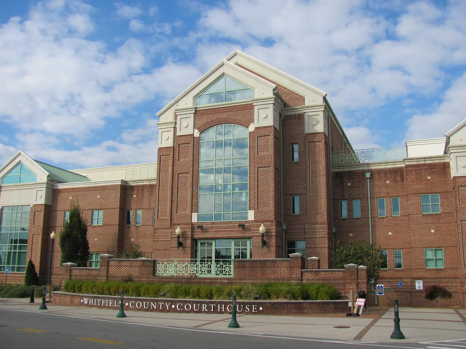
Whitfield County is an admin_level=6 county in northwestern Georgia with 102,864 recorded residents. Its area is approximately 751.1 square kilometres, and it was established in 1851.

Dalton is the county seat and a major carpet-manufacturing centre. The county lies in the Ridge and Valley region between the Cohutta Mountains and Rocky Face Ridge.

Catoosa County

Catoosa County is an admin_level=6 county in northwestern Georgia with 67,872 recorded residents. It covers approximately 421 square kilometres and was established in 1853.

Ringgold is the county seat near the Tennessee border and the Chickamauga battlefield region. The county lies between the Appalachian Ridge and Valley formations and the Tennessee River drainage.

City map Walker County
Arthur Rothstein, Public domain – Wikimedia Commons

Walker County

Walker County is an admin_level=6 county in northwestern Georgia with 67,654 recorded residents. It was established in 1833.

LaFayette is the county seat, and the county includes parts of Lookout Mountain and the Chickamauga and Chattanooga area. Chickamauga Battlefield lies nearby in the Georgia–Tennessee border region.

City map DeKalb County
John Phelan, CC BY 4.0 – Wikimedia Commons

DeKalb County

DeKalb County is an admin_level=6 county in metropolitan Atlanta with 764,382 recorded residents. Its area is approximately 702 square kilometres, and it was established in 1822.

Decatur is the county seat, while the county includes large parts of Atlanta’s eastern urban area. Stone Mountain, the South River and the Arabia Mountain National Heritage Area are notable geographic features.

City map Gwinnett County
Gwinnett Co. Schools, Public domain – Wikimedia Commons

Gwinnett County

Gwinnett County is an admin_level=6 county northeast of Atlanta with 957,062 recorded residents. It covers approximately 1,131 square kilometres and was established in 1818.

Lawrenceville is the county seat, and the county includes Duluth, Norcross, Suwanee and parts of Buford. The Chattahoochee River forms much of the western boundary, while Lake Lanier lies to the north.

City map Appling County
Michael Rivera, CC BY-SA 4.0 – Wikimedia Commons

Appling County

Appling County is an admin_level=6 county in southeastern Georgia with 18,444 recorded residents. It covers approximately 1,326 square kilometres and was established in 1814.

Baxley is the county seat, located near the Altamaha River and the Satilla River watershed. The county’s coastal plain roads connect Baxley with Jesup, Alma and communities toward the Atlantic coast.

Data sources: OpenStreetMap (ODbL), Wikidata (CC0) · Image: Wikimedia Commons

Georgia – Facts

Population 10711908
Area 153909 km²
Subregions 199
Named after George II of Great Britain
Year built 1788
Elevation 180 m
Located in United States
Country United States
Body of water Atlantic Ocean
Nickname Peach State
Native name Georgia
Official name State of Georgia
Described by Brockhaus and Efron Encyclopedic Dictionary, The Nuttall Encyclopædia, Great Soviet Encyclopedia (1926–1947), Jewish Encyclopedia of Brockhaus and Efron, Small Brockhaus and Efron Encyclopedic Dictionary, 1922 Encyclopædia Britannica, Encyclopædia Britannica 11th edition, The American Cyclopædia, Collier's New Encyclopedia, 1921, Encyclopædia Britannica Ninth Edition, New International Encyclopedia, The New Student's Reference Work
Part of contiguous United States, South Atlantic states

Data source: Wikidata (CC0)