
Ann Street in Savannah, Georgia
Ann Street in Savannah is a two-lane residential street. It runs in a north-south direction starting from West Bay Street and crosses Olive Street, West Bryan Street, Orange Street, Zubley Street, Alton Street and West Youmans Street and ends at West Oglethorpe Avenue. Ann Street also exists in Charlton County, Richmond County, Ware County, Walker County and DeKalb County.
- Road Type
- residential street
- Lanes
- 2
- Route
- north-south
Image
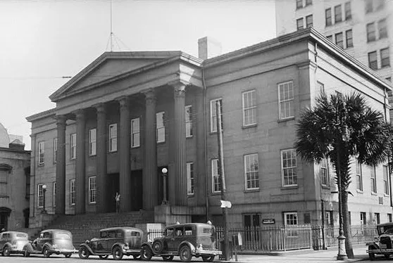
Convenience stores
Nightclubs
Cafes
Clothing stores
Tattoo studios
Bus stops
- bus lines 3, 3B, 4, 10, 11, 17, 25, 27, 28, 29, 31, 100X
Restaurants
Variety stores
Pubs
Bars
Stations
- bus lines 3, 3B, 4, 10, 11, 17, 25, 27, 28, 29, 31, 100X
Streets nearby
Zubley Street250 ft
Alton StreetRepeal 33 Bar & Restaurant
500 ft
Fahm StreetJ.C. Lewis Primary Health Vision Center, J.C. Lewis Primary Health Care Center, J.C. Lewis Behavioral Healthcare Center, J.C. Lewis Dental Center
0.1 mi
West Youmans StreetH, I, J, K, L, M, N, F, E, D, C, B, A, G
0.1 mi
Papy Street0.2 mi
Yates Street0.2 mi
Turner BoulevardSCAD Turner Fountain, SCAD Turner Bus Stop
0.3 mi
West Mc Donough Street0.3 mi
Montgomery StreetBelford's Savannah, Jay Maa Shakti Food Mart, Mushrooms, SCAD Montgomery Hall Bus Stop, Byte Cafe, Broughton Market #3, Cherry Picked Consignments, SCAD Gulfstream Bus Stop
0.3 mi
Fahm Avenue0.3 mi
West Perry Street0.3 mi
Quaker StreetSCAD Sign
0.3 mi
West Boundary StreetAmigos, Oglethorpe Trolley, Stoner’s Pizza
0.3 mi
Martin Luther King Junior BoulevardSilence is Golden, Saint Philip African Methodist Episcopal Church, balloon store, Mount Zion Baptist church, Fade City, MLK & 39th SB, MLK & 37th SB
0.3 mi
Louisville Road0.4 mi
Purse Street0.4 mi
Apartment buildings nearby
Ann Street Lofts250 ft
Arts centers nearby
Savannah Cultural Arts Center0.2 mi
Artworks nearby
SCAD Beach0.2 mi
Attractions nearby
Oglethorpe Trolley Tours Welcome Center0.2 mi
Bookstores nearby
Ex Libris0.3 mi
Buildings nearby
Savannah Bus Terminal0.2 mi
Savannah Welcome Center0.3 mi
Cafes nearby
Café at The Hive0.4 mi
Cemeteries nearby
Savannah Battlefield Memorial Park0.4 mi
Courthouses nearby
Eugene H. Gadsden Courthouse0.2 mi
Dormitories nearby
SCAD Turner House0.3 mi
Gardens nearby
SCAD Community Garden0.3 mi
Gas stations nearby
Chevron0.1 mi
Hotels nearby
The Ann Savannah, Apartments by Marriott Bonvoy250 ft
Aloft Savannah Downtown Historic District0.1 mi
Fairfield Inn & Suites Savannah Downtown/Historic District0.1 mi
Hampton0.2 mi
Embassy Suites0.2 mi
Military areas nearby
SCAD Turner House Checkpoint0.3 mi
Motels nearby
Thunderbird Inn0.2 mi
Museums nearby
Museum of Art0.2 mi
Savannah History Museum0.3 mi
Parking lots nearby
Hive Parking0.3 mi
Parks nearby
Battlefield Park0.3 mi
Places of worship nearby
First Bryan Baptist Church450 ft
Post offices nearby
Mail Center0.3 mi
Restaurants nearby
The Grey400 ft
Streams nearby
Springfield Canal0.3 mi
Technical colleges nearby
Herstand Hall450 ft
Crites Hall0.2 mi
Kiah Hall0.2 mi
Clark Hall0.3 mi
Tourist information centers nearby
Savannah Visitors Center0.3 mi
 Public transit map Savannah Legend
| Railway | |
| Bus | |
| Streetcar |
 Bicycle map Savannah Legend
| Bike path | |
| Bike lane on roadway | |
| Cycling allowed on bus lane | |
| Bicycle street | |
| Open to cyclists | |
| Open to cyclists, good path | |
| Cycling prohibited | |
| Cobblestone |
| Long-distance bike route | (depending on scale) | |
| Long-distance bike route |
 Pedestrian map Savannah Legend
| Path |
| Long-distance hiking trail | (depending on scale) | |
| Long-distance hiking trail | ||
| Pedestrians prohibited |