
Guam

Guam
This page is the City map of Guam, showing streets, paths, and places across the United States territory in the western Pacific. Guam covers approximately 544 square kilometres and had 153,836 residents in 2020, compared with 159,440 in 2010. The island is divided into 19 municipalities, including Hagåtña, Dededo, Yigo, and Tamuning. Guam has been an unincorporated territory of the United States since 1898, with a central administrative area around Hagåtña.
Yona Municipality

Yona is a municipality on Guam’s eastern side with a recorded population of 6,480 and an area of 51,799,762 square metres. The municipality extends from the central uplands toward the Pacific coast and includes access to the Pago River valley.
Yona is associated with Guam’s eastern coastal landscape and the entrance area of the Talofofo River system. Roads in the municipality connect residential areas with Route 4 and the southern part of the island.
To the mapTalo’fo’fo’ Municipality

Talo’fo’fo’ Municipality occupies part of southeastern Guam and is crossed by the Talofofo River. The settlement of Talofofo lies near the island’s southern coastal zone, where the river reaches the Pacific Ocean.
The municipality includes the Talofofo Falls area and the historic Talofofo caves, which are connected with Guam’s limestone and volcanic terrain. Route 4 links Talofofo with Yona to the north and Inalåhan to the south.
To the mapSinajana Municipality

Sinajana is a small inland municipality immediately south of Hagåtña in central-western Guam. Its built-up area is connected with Route 4 and the urban corridor between Hagåtña and Mangilao.
The municipality lies on the central limestone plateau rather than on Guam’s open eastern coast. Sinajana’s streets connect closely with neighbouring Mongmong-Toto-Maite, Agana Heights, and Chalan Pago-Ordot.
To the mapPiti Municipality

Piti lies on Guam’s western coast and includes the sheltered waters of Apra Harbor. The municipality is connected with Route 1 and Route 11, which serve the port and central-western districts.
Piti is known for the Guam Naval Base area and the UnderWater World Guam-associated marine environment near Fish Eye Marine Park. The coastal municipality also contains the historic Spanish-era Piti Guns, a World War II defensive site.
To the mapMongmong-Toto-Maite Municipality

Mongmong-Toto-Maite consists of three connected communities on the western side of central Guam. The municipality borders Hagåtña, Sinajana, and Tamuning and is served by roads leading toward Route 1.
Its location places it within Guam’s main urban corridor between the capital area and northern commercial districts. The municipality is inland from Apra Harbor and west of the higher central uplands around Mangilao.
To the mapHagåtña Municipality
Hagåtña is Guam’s capital and occupies a narrow coastal plain on the island’s west side. The city is bordered by the Hagåtña River and is connected by Route 1, also known as Marine Corps Drive.
Historic sites include the Plaza de España, the Dulce Nombre de Maria Cathedral-Basilica, and the remains of Fort Santa Agueda. Hagåtña was a centre of Spanish administration and was heavily affected during the 1944 Battle of Guam.
To the mapChalan Pago-Ordot Municipality

Chalan Pago-Ordot is located southeast of Hagåtña in central Guam. The municipality follows the Route 4 corridor toward Yona and includes the communities named Chalan Pago and Ordot.
The area lies inland from the west coast and near the southern edge of Guam’s central urban belt. Residential roads connect Chalan Pago-Ordot with Sinajana, Mangilao, and the coastal settlements of eastern central Guam.
To the mapAgana Heights Municipality
Agana Heights is a small municipality on elevated ground immediately south of Hagåtña. Its position above the capital provides a direct road connection to Route 1 and the central administrative district.
The municipality is associated with the hills behind Hagåtña rather than with a broad coastal plain. Agana Heights borders Sinajana and Mongmong-Toto-Maite and lies close to the historic Fort Santa Agueda area.
To the mapBarrigada Municipality

Barrigada occupies a central position on Guam between Hagåtña, Tamuning, Dededo, and Mangilao. Route 10 crosses the municipality and connects the central plateau with the western urban area.
The municipality contains Guam’s main inland airport zone near Antonio B. Won Pat International Airport, whose terminal is in nearby Tamuning. Barrigada’s central location also provides road links toward Andersen Air Force Base and northern Guam.
To the mapDededo Municipality

Dededo is Guam’s most populous municipality in the supplied municipal data, with 44,908 residents. It occupies a large area in northern Guam and includes extensive residential districts north of Tamuning and Barrigada.
Important places in Dededo include the northern commercial area around Micronesia Mall and the limestone plateau near Ritidian Point. Route 1 and Route 3 connect Dededo with central Guam, while roads also lead toward Andersen Air Force Base in Yigo.
To the mapMangilao Municipality

Mangilao lies on Guam’s east-central side and has a recorded population of 5,145. The municipality extends from the central plateau toward the Pacific coast and is connected to Hagåtña and Yona by Route 10 and Route 4.
The University of Guam campus is located in Mangilao, near the island’s eastern coastal escarpment. Mangilao also contains agricultural areas and roads leading into the Pago River valley.
To the mapYigo Municipality

Yigo is the northernmost municipality of Guam, with a recorded population of 20,539 and an area of 90,649,583 square metres. The municipality includes the northern plateau and extends toward the Pacific coast at Ritidian Point.
Andersen Air Force Base occupies a large area in northern Yigo, while Route 1 connects the municipality with Dededo and central Guam. Yigo’s northern coast includes limestone cliffs, forested land, and access toward the Guam National Wildlife Refuge at Ritidian.
To the mapHumåtak Municipality

Humåtak is a small municipality on Guam’s southwestern coast with a recorded population of 782. The village lies in a narrow bay bordered by steep hills and is connected to the southern road network by Route 4.
Humåtak is associated with Magellan Bay and the Spanish-era landing tradition connected with Ferdinand Magellan’s 1521 voyage. The coastal landscape includes the Humåtak Bay shoreline and hills that descend directly toward the Philippine Sea.
To the mapTamuning Municipality

Tamuning is a major urban and commercial municipality on western Guam, situated between Hagåtña and Dededo. It includes the Tumon Bay resort district and the area around Antonio B. Won Pat International Airport.
Tumon Bay is known for its sheltered beach and hotels, while Marine Corps Drive, or Route 1, crosses the municipality from north to south. Tamuning also contains Guam’s principal hospital and commercial centres along the western coastal corridor.
To the mapSånta Rita-Sumai Municipality

Sånta Rita-Sumai lies on the western coast beside Apra Harbor and the entrance to Guam’s principal deep-water port. The municipality includes the settlement of Santa Rita and the former Sumay area.
Naval installations and port facilities occupy much of the coastal zone, while Route 5 links Santa Rita with Piti and Hågat. The municipality also faces Cabras Island and the protected waters of Apra Harbor.
To the mapMalesso’ Municipality
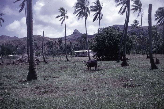
Malesso’ is a municipality on the southern tip of Guam, formerly known in English as Merizo. It faces Cocos Lagoon, a protected coastal lagoon separated from the open Pacific by barrier reefs and Cocos Island.
The village is connected with southern Guam by Route 4 and lies south of Hågat and Humåtak. Malesso’ is associated with the Merizo Bell Tower and the coastal waters around Cocos Island.
To the mapInalåhan Municipality

Inalåhan is located on Guam’s southeastern coast and is connected to the island’s main southern route by Route 4. The municipality includes a historic village area beside Inalåhan Bay and the Pacific Ocean.
Notable sites include the Inalåhan Pools, a coastal natural feature formed by reef and shoreline rock, and the village’s Spanish-period church setting. Inalåhan lies south of Talofofo and north of Malesso’ along Guam’s eastern-southern coast.
To the mapAsan Municipality
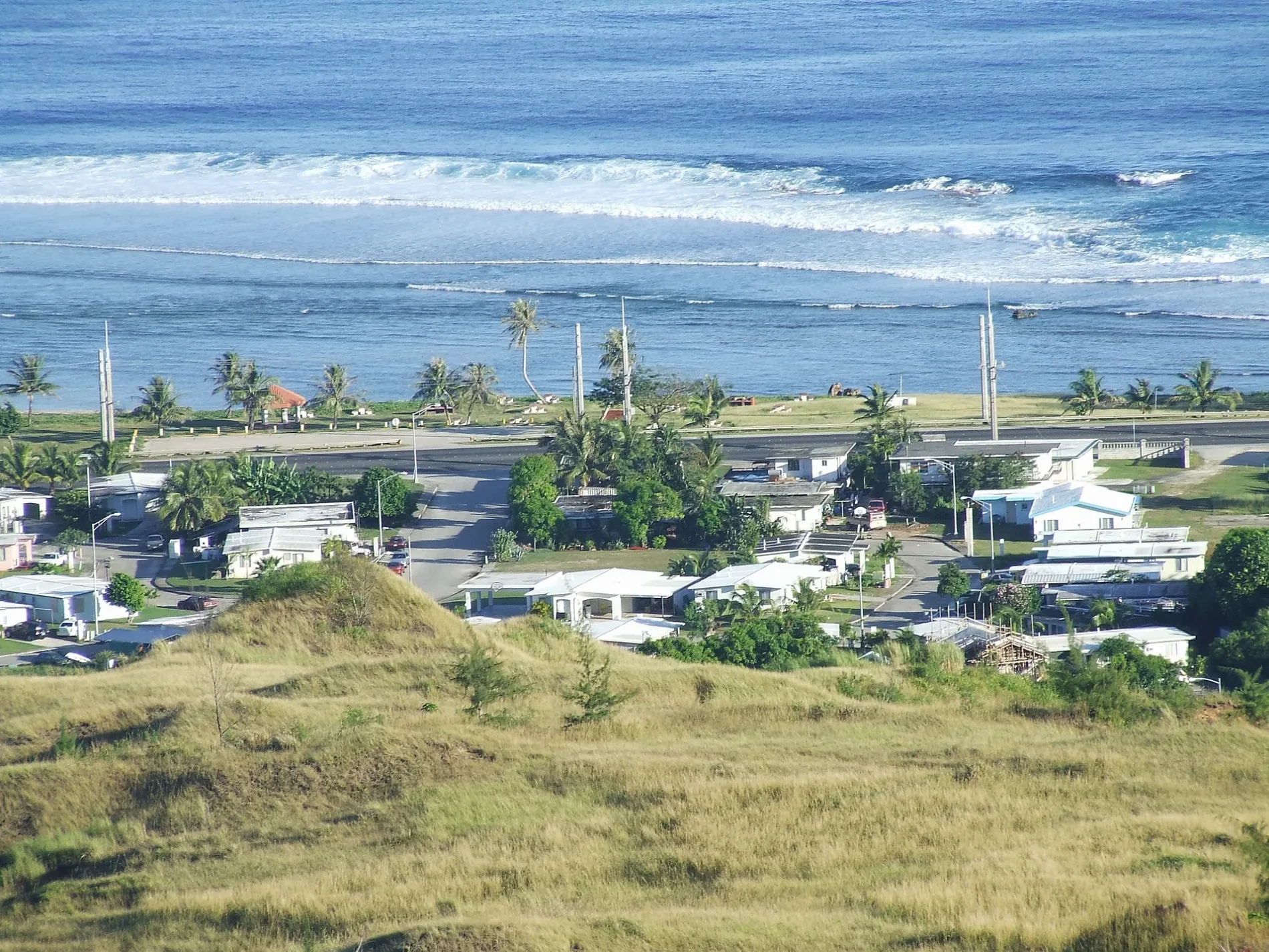
Asan occupies a coastal and hillside area immediately west of Hagåtña. The municipality is crossed by Route 1 and includes Asan Beach, a landing area associated with the United States recapture of Guam in July 1944.
Asan Beach is part of the War in the Pacific National Historical Park, which commemorates the 1944 campaign. The municipality’s shoreline faces the Philippine Sea, while steep slopes rise inland toward Guam’s central uplands.
To the mapHågat Municipality

Hågat lies on Guam’s southwestern coast between Sånta Rita-Sumai and Humåtak. The municipality is connected by Route 5 and includes Hågat Bay, a sheltered coastal indentation opening toward the Philippine Sea.
Hågat is associated with the historic village of Agat and with the southern part of the War in the Pacific National Historical Park. The coastal road links Hågat with Apra Harbor to the north and the villages of Humåtak and Malesso’ to the south.
To the mapData sources: OpenStreetMap (ODbL), Wikidata (CC0) · Image: Wikimedia Commons
| Year built | 1898 |
|---|---|
| Area | 544 km² |
| Located in | United States |
| Country | United States, Spanish Empire |
| Body of water | Pacific Ocean |
| Population | 153836 |
| Website | https://guam.gov |
| Nickname | Tånó y CHamoru |
| Native name | Guam |
| Official name | Guam |
| Part of | European Union tax haven blacklist |

 Public transit map Guam Legend
 | Railway | |
| Bus | |
| Tram |
 Bicycle map Guam Legend
 | Bike path | |
| Bike lane on roadway | |
| Cycling allowed on bus lane | |
| Bicycle street | |
| Open to cyclists | |
| Open to cyclists, good path | |
| Cycling prohibited | |
| Cobblestone |
| Long-distance bike route | (depending on scale) | |
| Long-distance bike route |
 Pedestrian map Guam Legend
 | Path |
| Long-distance hiking trail | (depending on scale) | |
| Long-distance hiking trail | ||
| Pedestrians prohibited |