
Idaho

Idaho
This page is the City map of Idaho, a state in the United States showing streets, paths and places across approximately 216,699 square kilometres. Idaho was admitted to the Union in 1890 and had 1,839,106 residents in 2020, compared with 1,567,582 in 2010. The state lies at an average elevation of about 1,524 metres and uses telephone area code 208. Its landscape includes the Snake River Plain, the Salmon River and the Rocky Mountains, while the map is divided into 48 subregions.
Ririe

Ririe is an incorporated city in Idaho and is mapped as an administrative level 8 subregion. It lies in eastern Idaho near the Snake River and the Ririe Reservoir. The city is located in the broader Bonneville County area, where Idaho Falls is the largest nearby urban centre. The map records Ririe as a city rather than as a county.
To the mapKamiah

Kamiah is an incorporated city in Idaho and an administrative level 8 subregion. It is situated in the Clearwater River region of north-central Idaho, near the valley associated with the Middle Fork Clearwater River. Kamiah lies in the area of Lewis and Nez Perce counties and is connected with the Nez Perce cultural landscape. The map classifies Kamiah as a city.
To the mapBurley

Burley is an Idaho town and the county seat of Cassia County. The mapped population is 11,704, and the city was established in 1905 at an elevation of 1,269 metres. Its recorded area is 16,681,928 square metres, and the community stands near the Snake River in southern Idaho. Burley is part of the agricultural Snake River Plain.
To the mapFort Hall

Fort Hall is mapped as a locality in Idaho at administrative level 8. It is located in the Snake River Plain near Pocatello and the Fort Hall Indian Reservation. The place takes its name from the historic Fort Hall trading post, which was established in the nineteenth-century fur-trade era. The surrounding landscape includes the Snake River and open basalt plains.
To the mapFremont County

Fremont County is an Idaho county with a recorded population of 13,388 and an area of 4,910 square kilometres. It was established in 1893 in the eastern part of the state. The county includes communities near the upper Henrys Fork and the western side of Yellowstone National Park. St. Anthony is the county seat, and Island Park is known for its forests and reservoirs.
To the mapBonneville County

Bonneville County has a recorded population of 110,089 and lies in eastern Idaho. Idaho Falls, on the Snake River, is the county seat and the principal urban centre. The county includes the Snake River Plain and reaches toward the Teton and Caribou mountain areas. Ririe and the Ririe Reservoir are located in the county’s eastern part.
To the mapCaribou County

Caribou County is an Idaho county with 7,027 recorded residents and an area of 4,658 square kilometres. It was established in 1919 in southeastern Idaho. Soda Springs is the county seat and is known for natural carbonated springs along the Bear River. The county extends across foothills and valleys near the Caribou-Targhee National Forest.
To the mapBear Lake County

Bear Lake County has 6,372 recorded residents and covers 2,718 square kilometres in southeastern Idaho. The county was established in 1875 and borders Bear Lake, a large natural lake shared with Utah. Paris is the county seat, and the Bear Lake valley lies between the Bear River Range and the surrounding highlands. The lake is the defining geographic feature of the county.
To the mapTeton County

Teton County has a recorded population of 11,630 and an area of 1,167 square kilometres. It was established in 1915 in eastern Idaho, west of the Teton Range. Driggs is the county seat, while Victor and Tetonia are other communities in the Teton Valley. The county’s eastern horizon is formed by the Grand Teton mountain landscape across the Idaho-Wyoming border.
To the mapBoundary County

Boundary County has 12,056 recorded residents and covers 3,311 square kilometres at Idaho’s northern border. It was established in 1915 and touches both Washington and Canada through the Idaho Panhandle region. Bonners Ferry is the county seat on the Kootenai River. The Selkirk and Purcell mountain ranges shape the county’s northern landscape.
To the mapBonner County

Bonner County has a recorded population of 47,110 and an area of 4,972 square kilometres. It was established in 1907 in the Idaho Panhandle. Sandpoint is the county seat and lies on Lake Pend Oreille, while Priest River is another major community. The county contains large lake and forest landscapes around the Pend Oreille River and Selkirk Mountains.
To the mapKootenai County
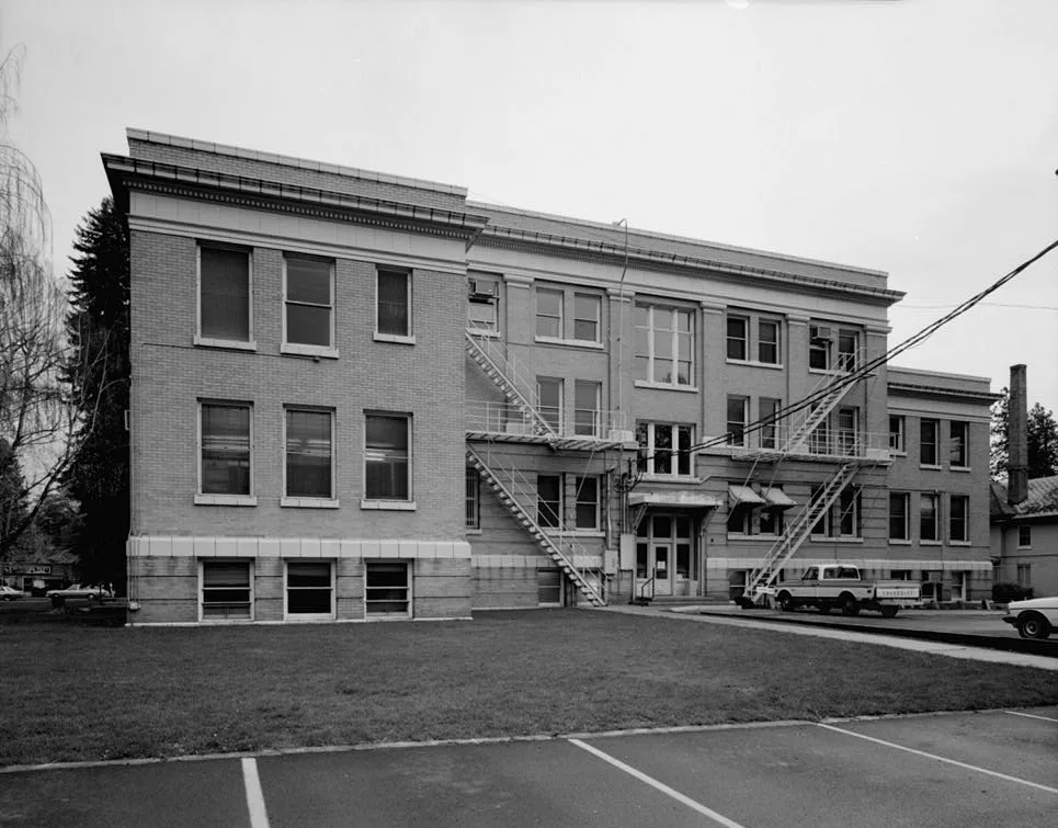
Kootenai County has 171,362 recorded residents and covers 3,408 square kilometres in northern Idaho. It was established in 1864, making it one of the state’s older counties. Coeur d’Alene is the county seat and stands beside Lake Coeur d’Alene, while Post Falls lies along the Spokane River. The county is part of the inland Pacific Northwest.
To the mapShoshone County

Shoshone County has 13,169 recorded residents and an area of 6,826 square kilometres. It was established in 1864 in the Idaho Panhandle and includes the historic Silver Valley. Wallace is the county seat, and the South Fork Coeur d’Alene River runs through the mining region. The Bitterroot and Coeur d’Alene mountains occupy much of the county.
To the mapAda County

Ada County has 494,967 recorded residents and covers 2,746 square kilometres in southwestern Idaho. It was established in 1864 and contains Boise, the capital and largest city of Idaho. The Boise River crosses the county, and Boise lies at the northern edge of the Snake River Plain. Meridian, Eagle and Garden City are also major urban communities in the county.
To the mapAdams County

Adams County has 4,379 recorded residents and an area of 3,548 square kilometres. It was established in 1911 in west-central Idaho. Council is the county seat, located in the valley of the Weiser River. The county reaches into the forested mountains of the Payette National Forest and includes parts of the Seven Devils region.
To the mapBannock County

Bannock County has 87,018 recorded residents and covers 2,972 square kilometres in southeastern Idaho. It was established in 1893, and Pocatello is its county seat and principal city. The Portneuf River passes through Pocatello before joining the Snake River. The county includes the Portneuf Range and the important transportation corridor between Utah and Idaho Falls.
To the mapBenewah County

Benewah County is an Idaho county mapped at administrative level 6 in the northern part of the state. St. Maries is the county seat and lies near the southern end of Lake Coeur d’Alene. The St. Joe River flows through the county toward the lake. Forested terrain and the Idaho Panhandle National Forest occupy much of the area.
To the mapBingham County

Bingham County has 44,990 recorded residents and lies in southeastern Idaho. Blackfoot is the county seat and stands on the Snake River Plain. The Snake River crosses the county, whose agricultural land includes irrigated fields and potato production. Bingham County is situated between Idaho Falls and Pocatello.
To the mapBlaine County

Blaine County has 24,272 recorded residents and covers 6,892 square kilometres in central Idaho. It was established in 1895, and Hailey is the county seat. Ketchum and Sun Valley lie in the Wood River Valley below the Sawtooth and Boulder mountains. The county includes high mountain terrain, including access to the Sawtooth National Recreation Area.
To the mapButte County

Butte County is an Idaho county at administrative level 6 in the eastern part of the state. Arco is the county seat and lies near the Big Lost River valley. The county includes the Craters of the Moon volcanic landscape, formed by basaltic lava flows on the Snake River Plain. Nearby Idaho National Laboratory occupies a large area east of the county.
To the mapCamas County

Camas County is an Idaho county at administrative level 6 in the south-central part of the state. Fairfield is the county seat and lies in the Camas Prairie between mountain ranges. Camas Creek drains the county toward the Big Wood River system. The county’s landscape includes open high-elevation grasslands and the Soldier Mountains.
To the mapCanyon County

Canyon County has 231,105 recorded residents and covers 1,563 square kilometres in southwestern Idaho. It was established in 1891, and Caldwell is the county seat. Nampa, Caldwell and Middleton form a major urban belt west of Boise, while the Boise River crosses the county. The Snake River forms part of the county’s southern boundary.
To the mapCassia County

Cassia County has 24,655 recorded residents and an area of 6,683 square kilometres. It was established in 1879 in southern Idaho, and Burley is the county seat. The Snake River runs along the northern part of the county near the Magic Valley. The southern landscape rises toward the Albion Mountains and the Idaho-Utah border.
To the mapClark County

Clark County has 790 recorded residents and covers 4,572 square kilometres in eastern Idaho. It was established in 1919, and Dubois is the county seat. The county occupies high desert and volcanic terrain north of the Snake River Plain. The Continental Divide forms part of the eastern regional landscape near the Montana border.
To the mapClearwater County

Clearwater County has 8,734 recorded residents and an area of 6,444 square kilometres. It was established in 1911 in north-central Idaho, with Orofino as the county seat. The Clearwater River flows through Orofino and joins the Snake River downstream. The county includes forested mountains and sections of the Nez Perce-Clearwater National Forests.
To the mapBoise County

Boise County has 7,610 recorded residents and covers 4,938 square kilometres. It was established in 1864 in the mountains north of Boise, and Idaho City is the county seat. The South Fork of the Payette River and the Boise River drainage cross the county. Historic Idaho City developed during the nineteenth-century Boise Basin gold rush.
To the mapCuster County

Custer County has 4,275 recorded residents and an area of 12,786 square kilometres, making it one of Idaho’s largest counties by area. It was established in 1881 in central Idaho, and Challis is the county seat. The Salmon River and its tributaries cross the county, while the Sawtooth and Salmon-Challis national forests cover extensive mountain areas. The Lost River Range includes Idaho’s highest summit, Borah Peak, nearby.
To the mapElmore County

Elmore County has 25,876 recorded residents and lies in southwestern Idaho. Mountain Home is the county seat and is located on the Snake River Plain east of Boise. The Boise River enters the county near C. J. Strike Reservoir before reaching the Snake River. Mountain ranges and desert basins surround the county’s populated agricultural corridor.
To the mapFranklin County

Franklin County is an Idaho county at administrative level 6 in the southeastern corner of the state. Preston is the county seat and lies in the Cache Valley near the Utah border. The Bear River drains the valley through nearby northern Utah and Idaho. Franklin County’s eastern edge approaches the Wasatch and Bear River mountain systems.
To the mapGem County

Gem County has 19,123 recorded residents and covers 1,465 square kilometres. It was established in 1915 in southwestern Idaho, and Emmett is the county seat. The Payette River flows through the Emmett Valley before joining the Snake River. The county lies between the Boise Mountains to the east and the lower Payette Valley to the west.
To the mapGooding County

Gooding County has 15,284 recorded residents and lies in south-central Idaho. Gooding is the county seat on the northern side of the Snake River Plain. The Malad River and the Snake River shape the county’s canyon and plateau landscapes. Gooding County is part of the Magic Valley, where irrigation supports agriculture.
To the mapIdaho County
Idaho County has 16,541 recorded residents and a recorded area of 22,021 square kilometres. It was established in 1864 and is the largest Idaho county by area; Grangeville is the county seat. The Salmon River and the South Fork Clearwater River cut through rugged central and north-central mountains. The county includes large areas of the Nez Perce-Clearwater National Forests and the Frank Church-River of No Return Wilderness.
To the mapJefferson County

Jefferson County has 27,157 recorded residents and lies in eastern Idaho. Rigby is the county seat, and the county extends across the Snake River Plain north of Idaho Falls. The Snake River forms a major drainage corridor through the area. Jefferson County also includes agricultural land near the foothills of the Teton and Lemhi ranges.
To the mapJerome County

Jerome County has 22,814 recorded residents and is located in the Magic Valley of southern Idaho. Jerome is the county seat on the Snake River Plain. The Snake River cuts the county’s northern edge through the deep Snake River Canyon. Irrigated farms and transport links connect Jerome with Twin Falls and other communities in the valley.
To the mapLatah County

Latah County has 39,517 recorded residents and covers 2,789 square kilometres in northern Idaho. It was established in 1864, and Moscow is the county seat and home of the University of Idaho. The Palouse landscape extends across the county with rolling agricultural hills. The Potlatch River and eastern tributaries drain toward the Clearwater River.
To the mapLemhi County

Lemhi County has 7,974 recorded residents and an area of 11,835 square kilometres. It was established in 1869 in eastern Idaho, and Salmon is the county seat. The Salmon River runs through the county, which contains the Lemhi and Bitterroot mountain ranges. The Continental Divide marks the eastern boundary near Montana.
To the mapLewis County

Lewis County is an Idaho county at administrative level 6 in north-central Idaho. Nezperce is the county seat, and the county lies between the Clearwater River and the lower Camas Prairie. The South Fork Clearwater River forms part of the regional drainage network. Agricultural plateaus and forested river valleys define the terrain around Kamiah and Craigmont.
To the mapLincoln County

Lincoln County is an Idaho county at administrative level 6 in the southern part of the state. Shoshone is the county seat and lies on the Snake River Plain. The Big Wood River approaches the county from the north before entering the Snake River system. The county contains irrigated agricultural land and high desert terrain near the Magic Valley.
To the mapMadison County

Madison County has 52,913 recorded residents and covers 1,226 square kilometres. It was established in 1913 in eastern Idaho, and Rexburg is the county seat. The Henrys Fork of the Snake River flows through the county’s agricultural plain. Madison County is also associated with Brigham Young University-Idaho, whose campus is in Rexburg.
To the mapMinidoka County

Minidoka County has 21,613 recorded residents and an area of 1,976 square kilometres. It was established in 1913 in southern Idaho, and Rupert is the county seat. The Snake River crosses the county near Minidoka Dam and the Minidoka National Historic Site. Irrigation from the river supports farms across the northern Snake River Plain.
To the mapNez Perce County

Nez Perce County has 42,090 recorded residents and covers 2,218 square kilometres. It was established in 1864, and Lewiston is the county seat at the confluence of the Snake and Clearwater rivers. The Port of Lewiston connects inland Idaho with the lower Columbia-Snake waterway. The county includes the historic Nez Perce cultural region and rolling Palouse uplands.
To the mapOneida County

Oneida County is an Idaho county at administrative level 6 in the far southeast of the state. Malad City is the county seat and lies in the Malad Valley near the Utah border. The Malad River drains northward through the valley toward the Snake River system. The county’s terrain consists of agricultural valleys surrounded by the Bannock and Malad highlands.
To the mapOwyhee County

Owyhee County has 11,913 recorded residents and an area of 19,934 square kilometres. It was established in 1863 and is Idaho’s largest county by land area, with Homedale as the county seat. The Owyhee River cuts through deep canyons and high desert in the southwestern part of the state. The county extends from the Snake River near the Oregon border toward the Nevada line.
To the mapPayette County

Payette County has 25,386 recorded residents and covers 1,062 square kilometres. It was established in 1917, and Payette is the county seat near the Snake River. The Payette River joins the Snake River at the county’s western side. Orchards, farms and towns occupy the lower Payette Valley north of the Snake River Plain.
To the mapPower County

Power County is an Idaho county with a recorded area of 3,736 square kilometres and a population of 7,878. It was established in 1913 in southeastern Idaho, and American Falls is the county seat. The Snake River forms the county’s main watercourse and fills American Falls Reservoir. The landscape combines irrigated farmland on the Snake River Plain with volcanic uplands.
To the mapTwin Falls County

Twin Falls County has 82,375 recorded residents and lies in southern Idaho. Twin Falls is the county seat and stands beside the Snake River Canyon. Shoshone Falls, on the Snake River east of the city, is one of the county’s best-known natural features. The county forms a central part of the agricultural Magic Valley.
To the mapValley County

Valley County has 11,746 recorded residents and covers 9,670 square kilometres. It was established in 1917 in west-central Idaho, and Cascade is the county seat. The North Fork and South Fork of the Payette River flow through mountain valleys and reservoirs. McCall, on the shore of Payette Lake, is the county’s best-known lakeside community.
To the mapWashington County

Washington County has 10,500 recorded residents and an area of 3,818 square kilometres. It was established in 1879 in western Idaho, and Weiser is the county seat at the confluence of the Weiser and Snake rivers. The county borders Oregon along the Snake River. The Weiser River Valley extends northward from the county seat into the foothills of west-central Idaho.
Idaho contains two documented long-distance cycling routes, including United States Bicycle Route 20.
To the mapData sources: OpenStreetMap (ODbL), Wikidata (CC0) · Image: Wikimedia Commons
| Year built | 1890 |
|---|---|
| Area | 216699 km² |
| Elevation | 1524 m |
| Located in | United States |
| Country | United States |
| Population | 1839106 |
| Website | https://www.idaho.gov |
| Nickname | Gem State |
| Native name | Idaho |
| Official name | State of Idaho |

 Public transit map Idaho Legend
 | Railway | |
| Bus | |
| Tram |
 Bicycle map Idaho Legend
 | Bike path | |
| Bike lane on roadway | |
| Cycling allowed on bus lane | |
| Bicycle street | |
| Open to cyclists | |
| Open to cyclists, good path | |
| Cycling prohibited | |
| Cobblestone |
| Long-distance bike route | (depending on scale) | |
| Long-distance bike route |
 Pedestrian map Idaho Legend
 | Path |
| Long-distance hiking trail | (depending on scale) | |
| Long-distance hiking trail | ||
| Pedestrians prohibited |