
West Central Road in Arlington Heights, Illinois
West Central Road in Arlington Heights is an asphalted secondary road (60005). It runs in an east-west direction and crosses South Fernandez Avenue, West Drive, West Kirchhoff Road, East Central Road, South Dunton Avenue, New Wilke Road, South New Wilke Road, Central Road, South Dwyer Avenue, South Ridge Avenue, South Walnut Avenue and South Mitchell Avenue. Ⓦ.
- Road Type
- secondary road
- Postal Code
- 60005
- Route
- east-west
Image
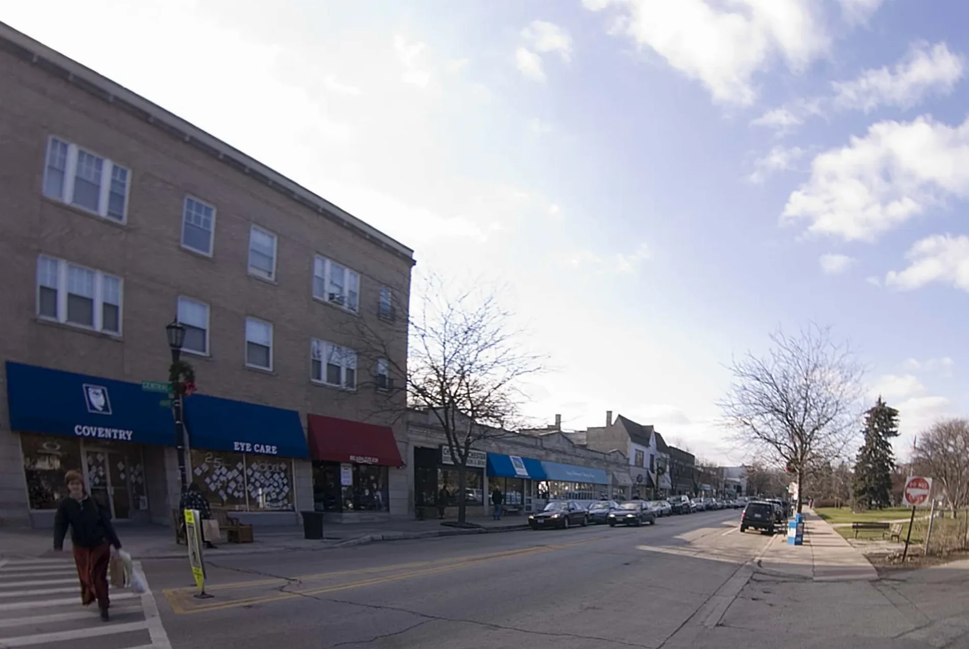
Beauty salons
Convenience stores
Sewing supply stores
Doctor's offices
Jewelry stores
Dry cleaners
Restaurants
Places of worship
Clothing stores
Wine shops
Fast food restaurants
Dentist offices
Auto repair shops
Veterinary clinics
Liquor stores
Pet stores
Training centers
Streets nearby
South Dunton AvenueChoice Nails, CoCo & Blu, Persin & Robbin Jewelers, Chick 'n Fizz, Flaherty Jewelers, Jimmy John's, Cilantro
100 ft
East Central RoadArlington Automotive, March Animal Hospital
200 ft
South Vail AvenueVail Street Parking Garage, Hey Nonny, Obsession, Special Eyes Optical, Lakemoor Dental & Orthodontics, Old National Bank
400 ft
South Evergreen AvenuePassero, Vintages, J Nails, Fausto's, Robyn's Nest, Liberty Cleaners, Starbucks, Once Upon a Bagel
0.1 mi
West Orchard Street0.2 mi
East Magnolia StreetDondi's Pizza, Scooby's Red Hots
0.2 mi
East Maple Street0.2 mi
South Belmont AvenueScarsdale
0.3 mi
East Cypress Street0.3 mi
West Cypress Street0.3 mi
South Chestnut Avenue0.3 mi
South Haddow Avenue0.4 mi
East Rockwell Street0.4 mi
South Mitchell Avenue0.4 mi
South Arlington Heights RoadFrancesca's, Tous les Jours, DaVita Dialysis, Emmaus Covenant Church, Northwest Suburban Pain Center, Transformations, Orthodontic Experts, Noodles & Company, Alt Thai, Mochinut, Chennai Central South Indian Kitchen
0.4 mi
West Rockwell Street0.4 mi
East Drive0.4 mi
South Burton Place0.4 mi
South Walnut Avenue0.4 mi
South Ridge Avenue0.5 mi
East White Oak Street0.5 mi
West Magnolia Street0.5 mi
East Ryan Court0.5 mi
South Pine AvenueThe Grove Mart Cafe
0.5 mi
South Drive0.5 mi
South Fernandez Avenue0.5 mi
East Cedar Street0.5 mi
South Salem Lane0.6 mi
North Drive0.6 mi
Emergency Drive0.6 mi
West Cedar Street0.6 mi
West Maple Street0.6 mi
West Noyes Street0.6 mi
South Highland AvenueForbici, Walter Zattera DDS Family Dentistry
0.6 mi
Kaspar Avenue0.6 mi
West White Oak Street0.6 mi
Clinics nearby
Day Surgery Center0.5 mi
Busse Center for Speciality Medicine0.6 mi
Golf courses nearby
Arlington Lakes Golf Course0.5 mi
Hospitals nearby
South Pavillion0.5 mi
Power Plant0.6 mi
Parking lots nearby
Parking Garage A0.4 mi
Emergency & Employee Garage0.6 mi
Parks nearby
Cypress Park0.2 mi
Dunton School0.4 mi
Places of worship nearby
Saint Simon's Episcopal Church0.5 mi
Preschools nearby
KinderCare0.2 mi
Other nearby
DCE 390.2 mi
Northwest Community Hospital Heliport0.6 mi
| Located in | Evanston |
|---|---|
| Country | United States |
Public transit map Arlington Heights Legend
| Railway | |
| Bus | |
| Streetcar |
Bicycle map Arlington Heights Legend
| Bike path | |
| Bike lane on roadway | |
| Cycling allowed on bus lane | |
| Bicycle street | |
| Open to cyclists | |
| Open to cyclists, good path | |
| Cycling prohibited | |
| Cobblestone |
| Long-distance bike route | (depending on scale) | |
| Long-distance bike route |
Pedestrian map Arlington Heights Legend
| Path |
| Long-distance hiking trail | (depending on scale) | |
| Long-distance hiking trail | ||
| Pedestrians prohibited |