
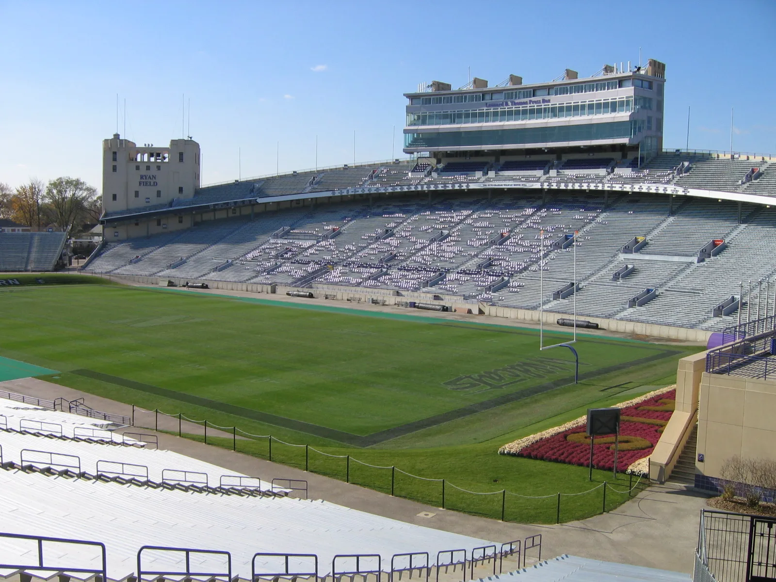
Ryan Field in Evanston, Illinois
Ryan Field in Evanston is a construction site (Elevation 184 m), Central Street 1501 (60201). Ryan Field is also known as Dyche Stadium. Ⓦ.
- House Number
- 1501
- Postal Code
- 60201
- Street
- Central Street
- Land Use
- construction site
- Website
- https://nusports.com/trads/nw-ryanfield.html
Image
Vending machines
Bakeries
Dentist offices
Bus stops
Streets nearby
Rosalie Street500 ft
Chancellor Street500 ft
Asbury AvenueAsbury & Brummel, CVS Pharmacy, Asbury & Mulford, Asbury & Harvard, Asbury & Oakton
0.1 mi
Jackson AvenueWalgreens
0.1 mi
Wesley Avenue0.2 mi
Ashland AvenuePaul Stevens Plaza, Bucephalus Bikes, Asenchen of Our Lord, Ashland & Simpson, Ashland & Payne, Ashland Arts
0.2 mi
Bryant Avenue0.2 mi
Lincoln StreetHaven Middle School, Green Bay & Lincoln
0.2 mi
Eastwood Avenue0.2 mi
Harrison StreetCentral St Metra
0.2 mi
Colfax Street0.3 mi
Colfax Terrace0.3 mi
Evanston-Wilmette Community Trail0.3 mi
Wellman Way0.3 mi
Hampton Parkway0.3 mi
Poplar AvenueEvanston Central Street
0.3 mi
Girard Avenue0.3 mi
Green Bay RoadVerizon, FedEx Office, Benjamin Moore, Evanston Central Street, Green Bay & Simpson, Green Bay & Jackson, Green Bay & McCormick, Kingsley Elementary School, Green Bay & Central (Metra), Green Bay & Noyes, Green Bay & Lincoln, Hollywood Feed, Green Bay & Isabella, Enterprise, Hertz, Sherwin-Williams, Green Bay & Emerson
0.3 mi
Central StreetCentral & Broadway/Poplar (Metra), Hewn, Central & Sherman, Central & Orrington, Central & Sheridan, Bluestone Cafe, Evanston North Post Office, Old Town Oil, hometech, Video Adventure, Pinto Kitchen, Christian Science Reading Room, Ad Hoc Home, The Spice House, MilleFiori, DeSalvo's Pizza, MyEyeDr., Tag's Bakery, Celtic Knot Public House, Paper Source, Foodstuffs, Vinissimo Wine Shop, Great Harvest Bakery, Central & Hartrey, Heroines & Heroes, Treat Nail Lounge, Central & Asbury, Central & Ashland, Central & Jackson, Central & Crawford, Kenny the Kleener, Starbucks, Central & Prospect, Central & Ridge, Curt's Cafe, Central & Lincolnwood, Byline Bank, Cameo Nail & Spa, Central & Cowper, Central & Central Park, Central & Lawndale, Chase, Fresenius Kidney Care, Central & Bennett, BMO, Northshore Fireplace, The UPS Store, Central & Ewing, Central & Reese, Central & McDaniel, Central & Walnut, Leonidas, Central & Green Bay (Metra), Trio Evanston Salon, Central Shoe Repair, Ardor Nail Lounge, Hogeye Music, Bonsai Cafe, Central & Eastwood, Ten Mile House, Central, Central & Girard (Purple Line), Central St & Girard Ave, Ventra
0.3 mi
Broadway AvenueBowdental of Evanston
0.4 mi
Isabella Street0.4 mi
Livingston StreetBaskin-Robbins, Green Bay & Livingston
0.4 mi
Jenks Street0.4 mi
Dupee Place0.4 mi
3rd StreetIsabella, 3rd Street & Central
0.4 mi
Gregory Avenue0.4 mi
Apartment buildings nearby
Central Station Apartments0.3 mi
Arts centers nearby
Evanston Art Center0.3 mi
Banks nearby
Chase0.4 mi
Canals nearby
North Shore Channel0.2 mi
Fast food restaurants nearby
Mustard's Last Stand0.2 mi
Fire stations nearby
Evanston Fire Department Station #230.3 mi
Parking lots nearby
NorthShore Evanston Parking Garage0.3 mi
Parks nearby
Chandler Park0.3 mi
Catherine Waugh McCulloch Park0.3 mi
Places of worship nearby
Saint Athanasius Roman Catholic Church0.2 mi
Railways nearby
UP Kenosha Subdivision0.3 mi
Sports centers nearby
Trienens Performance Center0.2 mi
Harry L. Wells Complex0.2 mi
Sports fields nearby
Sharon J. Drysdale Field0.2 mi
Koldyke Family Field0.3 mi
Stadiums nearby
McGaw Memorial Hall0.2 mi
Rocky and Berence Miller Park0.3 mi
Subway lines nearby
Evanston Branch0.3 mi
Train stations nearby
CTA Central Street Station0.3 mi
Evanston Central Street0.4 mi
University buildings nearby
Anderson Hall0.2 mi
Canning Family Private Suite0.3 mi
Mogentale Players' Lounge0.3 mi
| Named after | Patrick George Ryan |
|---|---|
| Dissolved | 2024 |
| Located in | Evanston |
| Country | United States |
| Location | Northwestern University |
 Public transit map Evanston Legend
| Railway | |
| Bus | |
| Streetcar |
 Bicycle map Evanston Legend
| Bike path | |
| Bike lane on roadway | |
| Cycling allowed on bus lane | |
| Bicycle street | |
| Open to cyclists | |
| Open to cyclists, good path | |
| Cycling prohibited | |
| Cobblestone |
| Long-distance bike route | (depending on scale) | |
| Long-distance bike route |
 Pedestrian map Evanston Legend
| Path |
| Long-distance hiking trail | (depending on scale) | |
| Long-distance hiking trail | ||
| Pedestrians prohibited |