
Central CTA Station in Austin, Chicago, Illinois
Central CTA Station in Austin in Chicago is a train station, North Central Avenue 350 (60644). Ⓦ.
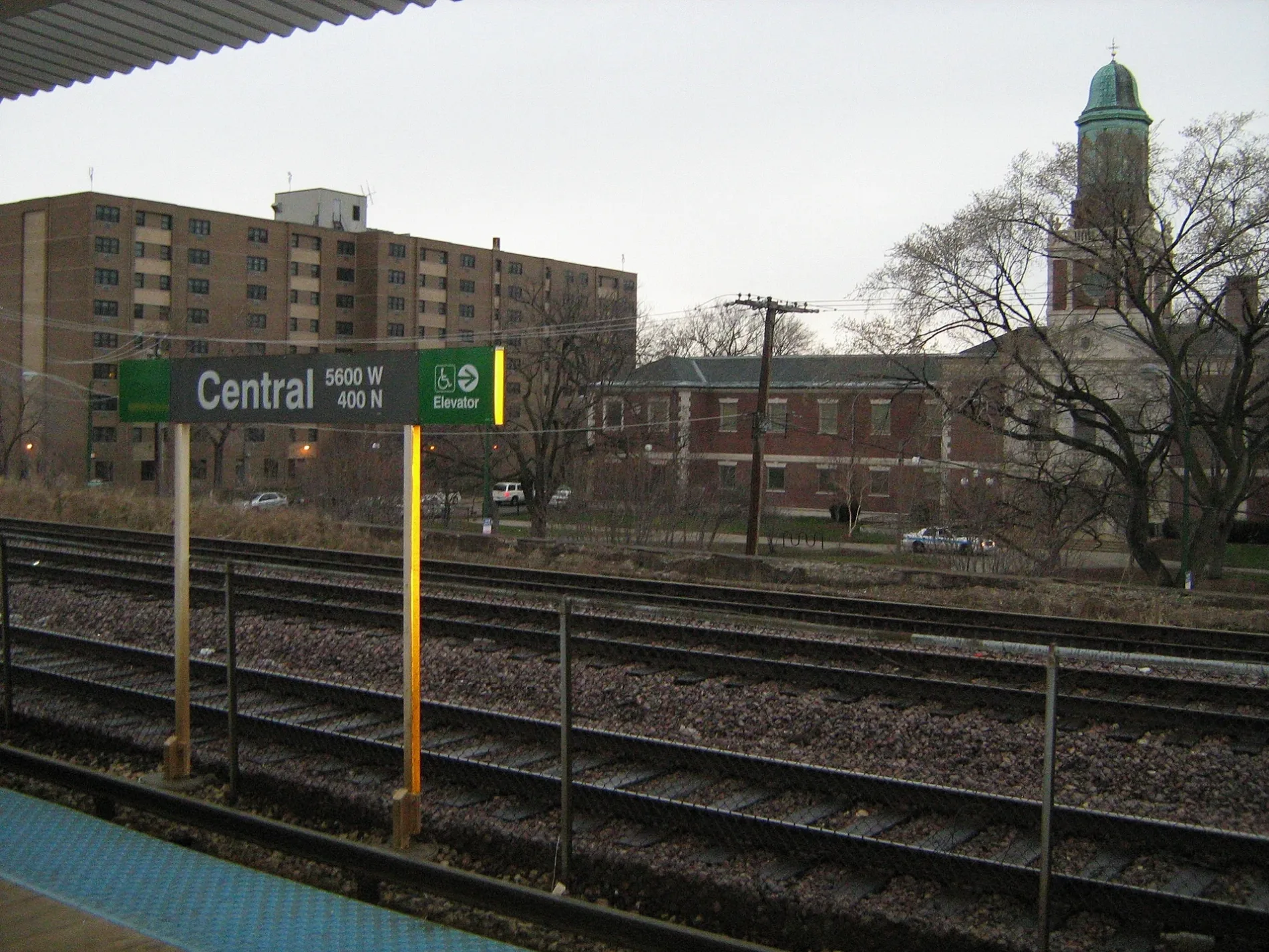
- House Number
- 350
- Street
- North Central Avenue
- Operator
- Chicago Transit Authority
- Website
- http://www.transitchicago.com/travel_information/station.aspx?StopId=33
- Postal Code
- 60644
- Wheelchair Access
- yes
- Building Type
- train station
Bus stops
Places of worship
Event venues
Schools
Vending machines
Stations
Subway stops
Streets nearby
West Lake StreetCicero, Lake & Austin, New Sound Cafe, Laramie, Lavergne, Unity Fellowship Baptist Church, Ventra
450 ft
North Pine AvenuePine Ave & Division St, Mount Calvary Church of God in Christ, Pine Avenue United Church
0.1 mi
North Lotus AvenueCommunity Lutheran School
0.2 mi
West West End AvenueCentral & West End
0.2 mi
North Central AvenueCentral & Ohio, Central & Huron, 1900 N Central, Central & Armitage (Metra), Central & Potomac, Central & Hirsch, Central & Division, Central & North Ave, Central & Bloomingdale, Central & Thomas, Central & Washington, Central & Madison, Central & Augusta, Central & Chicago, Central & Iowa, Central & Le Moyne, Central, Central & Race, Austin, Central & Lake, Central & Lake (Green Line), Lily of the Valley Baptist Church, Central & Corcoran (Green Line), Central & Corcoran
0.2 mi
North Parkside AvenueSunny Mount Zion Missionary Baptist Church, Greater First Baptist Missionary Baptist Church, Unity of Love Church
0.2 mi
West Fulton StreetCentral & Fulton
0.3 mi
West Midway Park0.3 mi
North Long AvenueLong Ave & North Ave
0.3 mi
North Waller Avenue0.3 mi
West Ohio StreetProgressive True-Vine MB Church, Laramie & Ohio
0.3 mi
West Race AvenueUniversal Missionary Baptist Church
0.3 mi
North Menard AvenueMenard Ave & North Ave, Saint Pauls School, Saint Angela School, New Greater Saint James Missionary Baptist Church, Menard Ave & Division St
0.3 mi
West Washington BoulevardGods All Nations Pentecostal Church, Saint John Church of God in Christ, Catalyst Circle Rock Charter School, Rock of Our Salvation Church, Circle Urban Ministries
0.4 mi
North Mayfield Avenue0.4 mi
West Madison StreetUncle Remus, Austin School of Beauty Culture, Miriam Daniels School, Winners Sports Bar & Grill, Terry's Place, Madison & Mayfield, Ted’s Place, Subway, Madison & Austin Terminal, Madison & Menard, Madison & Parkside, Bethel Green Missionary Baptist Church, Bethlehem Unity Missionary Baptist Church, Madison & Waller, Austin Blvd & Madison St, Madison & Austin, Central Ave & Madison St, Madison & Central, Madison & Lotus, Madison & Kilpatrick, Kenton Ave & Madison St, Madison & Kenton, Knee Way Pentecostal Church of God in Christ, Greater New Birth Church of God in Christ, Madison & Cicero, Metro by T-Mobile, Madison & Lamon, Laramie Ave & Madison St, Madison & Laramie, Earl Bedford School of Music, Madison & Leclaire, The Licking, Saint Jude Church of God in Christ, Holy Mission Church of God in Christ, Madison & Lockwood, Madison & Long, U-Haul, Boost Mobile, Smith & Thomas Funeral Home, Madison & Lavergne, Saint Jude Spiritual Church, Soul Saving Missionary Baptist Church, Primo Center
0.5 mi
Apartment buildings nearby
Lorraine Hansberry Apartments0.1 mi
Menard Apartments0.3 mi
Clinics nearby
PCC Austin Family Health Center0.2 mi
Commercial buildings nearby
Former Austin YMCA0.2 mi
Fire stations nearby
Chicago Fire Department Engine Company 960.1 mi
Gardens nearby
PCC Austin Farm0.2 mi
Houses nearby
Marie Schock House0.3 mi
F. R. Schock House0.3 mi
Beeson House0.3 mi
Hitchcock House0.3 mi
Schlect House0.3 mi
JJ. Walser House0.4 mi
Libraries nearby
Henry W. Austin Branch Library0.1 mi
Office buildings nearby
Austin State Bank Landmark Building550 ft
Parks nearby
Austin Town Hall Park0.1 mi
Levin Park0.3 mi
Places of worship nearby
Kingdom Missionary Baptist Church550 ft
Gammon United Methodist Church0.2 mi
Greater Holy Temple Church of God in Christ0.2 mi
Austin United Presbyterian Church0.2 mi
Saint Martin's Episcopal Church0.2 mi
Christ Unity Church0.3 mi
Third Unitarian Church0.3 mi
Playgrounds nearby
Austin Playground0.4 mi
Railways nearby
Geneva Subdivision0.1 mi
Residential buildings nearby
Parkside Terraces0.3 mi
Faith Residences0.3 mi
Retail areas nearby
Madison-Central Plaza0.5 mi
School buildings nearby
Former Francis Scott Key Elementary School0.2 mi
Former Robert Emmet Elementary School0.4 mi
Social facilities nearby
Senior Suites Of Austin0.2 mi
Sports centers nearby
Austin Town Hall400 ft
Subway lines nearby
Lake Branch0.3 mi
| Official opening | 1899 |
|---|---|
| Owned by | Chicago Transit Authority |
| Located in | Oak Park |
| Country | United States |
Public transit map Austin Legend
| Railway | |
| Bus | |
| Streetcar |
Bicycle map Austin Legend
| Bike path | |
| Bike lane on roadway | |
| Cycling allowed on bus lane | |
| Bicycle street | |
| Open to cyclists | |
| Open to cyclists, good path | |
| Cycling prohibited | |
| Cobblestone |
| Long-distance bike route | (depending on scale) | |
| Long-distance bike route |
Pedestrian map Austin Legend
| Path |
| Long-distance hiking trail | (depending on scale) | |
| Long-distance hiking trail | ||
| Pedestrians prohibited |