
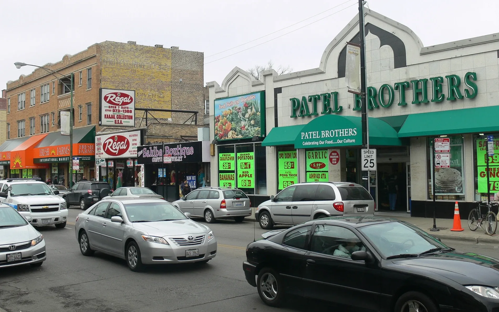
West Devon Avenue in Edison Park, Chicago, Illinois
West Devon Avenue in Edison Park in Chicago is a four-lane, asphalted, lit local road. It runs in an east-west direction and crosses North Kinzua Avenue, North Central Avenue, North Minnehaha Avenue, North Spokane Avenue, North Nokomis Avenue, North Navajo Avenue, North Hiawatha Avenue, North Le Mai Avenue, North Avondale Avenue, North Northwest Highway, North Harlem Avenue and North Neva Avenue. It connects Forest Glen, Norwood Park, North Park and Edison Park. West Devon Avenue is also known as Devon. Nearby there is a fast food restaurant. The nearest bus stop is Northwest Hwy & Devon (about 50 m away). West Devon Avenue also exists in Rogers Park and West Ridge. Ⓦ.
- Road Type
- local road
- Lanes
- 4
- Route
- east-west
Image
Fast food restaurants
Streets nearby
North Avondale AvenueAvondale & Highland , Edison Park
400 ft
North Northwest HighwayBP Shop, Northwest Hwy & Ozark, Northwest Hwy & Oliplhant (Metra), Northwest Hwy & Overhill, Tony’s Italian Deli & Subs, 6487 N Northwest Hwy, Northwest Hwy & Oketo, 6486 N Northwest Hwy, Northwest Hwy & Devon, Northwest Hwy & Harlem, Northwest Hwy & Oliphant (Metra), Northwest Hwy & Ogallah, Emerald Isle
400 ft
West Highland Avenue500 ft
North Oketo Avenue0.1 mi
West Palatine AvenueCanfield & Palatine, Palatine & Harlem
0.2 mi
North Harlem AvenueHarlem & Avondale, Harlem & Berwyn, Harlem & Foster, Bank of America, Harlem & Devon, Harlem & Northwest Hwy, Harlem & Talcott, Harlem & Farragut, Belarada, The Purple Tulip Cakery, Harlem & Higgins, Dollar Tree, Harlem & Rascher, Harlem & Balmoral, Harlem Blue Line Station (East Entrance), Harlem & Hood, Harlem & Myrtle, Harlem & Thorndale, Harlem & Peterson, Harlem & Summerdale
0.2 mi
North Oconto Avenue0.2 mi
West Clarence Avenue0.2 mi
West Schreiber Avenue0.2 mi
North Octavia Avenue0.2 mi
North Neva AvenueMather’s More Than a Cafe
0.2 mi
West Arthur Avenue0.2 mi
West Albion Avenue0.3 mi
West Hayes AvenueImmaculate Conception
0.3 mi
West Hortense Avenue0.3 mi
West Myrtle AvenueHarlem & Myrtle
0.3 mi
North Odell Avenue0.3 mi
West Imlay Street0.3 mi
North Nordica Avenue0.3 mi
North Nixon Avenue0.3 mi
North Olmsted AvenueSoup & Scoops, Metra
0.3 mi
North Olcott Avenue0.3 mi
West Isham Avenue0.3 mi
North Ogallah AvenueNorthwest Hwy & Ogallah
0.3 mi
West Everell Avenue0.3 mi
West North Shore Avenue0.4 mi
West Hood Avenue0.4 mi
North Olympia Avenue0.4 mi
North Onarga Avenue0.5 mi
North Oxford Avenue0.5 mi
West Pratt AvenueEdison Park
0.5 mi
Shops nearby
Former Bank of America0.5 mi
Banks nearby
Signature Bank450 ft
PNC Bank0.1 mi
Cafes nearby
Starbucks0.1 mi
Cell phone stores nearby
Verizon0.1 mi
Fast food restaurants nearby
Brandy's Gyros0.2 mi
Funeral homes nearby
Olson Funeral Home550 ft
Gas stations nearby
BP450 ft
Office buildings nearby
Avondale Office Center250 ft
Teamsters Local 734 Headquarters0.4 mi
Parks nearby
Olympia Park0.3 mi
Places of worship nearby
Jehovahs Witnesses Norwood Park Unit0.3 mi
Saint Alban's Episcopal Church0.3 mi
Church of the Full Gospel0.3 mi
Post offices nearby
Norwood Park Post Office0.2 mi
Railways nearby
UP Harvard Subdivision0.4 mi
School buildings nearby
Edison Park School Annex0.4 mi
Self storages nearby
Safeguard Self Storage0.3 mi
Sports centers nearby
Olympia Park Fieldhouse0.4 mi
| Named after | Devon |
|---|---|
| Located in | Chicago, West Ridge |
| Postal code | 60645 |
| Country | United States |
Public transit map Edison Park Legend
| Railway | |
| Bus | |
| Streetcar |
Bicycle map Edison Park Legend
| Bike path | |
| Bike lane on roadway | |
| Cycling allowed on bus lane | |
| Bicycle street | |
| Open to cyclists | |
| Open to cyclists, good path | |
| Cycling prohibited | |
| Cobblestone |
| Long-distance bike route | (depending on scale) | |
| Long-distance bike route |
Pedestrian map Edison Park Legend
| Path |
| Long-distance hiking trail | (depending on scale) | |
| Long-distance hiking trail | ||
| Pedestrians prohibited |