
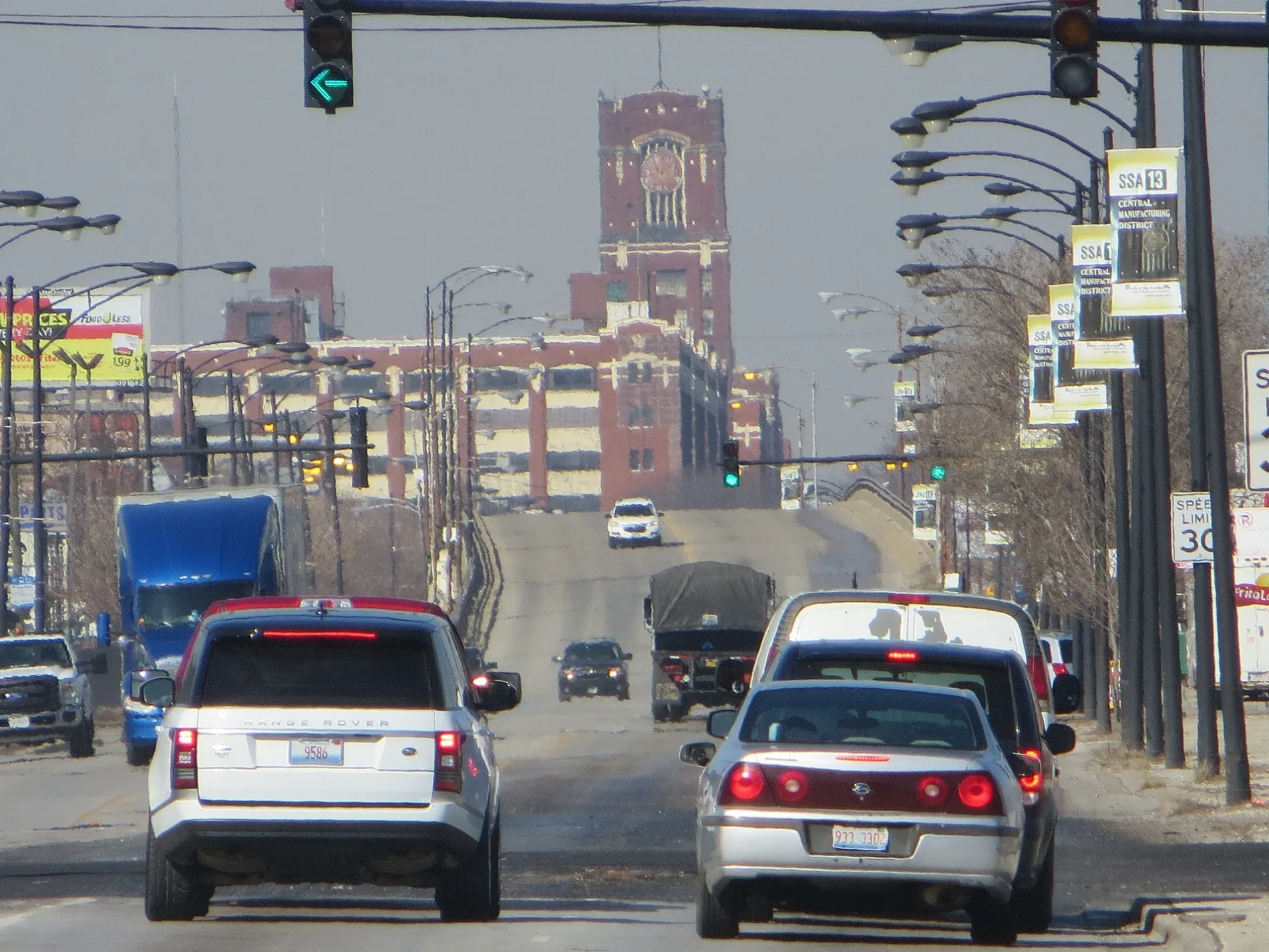
West Pershing Road in Grand Boulevard, Chicago, Illinois
West Pershing Road in Grand Boulevard in Chicago is an asphalted secondary road. It runs in an east-west direction and crosses South Western Boulevard, South Oakley Avenue, South Bell Avenue, South Irving Avenue, South Leavitt Street, South Hoyne Avenue, South Damen Avenue, South Winchester Avenue, South Wolcott Avenue, South Honore Street, South Wood Street and South Hermitage Avenue. It connects McKinley Park, New City, Armour Square, Brighton Park, Bridgeport and Grand Boulevard. West Pershing Road is also known as 39th Street (Chicago). The nearest stops are Pershing & Federal and Pershing & State. The bus line 39 stops here. Ⓦ.
- Road Type
- secondary road
- Route
- east-west
Image
Bus stops
- bus lines 39
Streets nearby
South Dearborn StreetMan on a Bench, The BOG, John + Pat Anderson's Cafe
300 ft
Bronzeville Trail (Proposed)Indiana, State & 40th Street
0.1 mi
East Pershing RoadState & Pershing, Pershing & Giles, Masjid Al Ihsan, Pershing & Vincennes, Pershing & Langley, Pershing & King Drive, Soul Ramen, Pershing & Wabash, Pershing & Indiana, Rothschild Liquors, Pershing & Michigan, Pearl's Place Restaurant, Bronzeville Salon Suites, LVL UP Coffee, Bronzeville
0.1 mi
South Federal Street0.1 mi
West 40th Street0.1 mi
Dan Ryan Expressway (Express)Sox-35th, 33rd Street
0.2 mi
East 40th StreetCottage Grove & 40th Street
0.2 mi
East 38th StreetState & 38th Street
0.2 mi
South Wells StreetWells & 47th Street, 5400 S Wells, Wells & 53rd Street, Wells & 52nd Street, Wells & 48th Place, Wells & 50th Street, 4900 S Wells, Wells & 51st Street, Fuller Park
0.2 mi
West Pershing RoadPershing & LaSalle, Pershing & Princeton, Pershing & Wentworth
0.2 mi
West 40th Place0.2 mi
South Princeton AvenuePrinceton & 42nd Place, Princeton Ave & Garfield Blvd, Princeton Ave & 47th St
0.2 mi
West 37th Street0.3 mi
South State StreetState & 41st Street, 5000 S State, State & 48th Street, 4900 S State, Walter Dyett, Bronzeville Scholastic Institute, DaVita Dialysis, State & 51st Street, State & 45th Street, State & 47th Street, State & 46th Street, State & 43rd Street, State & 44th Street, State & 42nd Street, State & Pershing, State St & Pershing Rd, State & 40th Street
0.3 mi
South Wabash AvenueThe Renaissance Collaborative, Center Court, IIT Campus Bookstore, 6, IIT Campus Business Center
0.3 mi
Dan Ryan Expressway (Local)Pershing & LaSalle
0.3 mi
East 37th Place0.3 mi
South Michigan Avenue4016 S Michigan
0.3 mi
South LaSalle StreetLaSalle & 43rd Street, LaSalle & 46th Place, LaSalle & Root
0.3 mi
East 41st StreetSaint Elizabeth School, Saint Elizabeth Headstart, Horner School
0.3 mi
West Root StreetRoot & Princeton, LaSalle & Root
0.3 mi
South Wentworth AvenueWentworth & Root, Nicky's Gyros, Subway, BP Shop, Wentworth & Garfield, 5400 S Wentworth, Pizza Hut Delivery, Metro by T-Mobile, Boost Mobile, T-Mobile, Wentworth & 46th Street, Wentworth & 44th Place, Wentworth & 45th Street, Wentworth & 43rd Street, 5000 S Wentworth, Wentworth & 51st Street, 4800 S Wentworth, 4901 S Wentworth, 4949 S Wentworth, Wentworth & 47th Street
0.3 mi
Abandoned railways nearby
Chicago Junction Railway0.1 mi
Apartment buildings nearby
The Pershing0.1 mi
Brownfields nearby
Former Crispus Attucks Public School0.1 mi
Buildings nearby
Root Street Tower0.3 mi
Commercial buildings nearby
Former Wabash Avenue YMCA0.3 mi
Convenience stores nearby
Mobil Mart0.2 mi
Disused railways nearby
Chicago Rail Link300 ft
Fast food restaurants nearby
Louisiana Famous Fried Chicken0.2 mi
Fire stations nearby
Former E16 Firehouse0.2 mi
Chicago Fire Department Engine Company 160.2 mi
Gas stations nearby
Mobil0.2 mi
Houses nearby
John W. Griffiths Mansion0.3 mi
Industrial areas nearby
Electrical Line Worker Training Yard0.2 mi
Motels nearby
Amber Inn Motel0.3 mi
Office buildings nearby
NALC Branch 110.2 mi
Hansberry Square of Legends South0.2 mi
Parks nearby
Stateway Park0.1 mi
Wentworth Gardens Park0.2 mi
Metcalfe Park0.3 mi
Places of worship nearby
Roberts Temple Church of God in Christ0.2 mi
Railways nearby
Wash Lead0.3 mi
Joliet Sub District0.3 mi
Residential areas nearby
Legends South-Hansberry Square0.1 mi
Restaurants nearby
Chicago Rib House0.3 mi
Sports centers nearby
Wentworth Gardens Park Fieldhouse0.2 mi
Subway lines nearby
Dan Ryan Branch0.2 mi
Technical colleges nearby
Dawson Technical Institute of Kennedy-King College0.2 mi
Warehouses nearby
Vanguard Archives0.2 mi
| Named after | John J. Pershing |
|---|---|
| Located in | Chicago |
| Country | United States |
Public transit map Grand Boulevard Legend
| Railway | |
| Bus | |
| Streetcar |
Bicycle map Grand Boulevard Legend
| Bike path | |
| Bike lane on roadway | |
| Cycling allowed on bus lane | |
| Bicycle street | |
| Open to cyclists | |
| Open to cyclists, good path | |
| Cycling prohibited | |
| Cobblestone |
| Long-distance bike route | (depending on scale) | |
| Long-distance bike route |
Pedestrian map Grand Boulevard Legend
| Path |
| Long-distance hiking trail | (depending on scale) | |
| Long-distance hiking trail | ||
| Pedestrians prohibited |